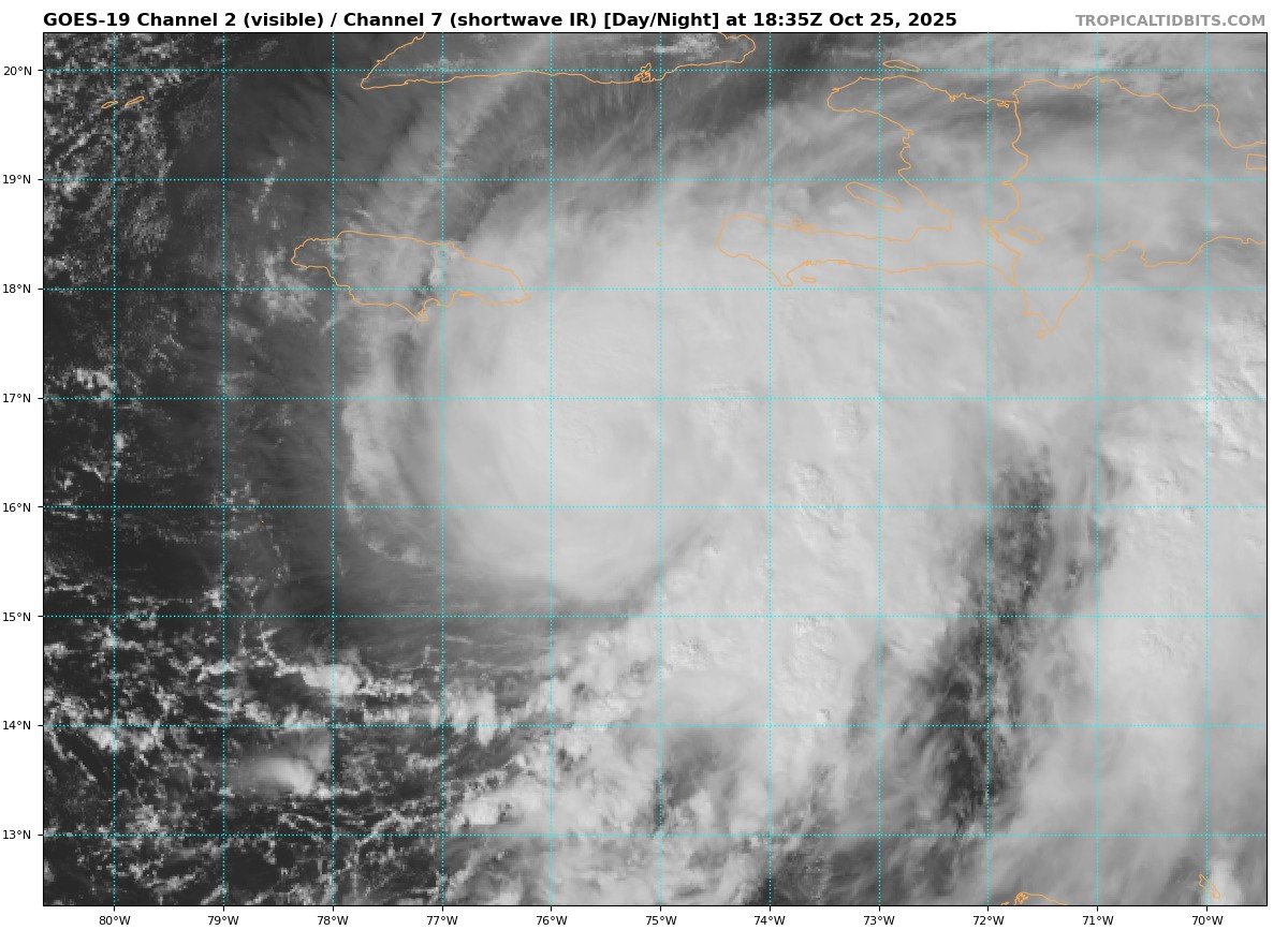
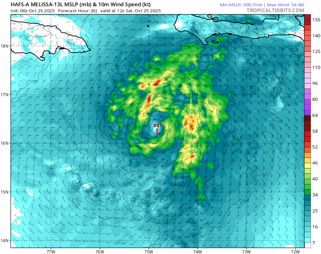
It’s looking very concerning for Jamaica and later eastern Cuba over the coming days as Melissa becomes a hurricane this evening and is forecast to undergo rapid intensification into a major hurricane by the end of the weekend over very warm sea surface temps as it nears the island. Slow forward motion beafore landfall over Jamaica as a category 4 hurricane is forecast by many models, while 40 out of 50 Google DeepMind ensemble members show Melissa becoming a Category 5. However, foward motion is expected to speed up early next week as it turns north across Jamaica then on towards Cuba, while some weakening of Melissa over the mountains of Jamaica and eastern Cuba is also expected.
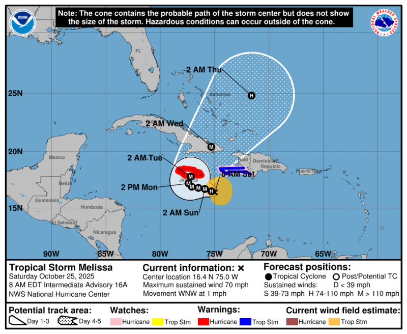
Good agreement between models now to take Melissa west then a sharp turn north as a hurricane over Jamaica then eastern Cuba during the first half of next week.
Due to Melissa’s slow motion on approach to Jamaica, there is the risk for Caribbean island to endure a prolonged multi-day period of damaging winds, heavy rainfall resulting in life-threatening flash flooding and numerous landslides, along with a potential for a storm surge too. The National Hurricane Centre predicts 20-30 inches (1.5 - 2.5 feet) of rain across the island.
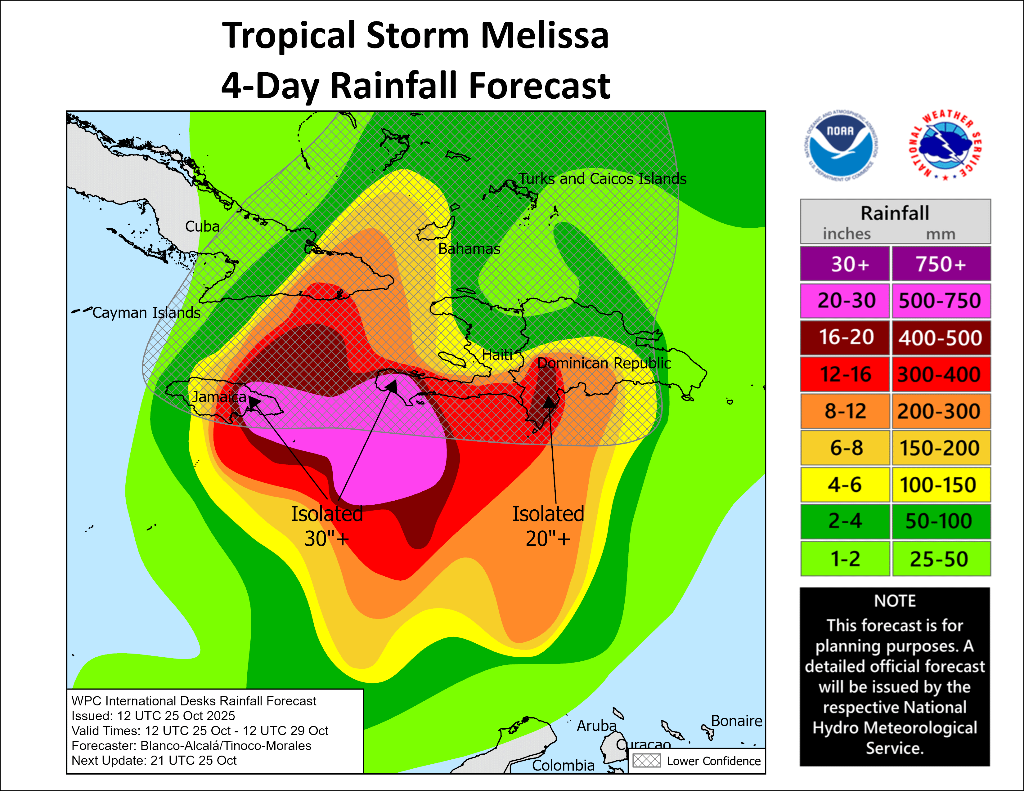
Jamaica’s Blue Mountain range is over 5000 ft high, with the highest point - Blue Mountain Peak standing at 7402 ft asl, (2256m). The lift from the mountains could exacerbate rainfall intensity further, bringing even higher totals, given Melissa’s slow movement. Totals over 3 feet over the mountains and the fast run-off of large volumes of water down the mountains could lead to catastrophic flooding.The combination of torrential rain and mountainous terrain on the island is a recipe for dangerous flash flooding and mudslides.
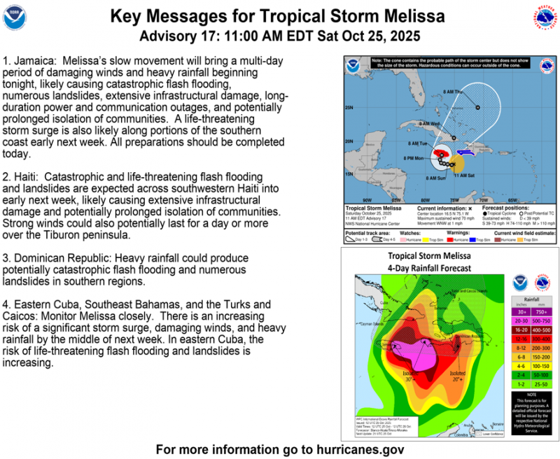
Melissa could also bring close to a foot of rain to parts of Hispaniola, which is the island that houses the Dominican Republic and Haiti, as it drifts closer to the west of the island through the weekend.
Once Melissa has cleared north from Jamaica early next week it is forecast by most models to cross Cuba and Guantanamo Bay on Wednesday, potentially still as a major hurricane. High mountains dominate eastern Cuba - so there is potential for more catastrophic rainfall here. After that, Melissa could go on to the Turks and Caicos and southeastern Bahamas, before clearing that area by early Thursday morning.
Jamaica’s strongest hurricane on record is Gilbert 1988, which made its first landfall near Kingston, the capital of the island, on September 12th as a category four hurricane with maximum sustained winds of 130 mph (115 knots) and a minimum central pressure of 960 millibars. Hurricane Gilbert’s eye traversed the entire island of Jamaica, only weakening back to 125 mph (110 knots) by the time it emerged from its western coast by the late afternoon hours.
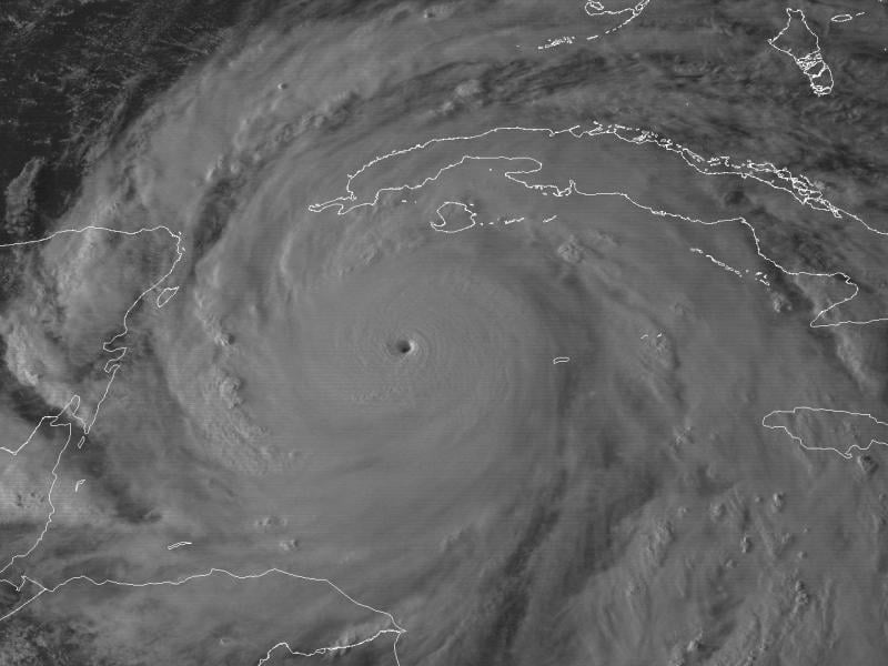
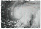
Above: GOES-7 visible satellite image of Hurricane Gilbert at 6:01 PM EDT September 13, 1988 at peak intensity of 185 mph (160 knots) and minimum central pressure of 888 millibars (26.22 inches).
45 people died on Jamaica as a result of Gilbert. Hurricane force winds lasted approximately 10 to 12 hours with the eye passing directly over the country. Jamaica’s banana industry lost some 400 million in export earnings, as the entire 7,500 acres of the crop of export bananas had been wiped out. Hundreds were left homeless and thousands were forced to seek refuge in emergency shelters which soon became overcrowded. Many designated shelters were destroyed by the hurricanes
Hurricane Gilbert made a second landfall on Mexico’s Yucatan Peninsula as a Category 5 storm
Melissa is forecast to have maximum sustained winds 155 mph (135 knots) so could be worse than Gilbert in 1988. The slow motion of the hurricane could bring more catastrophic flooding too.
Loading recent activity...