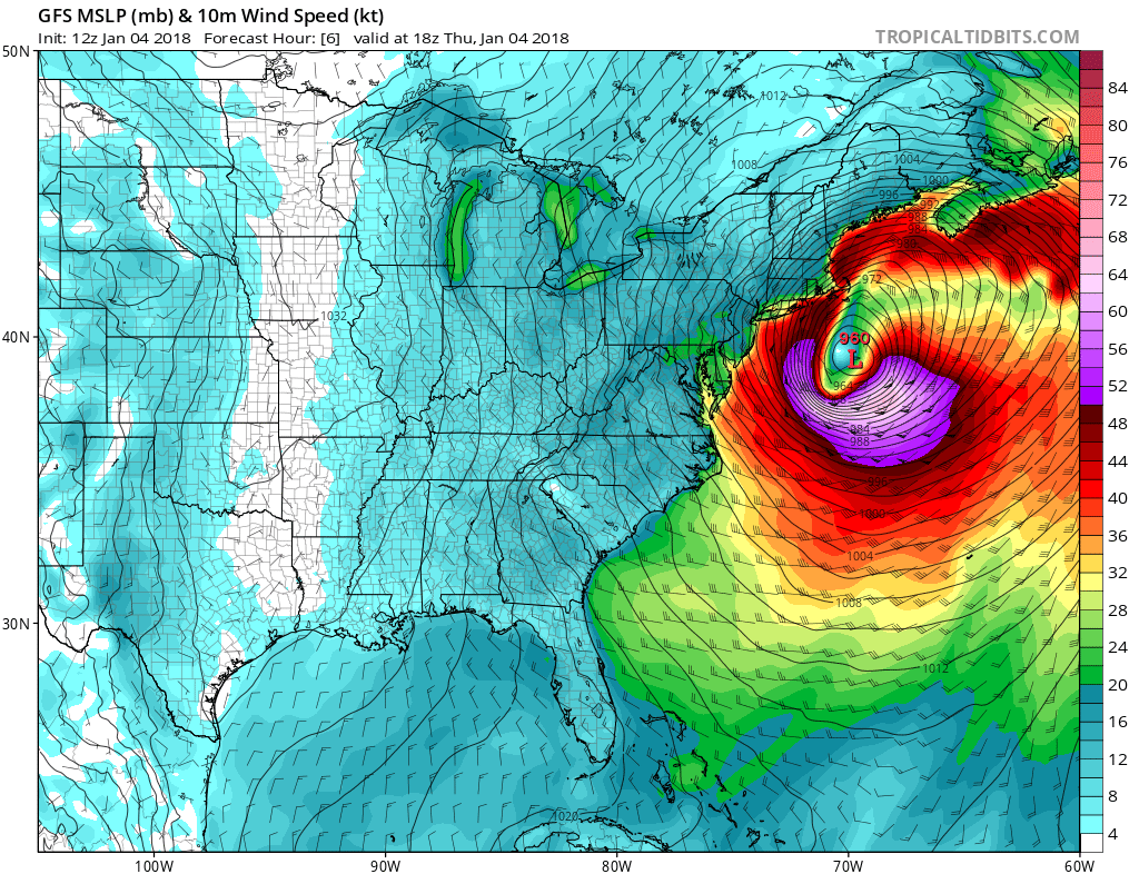
Winter Storm Grayson brought rare snow to Florida yesterday and, as it deepens today, will bring blizzards to Northeast U.S. Thursday-Thursday night.
After bringing a rare snowfall to parts of northern Florida, coastal Georgia and South Carolina on Wednesday, a developing area of low pressure just off the Atlantic coast of SE US yesterday strengthened last night and this morning as it tracked northeast past the Mid-Atlantic States and is now approaching the Northeast bringing blizzard conditions to coastal areas from Philadelphia through New York City and onto Boston. This rapidly developing ‘bomb cyclone’ off the U.S. east coast has seen pressure drops of 40-50mb over 24 hours. Normally rapid strengthening or ‘bombogensis’ of a mid-latitude winter storm would involve greater than 24mb drop in 24 hours, so this makes this storm all the more impressive.
Winter Storm Grayson, as it has been named by the U.S National Weather Service, formed on Wednesday off the Atlantic coast of Florida along the boundary of frigid cold air that has locked much central and eastern U.S. into a deep freeze and much warmer tropical air over the Gulf of Mexico, southern Florida and Atlantic. The winter storm has undergone rapid intensification over the last 24 hours, with pressure falls in the range of 3-6mb / 2 hours in response to strong forcing for ascent in the area of the low in the developmental left exit of a strong mid to upper level jet exiting NE USA and the left exit of another jet streak moving NE along the east coast marking the boundary between frigid continental cold and a tropical moisture plume offshore.
The beginnings of the storm yesterday brought a mess of snow, sleet and freezing rain from northern Florida to the Carolinas on Wednesday. The normally mild Atlantic cities of Savannah in Georgia and Charleston in South Carolina saw the heaviest one-day snowfall on record from Grayson. The winter storm produced the first measurable snow in Tallahassee, Florida, in over 28 years.
As Winter Storm Grayson continues up the east coast on Thursday, blizzard conditions are affecting mid-Atlantic coastal areas and states in the northeast of the U.S. Winds will be on the increase for the rest of Thursday, as the storm continues to strength as it tracks northeast offshore of the east coast. Wind gusts of 70mph are forecast over New England, as the storm approaches off the coast this evening and overnight, combine this with snowfall rates of a couple of inches per hour from New York City to Boston areas.
A blizzard is a storm that produces snow or blowing snow with winds in excess of 35 mph and a visibility of less than one-quarter of a mile for at least three consecutive hours, according to the American Meteorological Society.
Parts of SE Virginia in the mid-Atlantic coast has already seem 6-10 inches and the coastal areas from here through to New England could see up to a foot of snow, inland ranging from 3-8 inches, depending how far away from the coast. Across New England, there is potential for 12-24 inches of snow fall over Maine and New Brunswick. Add in the strong winds of 40-70mph, resulting blizzards, whiteouts and power cuts will all combine to make travel difficult to impossible while the storm passes through the area.
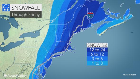
Credit: accuweather.com
Airline delays and cancellations have begun in the Northeast of the U.S. and will continue to escalate, with ripple-effect delays occurring across the nation. Some aircraft and crews are likely to be displaced by the severe storm in New England. De-icing activity, slippery runways, poor visibility and gusty winds will lead to flight delays in New York City, Boston, Hartford, Connecticut, and Philadelphia.
As the winter storm clears away north over NE Canada early Friday, another blast of dangerously cold arctic air following behind the storm may bring sub-zero temperatures to Boston and New York City tomorrow and this weekend. Actual temperatures may reach their lowest point of the season so far in coastal areas of the Northeast, such as in Washington, D.C., Philadelphia, New York City and Boston.
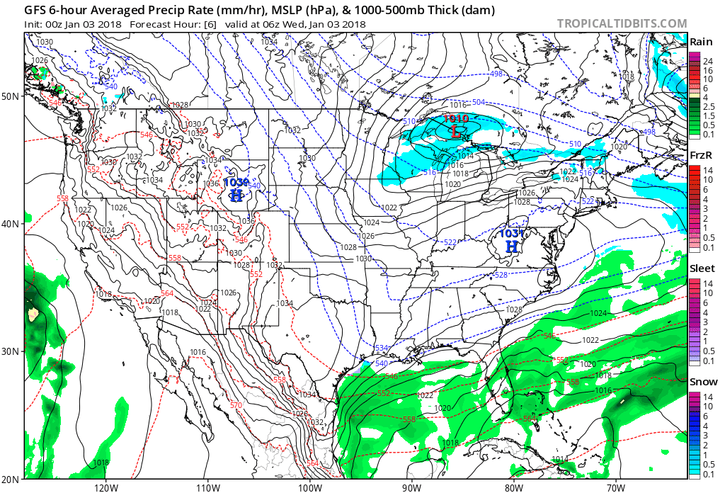
Winter Storm Grayson has far-reaching effects over the side of the pond too. No we won’t see the same winter storm cross the Atlantic and bring blizzards here, despite what the tabloids may say. But the energy / poleward transport of warmth aloft thrown out by this east coast storm will be responsible for bringing a ridge of high pressure across the NE Atlantic and northern Britain this weekend into early next week, which will disrupt the recent onslaught of Atlantic depressions rolling through and bringing wind, rain and mild weather.
Watch the N American east coast storm in far left amplify the mid-level flow (colours) downstream to bring a ridge of high pressure close to the UK this weekend
Instead we will see cold air filter down from the north over the weekend around this developing high close to / over northern Britain, bringing some cold wintry sunshine for many by day on Sunday and Monday and some hard overnight frosts. Despite some recent model output moving the high across Scandinavia and bringing a cold easterly to the UK for rest of next week, this looks increasingly unlikely now, as the unsettled and milder Atlantic tries to push back in from the west.
Loading recent activity...