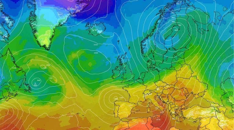




Thursday saw the warmest day of the year so far – with Porthmadog in NW Wales reaching 20.3C, beating Wednesday's 19.2C that was the warmest day of the year until today. So it will come as quite a shock for some as cold arctic air sweeps down from the north this weekend. It looks like the cold northerly flow will linger through much of next week too. Just when Wednesday’s warm spring conditions may have had us thinking that winter is well and truly behind us now.
High pressure has brought spring-like conditions for many this week, the highest temperatures were across western parts of Wales, England and Ireland on Wednesday, as the high has positioned favourably to bring light winds combined with the sunshine here. A brisk and cool easterly wind around the periphery of the anticyclone across southern and eastern counties kept temperatures lower here.
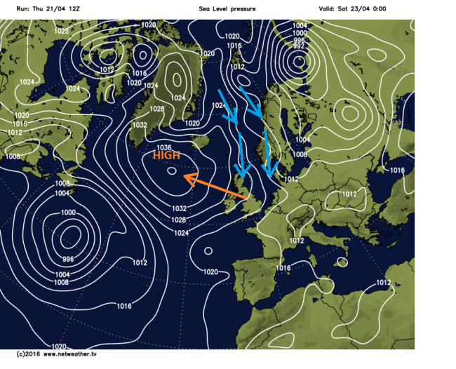
The area of high pressure sat over the UK this week that has been a friend for fine weather lovers will become the enemy as it retrogrades WNW into the weekend, allowing the wind to swing round to come from a northerly direction, feeding much colder air straight from the arctic, not just for a few days like last weekend – but probably through the whole of next week too.
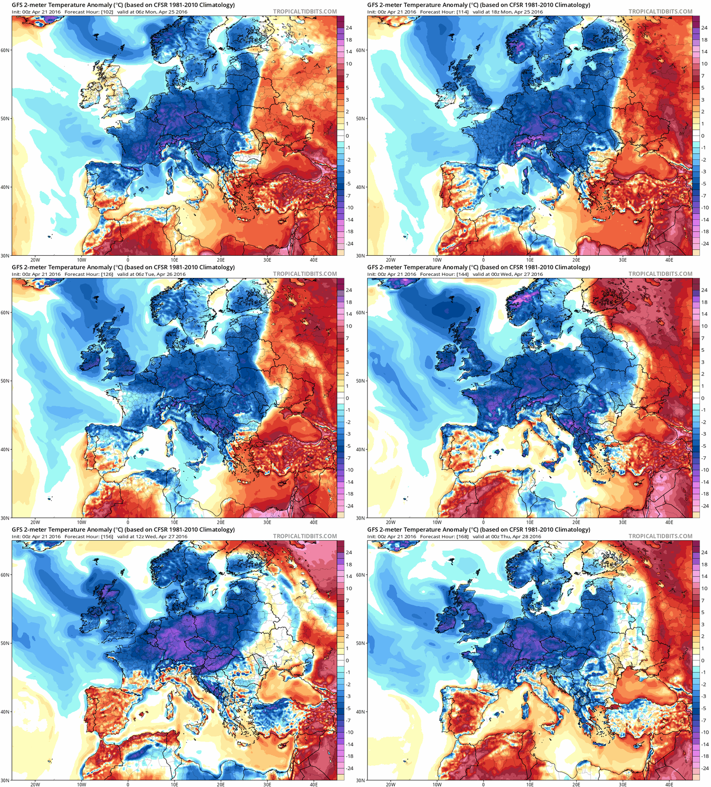
This animation of GFS 2m temperature anomaly shows much colder air spreading south over the next few days and lasting through next week
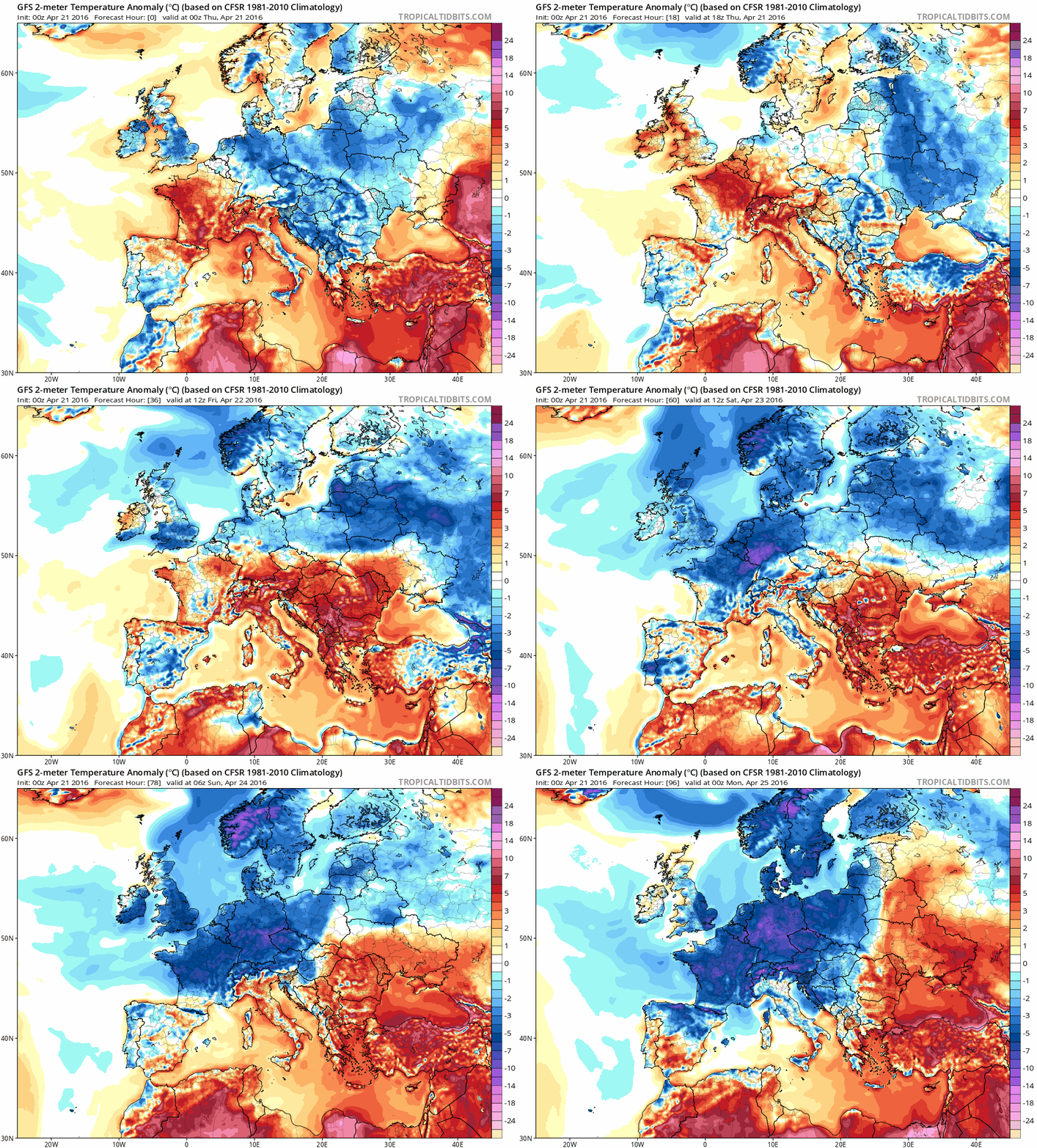
Overnight and through Friday, a band of thicker cloud and outbreaks of rain will push up across southern England and south Wales, as high pressure begins to retreat west out over the Atlantic. Drier further north, but a cold northerly wind setting in, which will push the cloud and rain away from the south on Saturday – with all areas under a cold northerly flow for the rest of the weekend. The northerly wind will be strongest towards the east and this is where we will see most of the wintry showers too, falling as wintry mix of rain, sleet, hail or snow. A few showers feeding in from the Irish Sea across western parts too. Rather cold in the east where we see the showers, perhaps 6-8C at best, otherwise 9-11C at best.
We could see wintriness from the showers almost anywhere, even the London Marathon on Sunday may see a wintry mix from the showers likely here at some point during the run – with temperatures struggling to 8 or 9C. Not bad conditions for the runners to keep cool, but not so great for the spectators.
Then through much of next week, high pressure will be sat to the west over the mid-north Atlantic while low pressure dominates to the east over the North Sea, Scandinavia and Denmark. This keeps the flow coming from the points to the north. More showers on Monday, though it will be less cold for southern areas, as winds turn northwesterly for a time. However, another cold plunge from the arctic looks likely to spread across all parts on Tuesday. Temperatures on 06z GFS run indicating highs of only 7-9C in the south, even colder in the north.
Another cold plunge from the north by Tuesday
The average maximum temperatures for late April are below
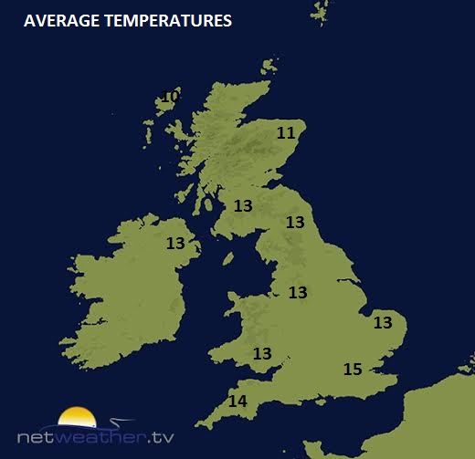
Temperatures we are likely to see next week, on average:
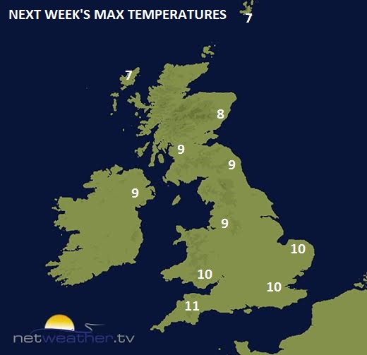
Tuesday perhaps the coldest day of the week
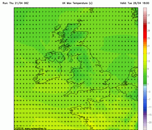
Expect wintriness from the showers, even in the south, by the end of Tuesday
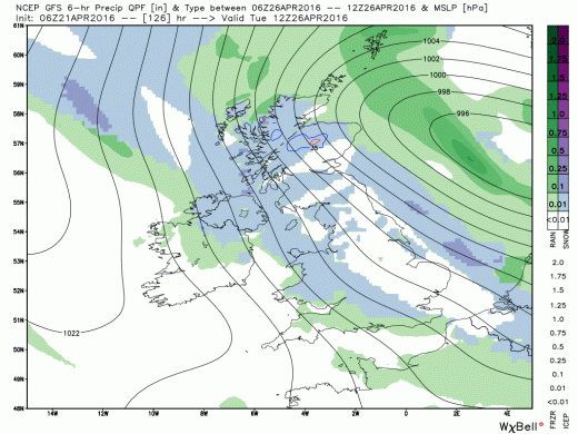
This coming cold spell could be the longest spell of below-average temperatures the UK has seen for some time. The cold flow from the north perhaps not relenting until next weekend, when the most reliable weather models are indicating the wind backing to less cold westerly flow for the beginning of May - with temperatures returning back to normal.
So to sum up, cold air from the arctic arrives by Saturday across all areas, staying cold next week, with a further cold plunge from the arctic on Tuesday, frost likely overnight where skies clear and wintry showers likely almost anywhere.
Loading recent activity...