The Atlantic is going to throw some more wet and windy weather our way for the middle of this week. Southwestern and western parts will see the most rain with some shelter in the east.
Tuesday will see a sunnier lull for many parts of the UK after some very wet weather. The last of the stubborn frontal rain will clear SE Britain on Tuesday morning, with the cloud cover holding on a bit longer for East Anglia and the Home Counties. Blustery showers will pester the far northwest of Scotland but elsewhere it looks dry and fine but feeling cooler.

However, the next Atlantic system is waiting out to the west. Ahead of this, dense fog is expected to form during a chilly Tuesday night, ready for a foggy commute on Wednesday morning. This will mainly affect inland southeastern Britain, along the M3, M4 and M25 and lasting longest for inland East Anglia and Kent. Further west, it will be windy with a fresh to strong southerly wind accompanying frontal cloud and rain.
Northern Ireland will become wet and windy before dawn. The wind and rain will reach across Scotland and the Irish Sea as more people are on the move on Wednesday morning.

The cold front will bring heavier rain as it arrives from the west. Gales are expected through the Irish Sea and the Minch as northern Scotland, particularly the northeast, could experience gusty winds with sunny spells to the lee of high ground.
Southeastern Britain will stay cold and grey with a bit more of a breeze picking up through the day. There will be the rain band heading over Wales, northern England and into SW England with blustery winds. To the northwest of this, the skies will brighten with bands of heavy showers reaching the Western Isles and NW Highlands.
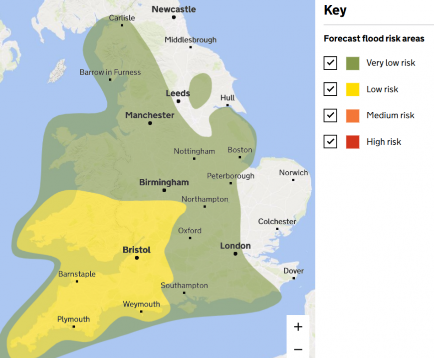
Flood risk areas for England and Wales Wednesday 17th
This will be rather similar to Monday, with a band of frontal rain extending SW/NE across Britain and drier conditions to the NW and SE of this band. It has been so wet in recent weeks that flooding concerns are already being highlighted, particularly for SW Britain.
Milder air will arrive with this system, lifting temperatures into double figures. There will be blustery conditions along the south coast of England on Wednesday evening. Colder air will follow the main cold front but waves develop along this frontal boundary. This will slow its progress southwards and is likely to introduce some heavier pulses of rain for Thursday.
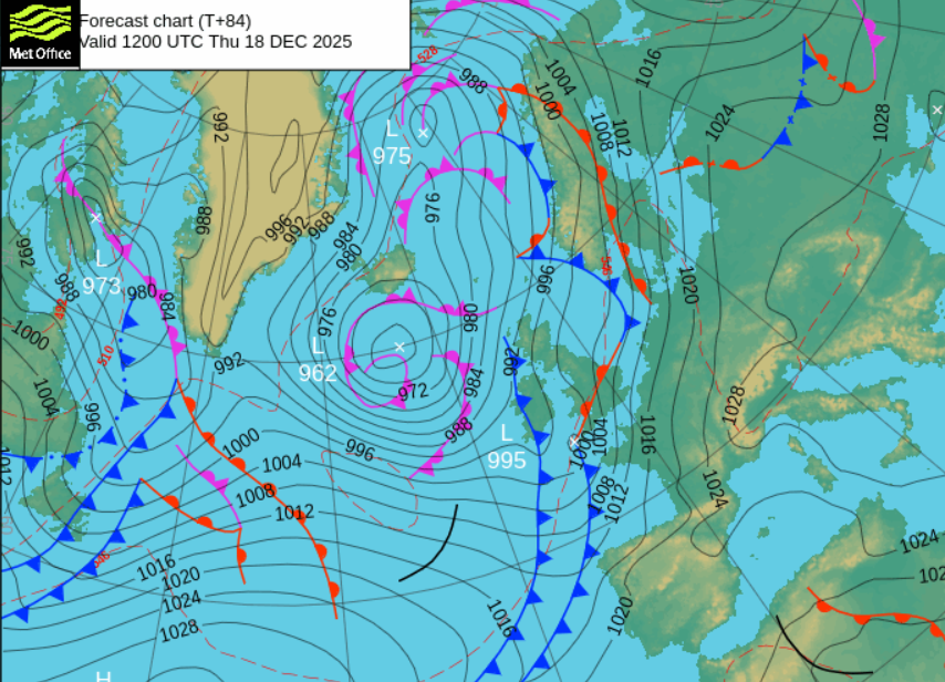
Developing low centre along the waving frontal boundary Thursday 12z
There will be low confidence about where the waving front will push its heavier rain on Thursday but there will be the risk of flooding from rivers and surface water. Not only will there be rain from the developing low along the main frontal boundary, but a second cold front may also bring outbreaks of heavy rain from the northwest during the day. Inbetween, there will be sunny spells for a few places and mild air from the south.
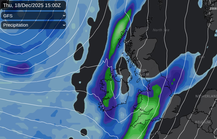 ECM model showing similar low centre with heavy rain for SW Britain and showery line from the west.
It will all be pushing its way eastwards, with clearing skies, continuing blustery showers from the northwest and a colder flow of air ready for a sunnier Friday.
Loading recent activity...