


It’s a cold start on Friday but there will be a lot of sunshine. There will be early frost and patches of ice but it will look lovely out of the window. It will feel cool through the weekend but much colder air will arrive from the north as we end Sunday. That adds interest for next week's forecast.
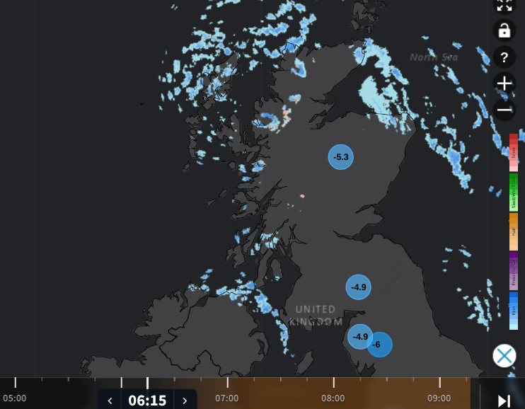
A chilly start on Friday with a few wintry showers showing on the Netweather Radar over the NW Highlands
Thankfully, the cold northerly wind is easing for eastern Britain and that felt cruel yesterday. There will be light winds for much of central and southern Britain on Friday. Temperatures will only reach 6 to 8C so the air is cold but the sunshine will be cheery. Further north there will be a westerly breeze with more cloud and clusters of showers. These will pester western Scotland, with a few for Northern Ireland and reaching coastal parts of NW England and North Wales off the Irish Sea, for Blackpool, Formby and Rhyl. The far north of Scotland will see lots of blustery showers on Friday. There has been some snow overnight for the NW Highlands but today’s showers will turn to rain in daylight hours.
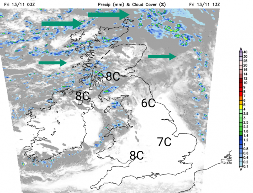
Tonight the breeze will continue in the far north with patchy cloud and showers from the west. The wind will back to a southwesterly which will take the showers into the Solway Firth, so there could be patchy ice for sheltered spots. For most there will be clear spells and hardly any breeze so temperatures will fall away and it will feel cold. Frost will form so make sure there is a de-icer for the car. Temperatures in southern Britain could fall to -5C tonight. There could be some fog patches too.
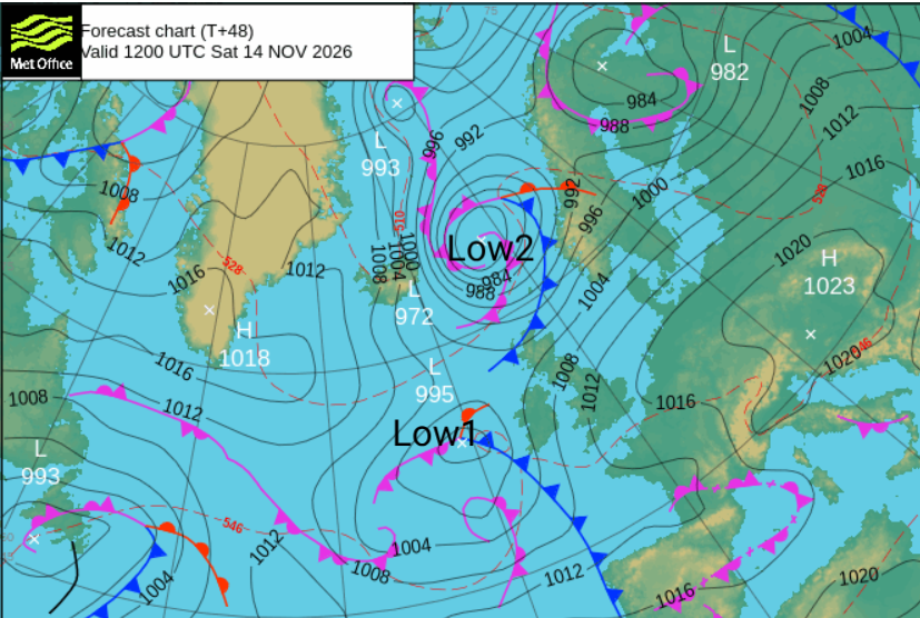
The high pressure will move from right over the UK on Friday to central mainland Europe. MOre of a breeze will pick up, stirring the atmosphere by Saturday afternoon but much of England and Wales will have a fine and sunny day. There will be more cloud for the far north of England and still a feed of showers for Cumbria and SW Scotland and the Southern Uplands. There will be a noticeable southerly wind for Wales and Cornwall with temperatures around 9 to 11C. The same wind for western Scotland and Northern Ireland where there will be more cloud linked to Low1 out in the Atlantic. Frontal rain will reach over Northern Ireland on Saturday evening. For central and eastern Britain temperatures will be around 7 to 9C, 10C in London. Low2 will bring blustery weather to the far north of Scotland and rain from the cold front will set in for the Islands later on Saturday. To the north is this is the colder airmass.
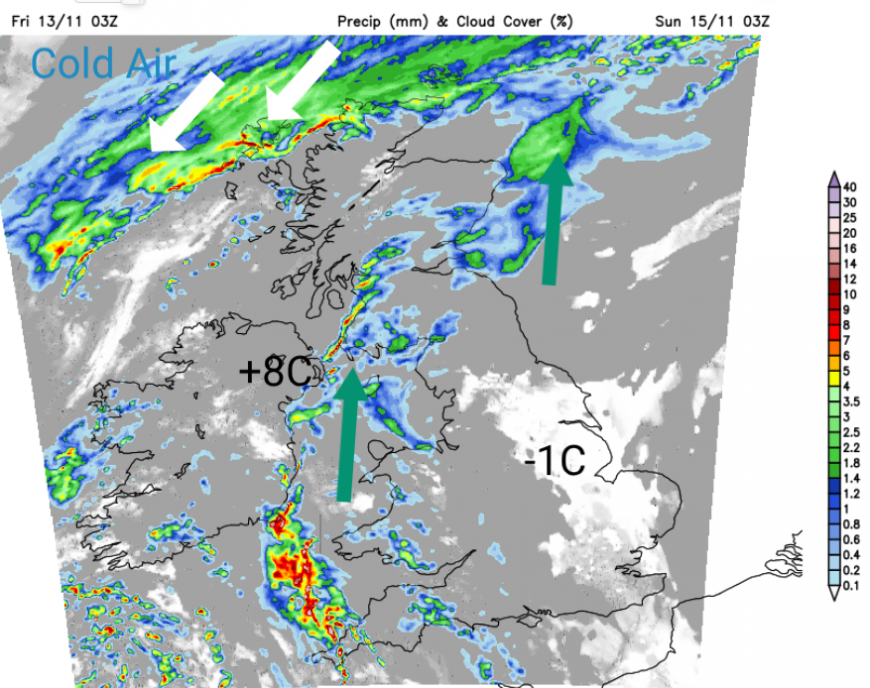
Sunday will be an unsettled day with low pressure over the UK. there will be more cloud with outbreaks of rain, from Low1 over England and Wales and southern Scotland. There will be milder air with temperatures around 10 to 14C but a breeze coming onto the south coast of England.
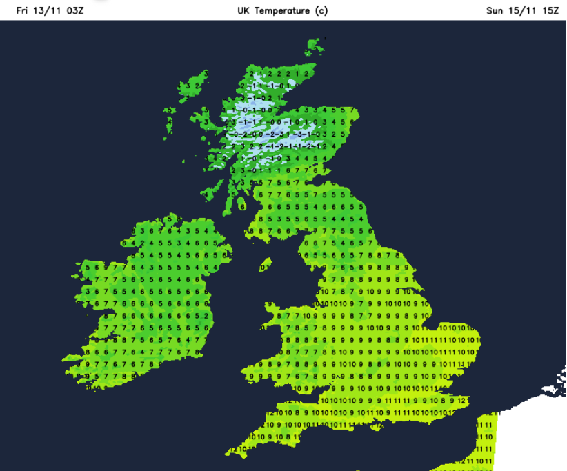
There will be a distinct change for northern Scotland. Rain, sleet and snow linked to Low2’s cold front with strong winds, even gales for the Islands and west coast. The strong N winds will reach Northern Ireland and NW gales through the Irish Sea for Sunday evening. The mix of rain, sleet and snow will move over northern Britain with blustery winds around the low over southern Britain for Sunday night.
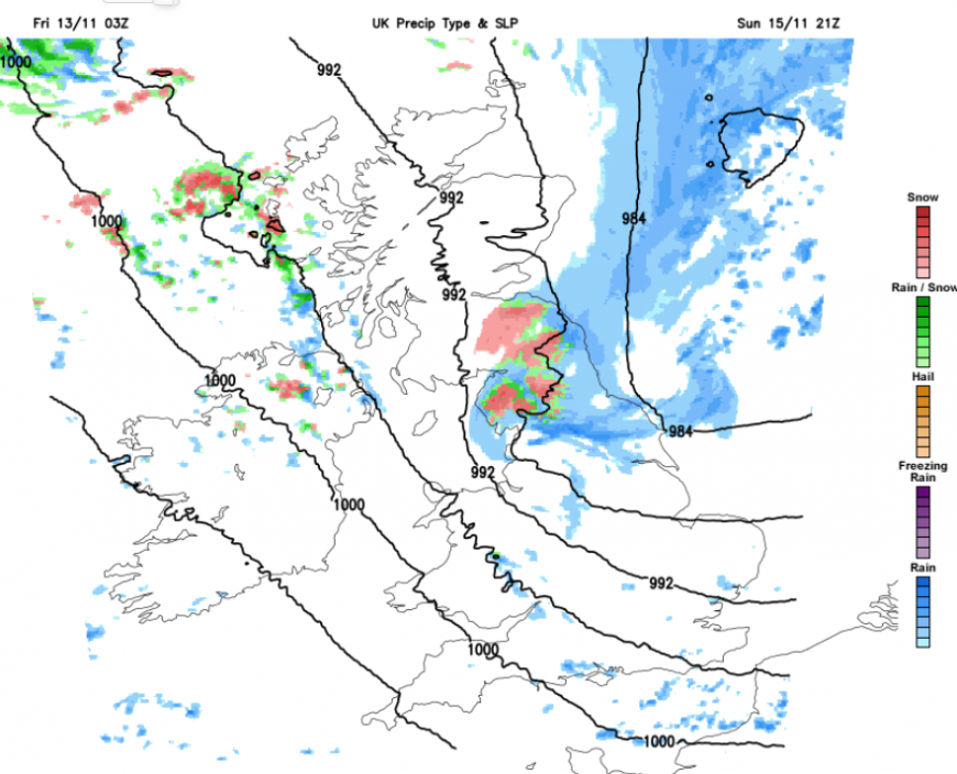
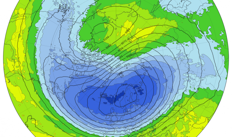
This should all clear away over the North Sea by Monday morning but it leaves the UK in a cold airmass with a wintry tinge. For Scotland and northern England there will be temperatures of zero down to minus 8C with the risk of ice and further snow showers from the northwest. Lying snow is likely over the hills and mountains, but there could be some slushy bits, even a covering for lower levels. Just something to keep an eye through the weekend. How this develops with a scattering of wintry showers passing over Northern Ireland, Snowdonia and the Peak District too.
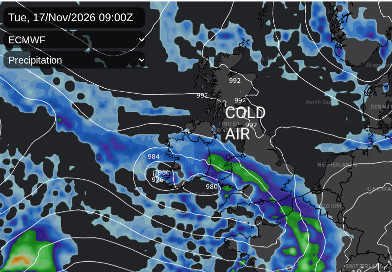
Interesting later on Monday a new frontal band will arrive from the southwest and hit that cold air. Confidence is low around the details and its tricky with snow or rain in these setups. Just a soaking, or will it be a coating of the white stuff? Monday night might get exciting, if you like a bit of November snow. The ingredients of cold air and an incoming front are there.
Loading recent activity...