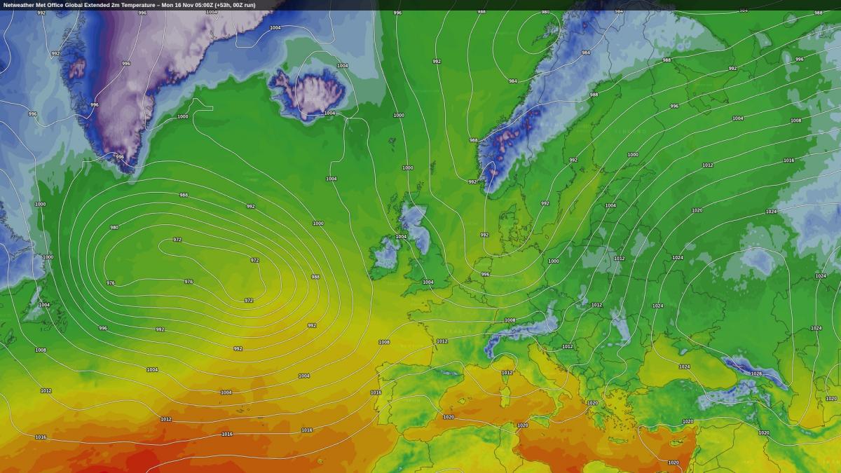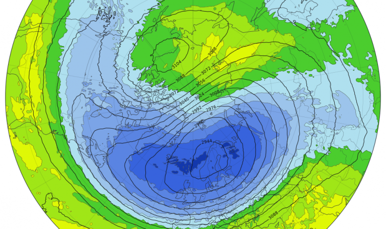



Following the current cold bright spell, there will be a transition to much wetter weather after mid-November, but it will still not be a straightforward transition into a typical unsettled late autumn El Nino pattern with southerly and south-westerly winds. This may be related to the recent exceptionally early sudden stratospheric warming event. Pressure will remain high to the north-west of Britain during the coming week. Towards the end of November, there are signs that we may get a Scandinavian blocking high which may spread more extensively to our north.
At present, widespread snow looks unlikely during the coming 10 days, but there will be some wintry showers in northern Scotland on this coming Monday, and on Tuesday, frontal systems pushing into the cold air mass will bring snow for parts of Scotland and northern England, albeit probably mostly reserved for high ground. Another cold northerly blast looks probable for next Friday/Saturday, although again probably not cold enough for widespread snow at low levels.
Nonetheless, outside of these cold snaps, it does look set to be wet and fairly mild for most of the time, and particularly wet in the south-west, which will be a substantial change from the generally quiet, dry, settled weather of early to mid-November. Unlike the anticyclonic spell in early November 2024, the anticyclonic weather of early November 2026 has not been particularly mild, with temperatures widely running a little below the 1991-2020 long-term average for the first half of November, and close to the old 1961-1990 average.
Today's forecast model runs in the extended time frame (day 10 onwards) are often reminding me of late November 2023 - also an El Nino year - when an extensive high pressure region to the north drew in increasingly cold north-easterly winds during the last week. Showers in eastern counties fell as rain initially but turned increasingly wintry during the last few days, and some areas of eastern Scotland and north-east England had lying snow down to sea level by the 30th. Sub-zero maxima occurred quite widely in freezing fog. As fronts pushed into the cold air mass, there was widespread snow from the Midlands northwards on the 2nd/3rd December. The rest of December 2023 was generally mild and changeable, but it was a notable early spell of wintry weather.
Early snowfalls have been a recurring theme in recent years, with widespread snow around 18-23 November 2024 which even penetrated to south-west England for a time, and snow for some, particularly eastern Scotland and north-east England, around 20 November 2025. In some regions, in both the 2023/24 and 2024/25 seasons, November or early December had the most significant snowfall of the season. In 2025/26, this was not generally the case, as most of the areas that had snow on 20 November had more substantial snowfalls from northerly winds in the first week of January 2026.
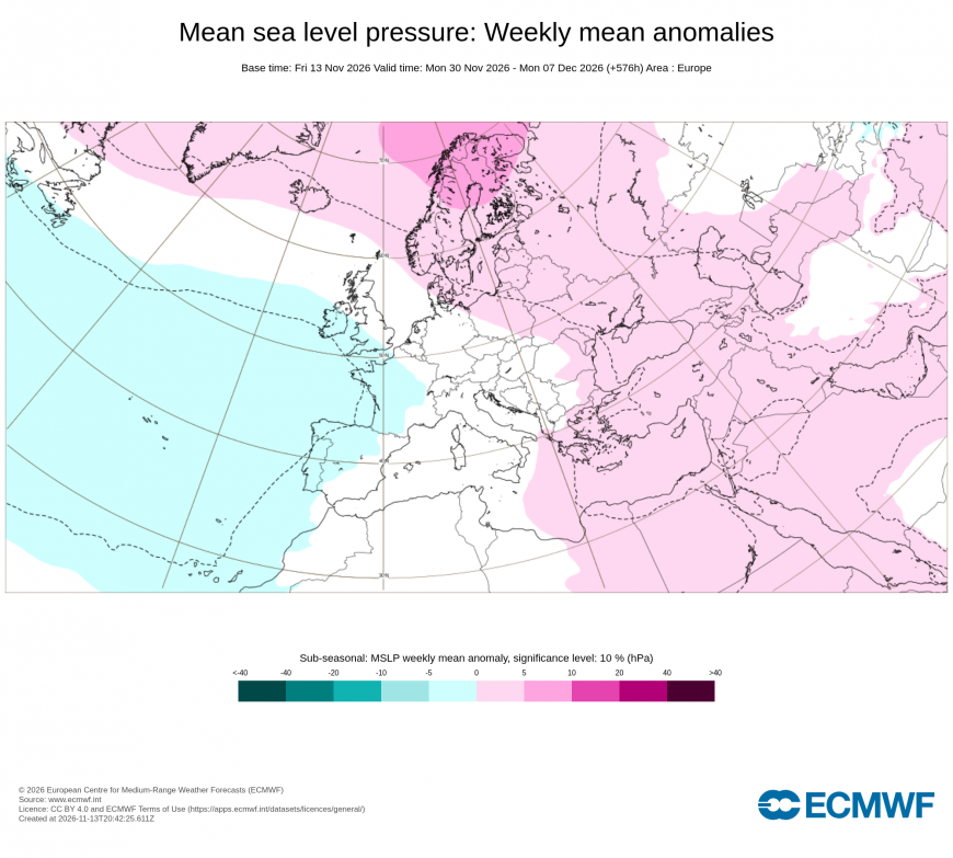
As of 14 November 2026, many current model runs are sending cold air slowly in from the north-east towards the end of November and early December, like what happened in 2023. There is also support for this on the latest ECMWF 42-day forecast, which has a Scandinavian high during the first week of December, retrogressing towards Greenland into the second week. An extreme form of that pattern happened during the first half of December 2022, which saw an exceptionally strong Greenland high develop, giving Britain an extended cold spell, with snow for some, although some areas had very little or no snow during the spell.
Temperatures are still running record warm globally, although not far ahead of November 2023, with a strong emphasis on high sea surface temperatures. Due to the current northerly blast, north-west Europe is one of the few cooler than average regions at present, but this is looking set to change for much of next week as low pressure brings in milder air. Much of Greenland is also seeing below-average temperatures at present. Conversely, much of Asia and western Canada and Alaska is currently exceptionally warm for the time of year.
Much of the eastern US is currently having a cold northerly blast, but the weather in North America and Canada is forecast to be mild for the time of the year during the coming week, with an anticyclone moving eastwards and drawing up warm air masses from the south-west. There are hints that a cold northerly could set in over Canada at around day 7-10, eventually sending some cold air back into eastern North America.
In the Southern Hemisphere, there is widespread late spring heat over the land masses, with pockets of hot weather over South America, south Africa, eastern Australia, and some eastern parts of New Zealand, although parts of western Australia are currently on the cool side.
Loading recent activity...