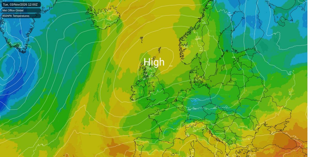



High pressure sits just off north-west Scotland today, and a north-easterly breeze around its southern side is pushing showers in off the North Sea. From this afternoon into the evening there is a 70 to 90% chance of catching one from the Norfolk coast round to Essex, north Kent and the Thames estuary, highest near Dartford in the early evening. Most will be brief, with no more than a couple of millimetres wherever they fall. Inland there is about a 60% chance of a shower in the Midlands this evening, and a smaller one in Yorkshire, eastern Scotland and the south-west. Wales, north-west England and Northern Ireland should stay dry this afternoon and evening.
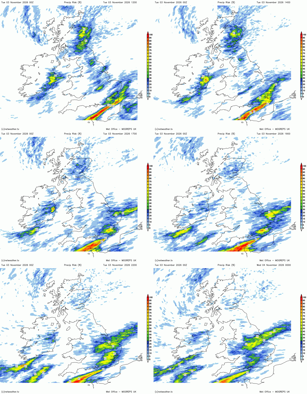
Overnight a weak line of showers drifts from the Humber across South and West Yorkshire, giving Leeds and Hull around a 60% chance of rain in the small hours of Wednesday. The line fades by mid-morning. A few light showers are expected over the Yorkshire Dales and the Lancashire hills later on Wednesday, with north-west England at an even chance of one. Elsewhere on Wednesday the risk is lower in the Midlands, the south-west and the south-east, and small in Wales, Scotland, East Anglia and Northern Ireland. Thursday is largely dry, though the North York Moors and the Pennines could catch a passing shower around midday.
The wind turns east-north-easterly across England and Wales on Wednesday and freshens down the English Channel. Gusts of 35 to 40mph are likely on the exposed south Devon coast around Torquay in the morning, a little stronger over the Channel itself and on the tops of the Welsh hills and Dartmoor.

Afternoons stay chilly in the south, with 8 to 12C across southern England and Wales on Wednesday and Thursday, two to three degrees below average for early November. Scotland and Northern Ireland are closer to normal, with Belfast near 12C. By Friday the easterly slackens and the afternoon reaches 10 to 13C in the south, warmest along the Channel coast.
Nearer the centre of the high, Scotland and Northern Ireland keep light winds, and where the skies clear the nights turn frosty. Omagh is likely to dip to about -1C early on Wednesday, with a frost across the valleys of Tyrone and around Londonderry, while Belfast on the coast stays near 9C. Skies clear more widely on Wednesday night and the frost spreads into the Highland glens. Aviemore should fall to about -1C by dawn on Thursday, with the most sheltered glens perhaps down to -2C and a widespread frost through Strathspey and upper Deeside. Aviemore may only manage about 6C that afternoon. More cloud on Thursday night makes Friday's dawn less frosty in the Highlands and Northern Ireland.
On Friday the high weakens and slips away towards southern Norway. Friday is expected to be mostly dry, with a 40% chance of a shower around the south Devon coast early in the day and a lower one in eastern Scotland and the south-east.

Saturday looks grey for most, with a blanket of cloud over almost all of England, Wales, southern Scotland and Northern Ireland as the high pressure fades further. The Met Office's high-resolution model draws a band of light rain from north Wales across the Midlands towards Essex on Saturday afternoon, but other models do not, and the wider ensemble gives it little support. A largely dry Saturday is still the likely outcome, though there is a 20 to 30% chance of drizzle or patchy rain from Yorkshire and the Midlands down to the south-east. A few showers could also brush the Devon and Dorset coasts. Temperatures change little, mostly 9 to 13C, though Bangor may only reach about 8C.
Loading recent activity...