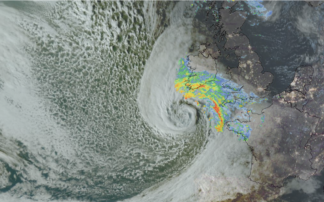
Here comes Storm Austen for Thursday night and Friday by day. By Thursday evening (before 6pm), there was a beautiful but ominous-looking swirl of cloud on the Satellite imagery (see above). Also visible is a shield of frontal cloud with rain showing on the radar across southern Ireland, SW Britain and NW France.
Out over the Atlantic, there is a web-like pattern of open-cell convective cloud where there is cold, unstable air following Austen. Ahead of Austen, over much of Britain, there are clear skies allowing temperatures to plummet, and we can see the city lights illuminated on the image above, taken before 6pm on Thursday 22nd October.
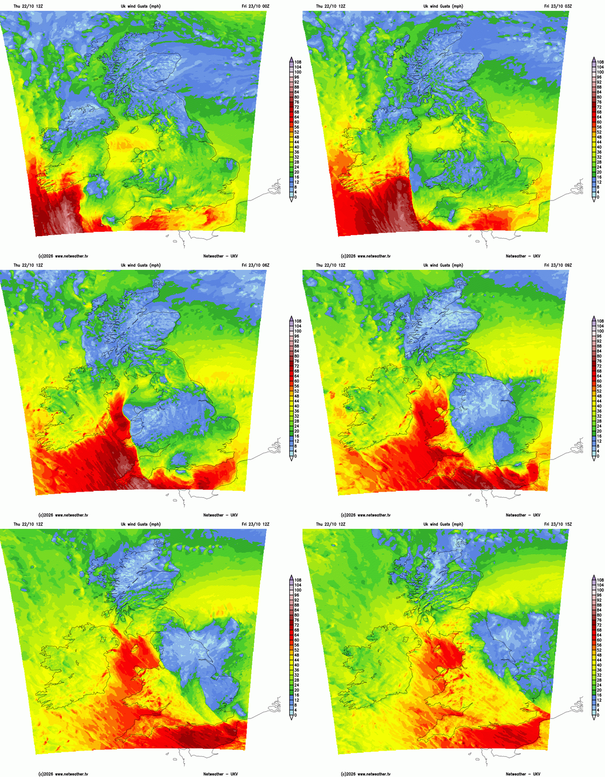
“Storm Austen is likely to bring some disruption and possible damaging winds on Friday morning.”
This is the first storm of the season. It will bring strong winds, high gusts and heavy rain for the end of the working week. There are wind warnings over Wales and England, including an Amber warning for Devon, Cornwall and the Isles of Scilly starting at 1am.
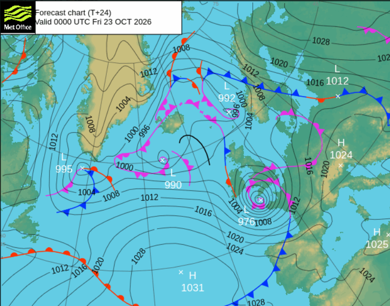
The Inshore Waters forecast for the north coast of Cornwall and Devon around the Bristol Channel and south Wales coast, Issued at: 18:00 (UTC) on Thu 22 Oct 2026. For coastal areas up to 12 miles offshore
24 hour forecast: Wind- Southeasterly 6 to gale 8, becoming northwesterly severe gale 9 to violent storm 11, decreasing 7 to severe gale 9 later. Sea state- Moderate or rough, becoming rough or very rough, occasionally high in west.
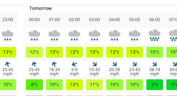
Netweather 14 day forecast showing weather, air temperature, wind -gust, feels like temperature
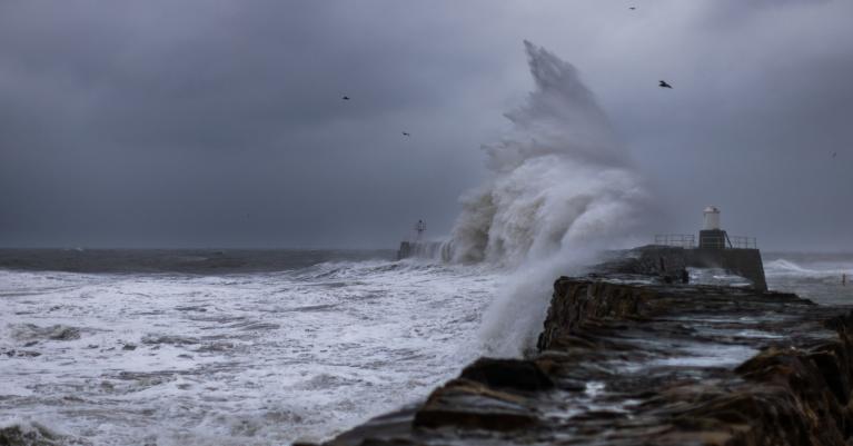
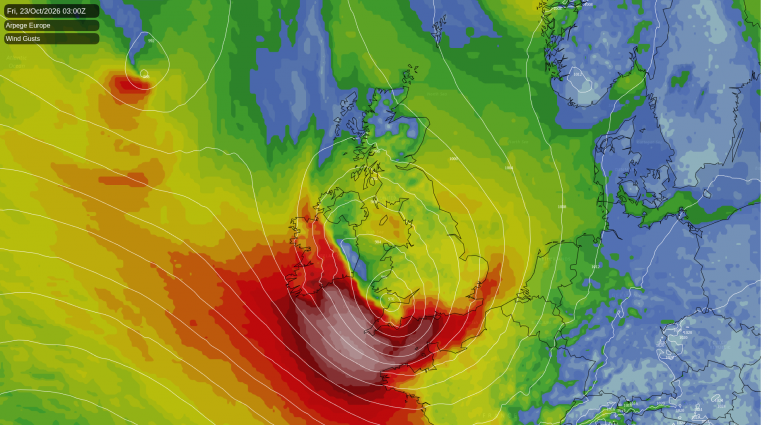
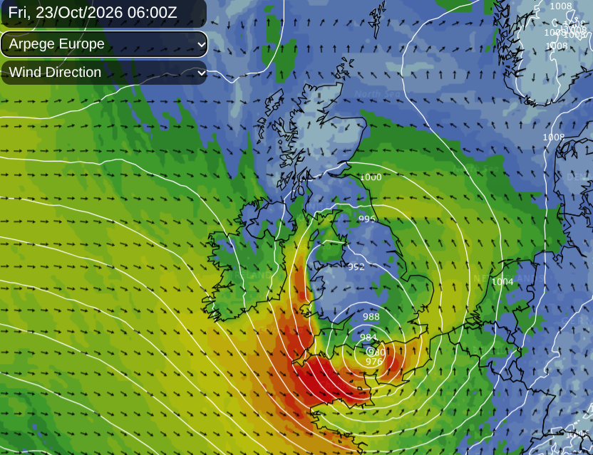
It will be just before dawn when the gales around the back side of the low are forecast to hit Cornwall and the Isles of Scilly. Looking at the location forecast for Truro in Cornwall you can see wet and windy weather initially, in a mild southerly wind. The wind then veers dramatically to a cold northwesterly with significantly higher gusts, 60 to 70mph around dawn. This leaves a miserable and potentially dangerous start to Friday. There will be large waves and tricky conditions along the coasts. Conditions in SW England and the Channel Islands look treacherous for the start of Friday.
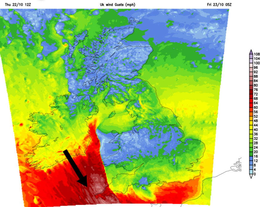
Jersey Met is forecasting “West to northwest severe gale F9 with gusts to 75mph, perhaps storm F10 with gusts to 85mph, occasionally gale F8 later” for Friday morning with wild conditions through the day.
Gales will continue along the English Channel during Friday, extending to the eastern Channel in the afternoon. It is likely that there will be disruption to ferry services. Not ideal as there will be extra half-term holiday traffic.
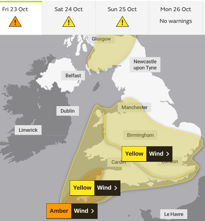
The yellow wind warnings are staged from SW and S Britain midnight to the evening rush hour and the central swathe from Merseyside to the Thames estuary during the day and later into Friday evening. Travel disruption is likely, trees could fall as they are still in leaf, and power cuts are possible. Be prepared and if you can alter travel plans it might be worthwhile.
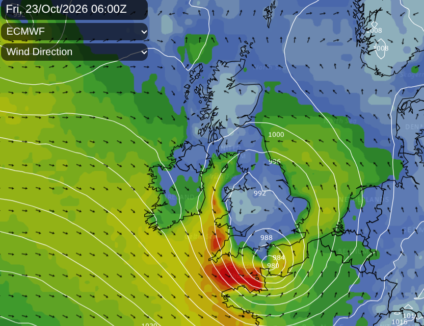
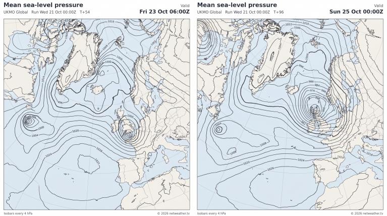
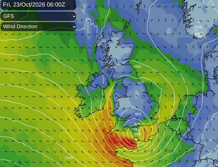
There is a lot of agreement around the track of the low, perhaps still some uncertainty about depth of the low by Friday morning.
Meteo France has widespread yellow wind warnings along with Amber wind warnings for northern regions and the risk of coastal flooding. The strongest winds and gales will be around the southern and western flank of this low.
Rain
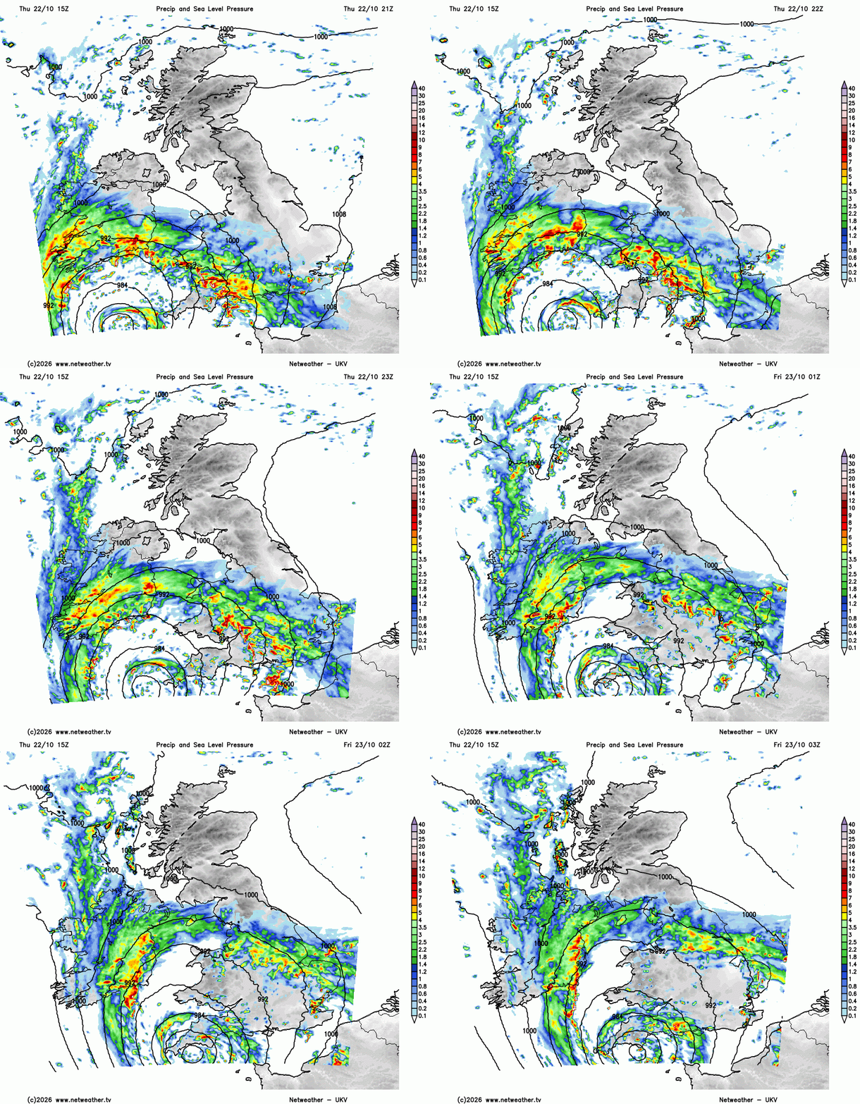
As the low pressure moves along the Channel, there will be bands of heavy rain wrapped around the storm. The main frontal bands will move from Northern Ireland and the Irish Sea over southern Scotland to start Friday. There is the risk of flooding and the Met Office has a yellow rain warning for southern and eastern Scotland on Friday.
The Isle of Man has a yellow rain warning
“Rain becoming persistent and heavy tonight, before gradually easing and petering out later tomorrow morning [Friday] and early afternoon. Totals expected 15-30mm, with risk of localised flooding, particularly where any drains are blocked.”
The persistent rain will then cover more of mainland Scotland with snow on the mountain tops. There will be an onshore wind for the Lothian coast, adding to the miserable wet weather. The wet and windy weather will continue for eastern counties of Scotland through Friday evening and then clear away overnight.
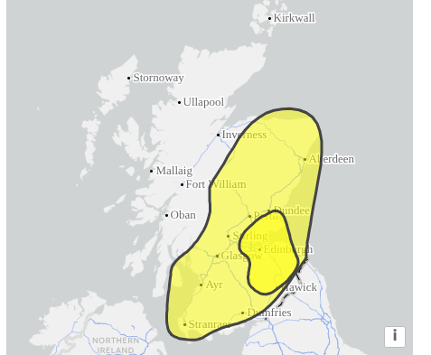
From the Scottish Flood Forecast - "Sustained and heavy rain is expected to affect parts eastern & central Scotland from Friday and through the weekend, with the greater risks around Fife, Edinburgh, the Lothians and Scottish Borders. There is currently a low chance of some significant river flooding impacts on Friday...further moderate impacts due to rain and coastal flooding on Saturday."
There will be a chilly lull overnight Friday into Saturday before the next Storm, Boelo arrives during Saturday. This one will be furhter north but will bring widespread wet and windy weather on Saturday from the west and wild conditions overnight into Sunday for Scotland in particular.
Will it be windy? Online chat and discussion about the storms in the Netweather community forum. Storm Austen and Storm Boelo
Loading recent activity...