If you are travelling this weekend or planning something outdoors, Storm Austen on Friday is not the end of the wet and windy weather for this week.
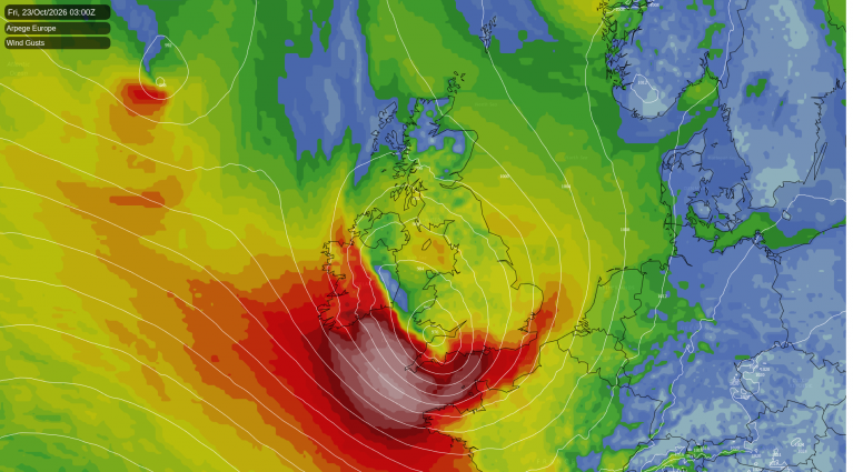
Storm Austen will arrive during Thursday night for SW Britain but will soon track across southern England and the English Channel during Friday morning with wild conditions. There is still some uncertainty about where could see the worst of the gales and high gusts, including if that will be northern France instead. There is a wide yellow wind warning for southern Britain, and a more focused Amber wind warning earlier on Friday over Cornwall, the Isles of Scilly and western Devon in the northwesterly winds behind the low centre.
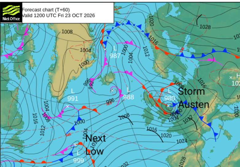
The Austen low centre will move eastwards during Friday and behind it there will be a colder northwesterly flow with strong winds continuing along North Sea coasts until the rain finally clears from Aberdeen.
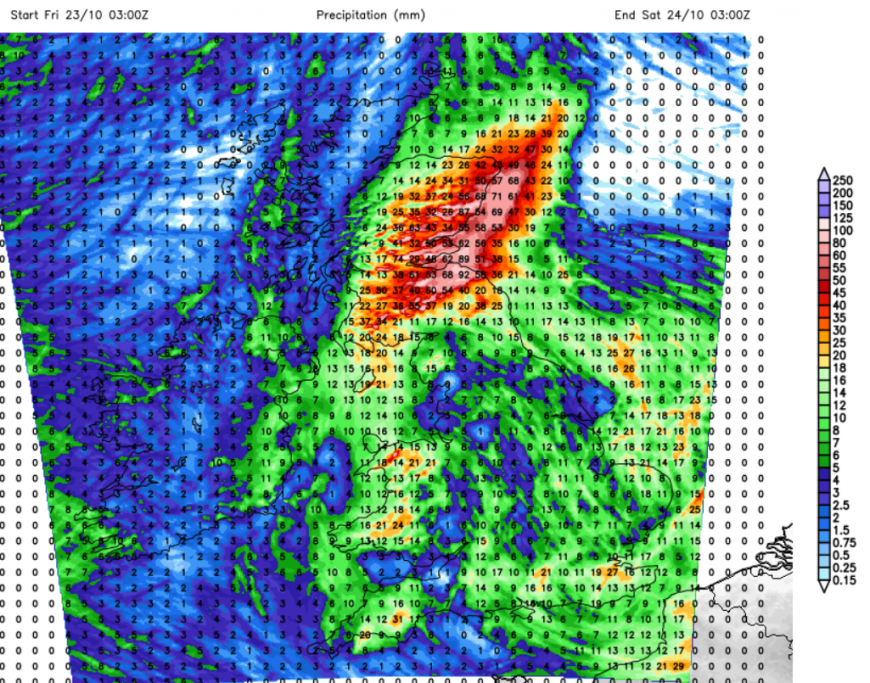
There is a heavy rain warning for a swathe of Scotland running from the northeast to the southwest and including Glasgow to Edinburgh.
“Storm Austen bringing persistent heavy rain, with the chance of some travel disruption and flooding in a few places”
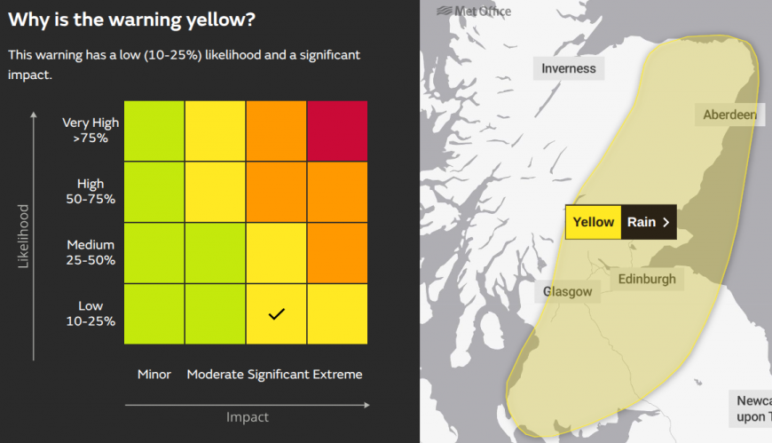
Conditions on Friday within this rain-warned area will be miserable with gusty cold winds and heavy rain. The rain will edge from southern Scotland over eastern counties and over Grampian during the day.
"Heavy rain is expected to affect parts of Scotland from Friday and through the weekend. There is currently a low chance of some significant river flooding impacts on Friday but forecast details remain uncertain and the situation is being closely monitored. Further heavy rain is expected on Saturday and into Sunday." Scottish Flood Forecast
For England and Wales, there will be heavy showers and the cold NW wind through the Friday evening rush hour and impacts from earlier in the day may still be ongoing. It will turn chilly over northern Britain during Friday night.
All of this clears overnight into the early hours of Saturday with a brief lull. It won’t last long but there will be a time of lighter winds and drier weather overnight for Britain.
Saturday
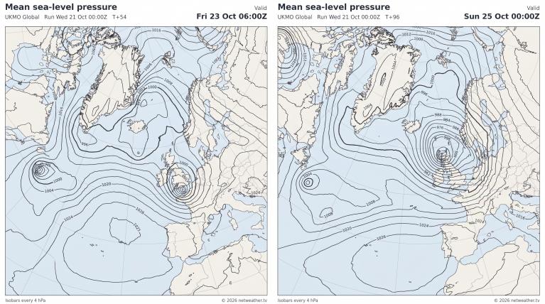
The rain and the winds will start up again soon enough. This low will be much deeper than Austen and will develop away to the northwest of Scotland on Saturday. However, it seems to make a strange detour on the ECM model and swings southeast over mainland Scotland during Saturday night.
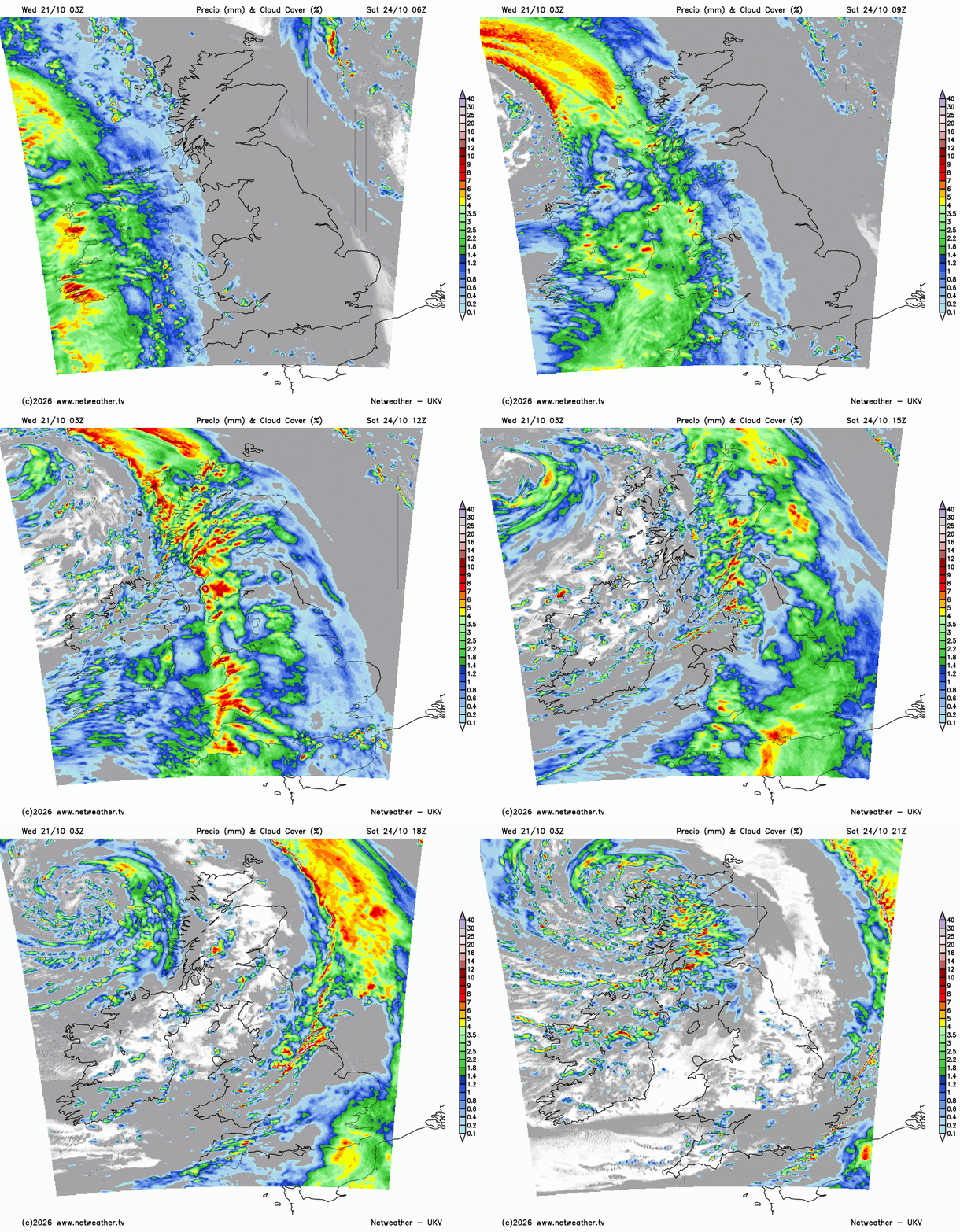
The frontal rain will sweep in from the west on Saturday morning. It will be wet and windy for a time but not as cold in a southerly flow. There will be some lively downpours behind the main frontal rain and then clear, brighter conditions to end the day for Northern Ireland and northern Britain, although still with hefty showers.
As the lively line convection and mild air clears southeastern Britain, a mass of heavy showers will cover Scotland from the west with bands extending down over Ireland. It will be chilly here early evening but will recover slightly during the night.
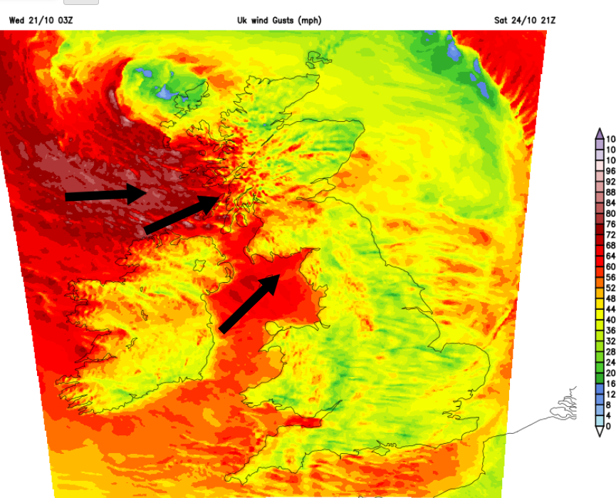
Saturday night is likely to be the time of the strongest winds around this second low. Where these hit will depend on where the centre of the low moves over and there has to be some uncertainty around that at this early stage. The UKV has been signalling western Scotland, particularly the Islands, and the north coast of Northern Ireland to have a stormy night.
Sunday
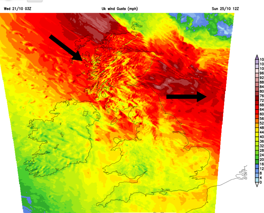
Early on Sunday morning the low centre will move away over the North Sea as the rain bands clear from northeastern Scotland and the Northern Isles. The gales could continue through Sunday for parts of Scotland, with a windy day for much of the UK. It might stay stormy for the far northeast of Scotland for much of the day, which will impact ferry services.
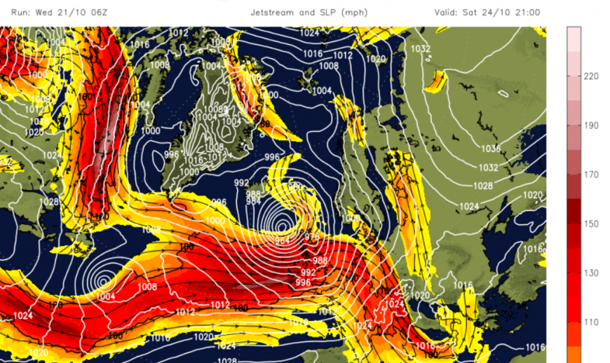
Both these impactful low pressures will develop near to a strong jet, which has moved further south this week. With the strong jet in place, it's not a surprise to see two Atlantic low pressures deepen close to the UK.
More discussion in the Netweather community forum
Loading recent activity...