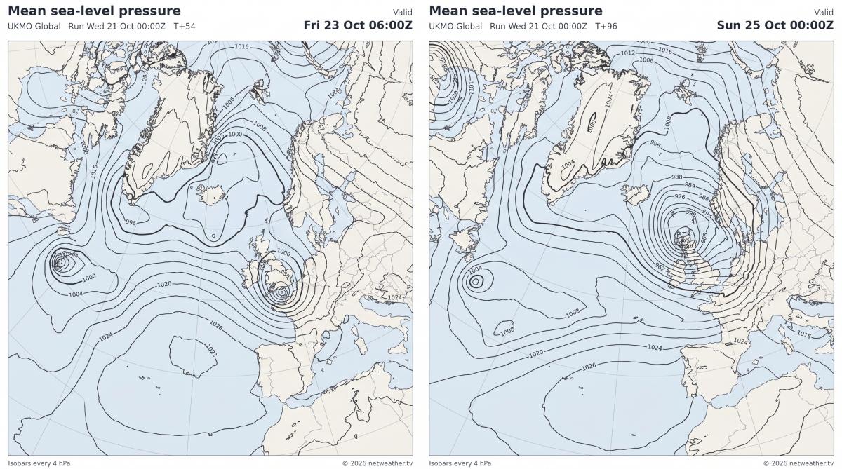
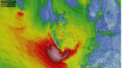
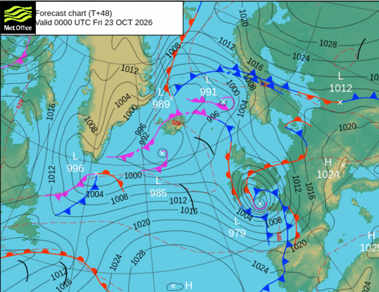
Storm Austen was named on Tuesday by the UK Met Office. An incoming low pressure which will rapidly deepen on Thursday 22nd October over the Atlantic before reaching Cornwall in the middle of Thursday night. The low centre will continue eastwards along the English Channel on Friday.
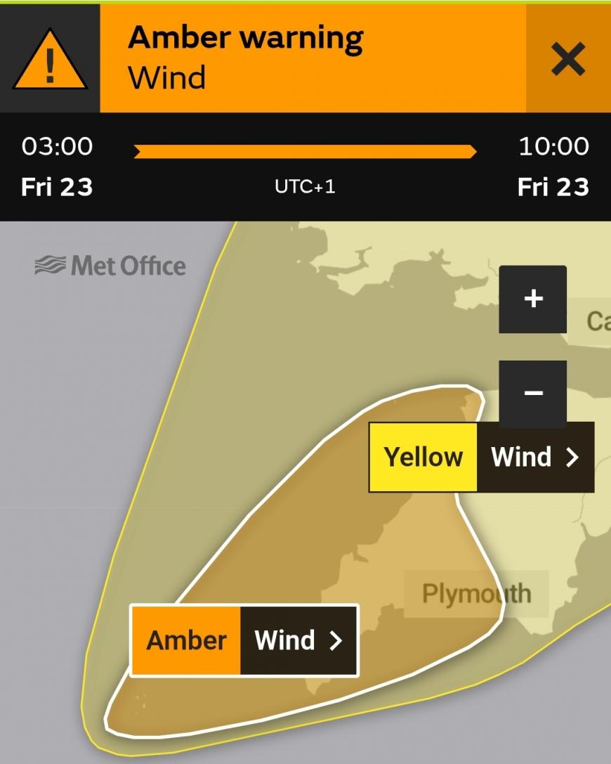
Amber warning area: “Storm Austen likely to bring some disruption and possible damaging winds on Friday morning.”
“A spell of very strong northwesterly winds is likely on Friday morning. There is a good chance that gusts of 60-70 mph will develop widely for a time with perhaps some gusts around 80 mph for exposed headlands. Very strong winds will be combined with spells of heavy rain. Remaining windy for the rest of Friday but winds will gradually ease.”
The wider yellow wind warning covers southern Wales, SW England, southern coastal counties of England and the Isle of Wight. As the forecast models have become more aligned we see the warning matrix change.
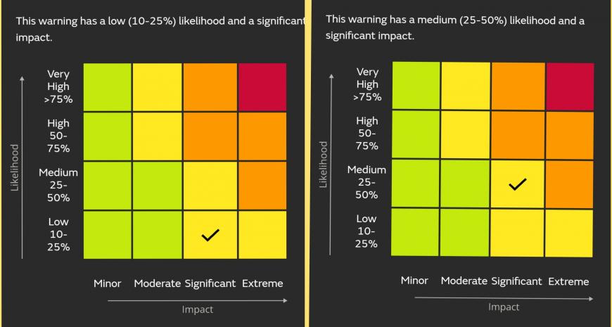
There now a higher likelihood of severe weather, so the tick has moved up a rung. The amber area has a high (50-75%) likelihood and a significant impact.
Austen rains
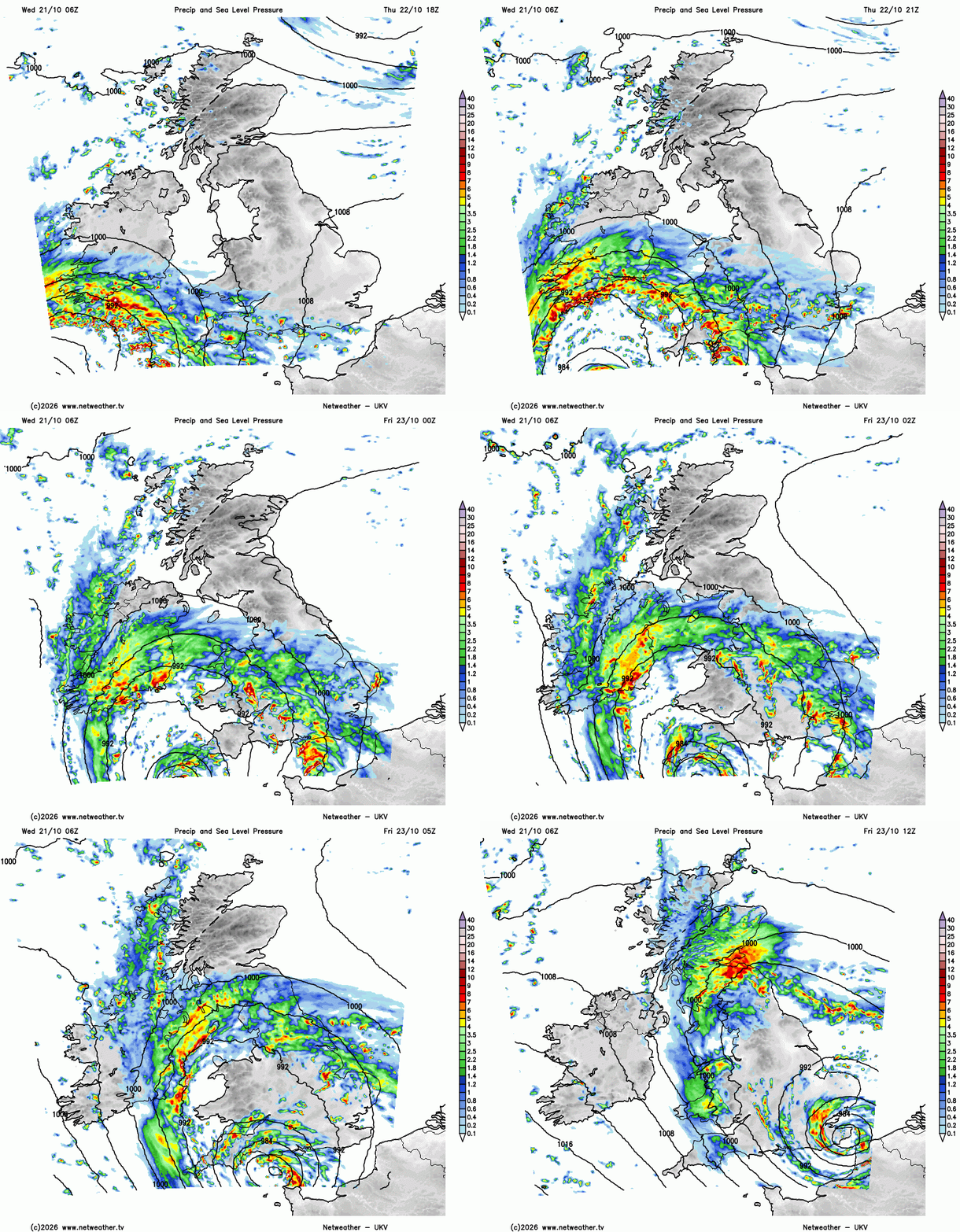
The weather will deteriorate over southwest Britain on Thursday evening. On the UKV precipitation and pressure chart you can see the rain-wrapped low, the storm centre moving along the south coast of England on Friday morning. There are also warnings for northern France. The bands of rain from Austen will reach over Northern Ireland and northern England to start Friday. This will clear Norhtern Ireland but really set in for southern and eastern Scotland.
There is the risk of inland surface water flooding and for SW Britain, coastal or tidal flooding.
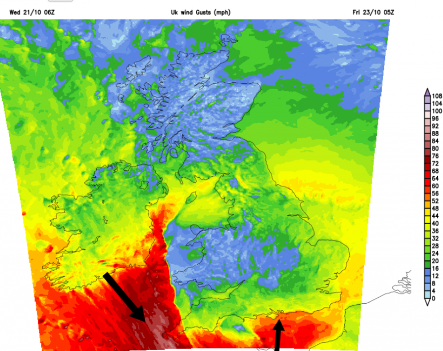
Austen winds
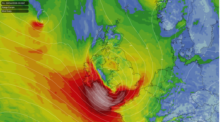
Although the winds will pick up on Thursday evening from the south or southeast it is around the back edge of this low that we could see the most impactful winds. A zone of higher gusts with gales from the northwest will arrive around dawn as people begin to get on the move. The Channel Islands are mentioning severe gales and Force 9 winds in their forecast for Friday morning. Currently the worst of the winds in the day do look to be along the Channel but if the low is a bit further north, it could be the south coast of England that sees higher impacts. The forecast may change in the next day or so.
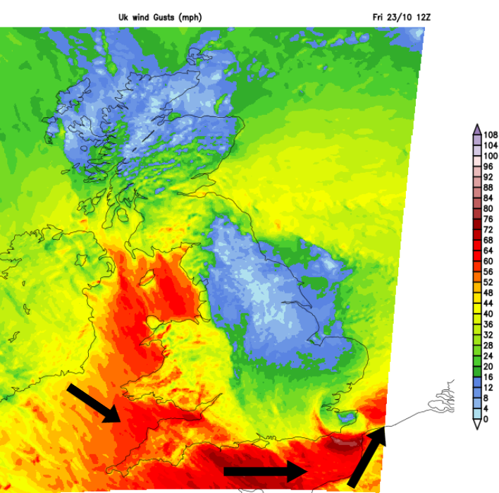
On the UKV for 12z (1pm) on Friday there is a core of higher gusts around the southern flank of the storm. The winds are stronger over the sea than the land usually due to less friction but that core signal looks nasty. The trees still have plenty of leaves on them, it has been a summer of drought and heat stress.
Preparations and Resilience
The headlines are full of ‘batter’ and ‘smash’ relating to the incoming Storm Austen. The Mirror is urging ‘Brits’ to “gather batteries”? I’m not clicking on that, but it does relate to local resilience. If your electricity did go off in a storm, would you be prepared? Do you have a working torch that’s not on your phone? Those who lived through the electricity strikes of the 70s will probably have candles ready. (The modern advice is to have a different backup light source so that you don’t burn your house down).
This is why we have warnings, not just as something interesting to talk about with a different name off the list. It is to provoke a thought process; sometimes leading to preparation and sometimes alterations to plans. This can save lives and lessen damage, and hopefully the number of people who might become stranded. It can reduce stress and allow people to hunker down at home until the severe weather has passed.
All of this can lessen the strain on our emergency services.
There is ongoing chat and planning about resilience in communities. You might initially think about emergency situations such as flooding, power outages, deep snow or, as has happened in France and the Netherlands this month, more sinister interruptions to food supplies. However, local resilience is about longer-term adjustments so that communities become less vulnerable by how they live. Then when problems or emergencies do emerge (such as in the COVID pandemic) communities can assist alongside any wider government provision.
Communities can be best placed to respond to local impacts of global crises such as economic disruption, health strains and the climate crisis. Temporary groups will appear in times of need alongside existing organisations but climate action groups, community clubs and parish councils will be trying to make longer-term plans now, and probably looking for volunteers or just interested folks to discuss options with.
The UK government has advised households to store enough food and water for three days, in case of an unspecified event, which could increase the country’s resilience. Have you started buying a few bits? Have you dipped into the stores already because they were handy?
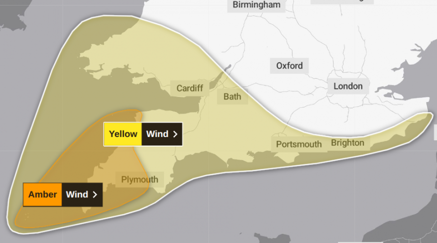
Wider yellow wind warning for Storm Austen on Friday 24th
The Met Office do have suggestions within their warnings. For upcoming stormy weather, they suggest “Check for loose items outside your home and plan how you could secure them.” So if you have a wobbly fence or a trampoline that looks like it could escape, now is the time to get on with it. Or tell the person in your household who should have fixed the fence weeks ago that a storm is coming! Potentially two storms as there could be another one further north at the weekend. Also don’t just put out your recycling bins on Thursday night, because Friday morning is your fortnightly/ three weekly pickup.
“People cope better with power cuts when they have prepared for them in advance. It's easy to do; consider gathering torches and batteries, a mobile phone power pack and other essential items.” MO
There is your “gathering batteries” update along with a warning to stay away from the coast and the large waves. Iceland recently had its first storm of this season and there were people on the Reynisfjara beach who got swept into the sea while taking photos. The local emergency plan had already been activated, warning people to stay away, as it is a viewing destination for tourists. And yet people still ignored the warnings, and others had to risk their lives pulling them out of the wild sea.
The outlook
The UK is in for a spell of wet and windy weather with Storm Austen arriving on Thursday night, in the dark as most people will be sleeping. There will be further impacts from the strong winds on Friday, with disruption to travel likely. The Straits of Dover could be wild by lunchtime, which may impact Channel ferry crossings for the rest of the day.
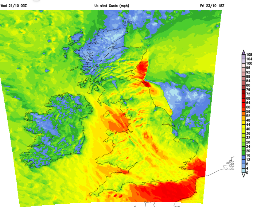
These strong winds will last into Friday evening for North Sea coasts as the low clears away. The UKV highlights a red zone of high gusts off SE Scotland on Friday evening.
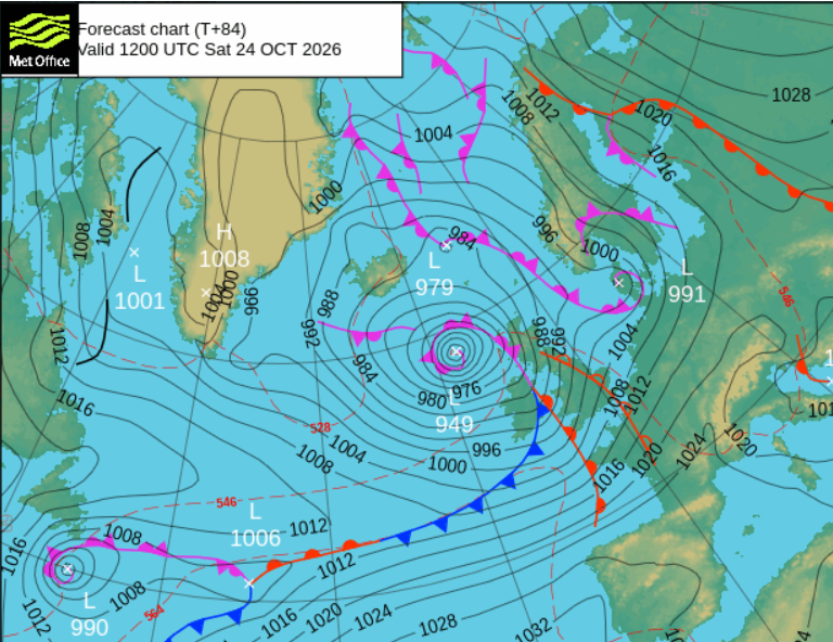
And even as that clears, another deep Atlantic low will be heading in with wild weather by Saturday lunchtime and this could last for most of the weekend, and be more widespread. All as more schools go on their October half-term break and people might be travelling.
Loading recent activity...