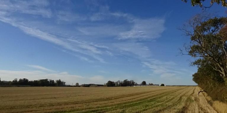
The weather looks to remain changeable as we head towards the middle of the month, with Atlantic frontal systems crossing the UK at times, bringing occasional spells of rain, but with transitory ridges passing through between these systems - bringing dry and sunnier spells.
Sometimes in early autumn, we see the remnants of ex-hurricanes or tropical storms that recurve out of the tropical North Atlantic and hitch a ride on the jet stream towards NW Europe, while boosting the strength of the jet stream too, bringing either wet and windy weather or, if they track far enough north, helping high pressure build to bring warm or hot weather.
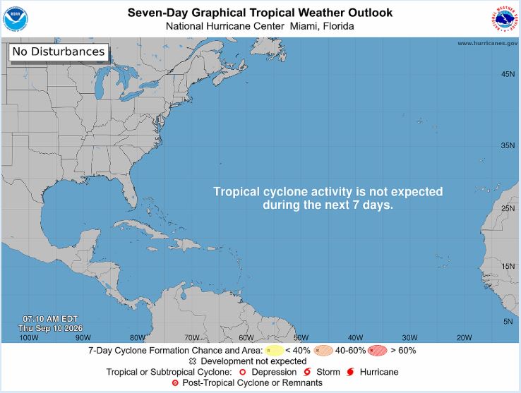
However, the Atlantic Hurricane season has been exceptionally quiet. Yesterday’s date, 10th September, marks the climatological peak of the Atlantic hurricane season - the date that has the highest likelihood of tropical development. But the season has produced just 5 named storms & 0 hurricanes, & lowest amount of Accumulated Cyclone Energy (ACE) on modern record. The developing Strong El Nino event increases wind shear across the western tropical Atlantic and Caribbean and has been at record levels, beating every other year during the satellite era.
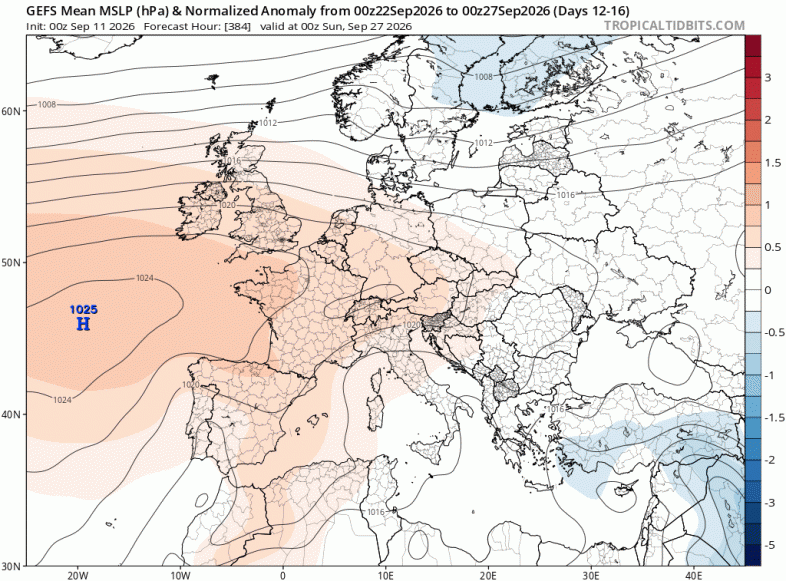
Although, by no means concrete yet, there remains a signal from the weather models and their ensembles for high pressure to build for longer towards southern UK, with a greater chance of more prolonged settled weather here. Though northern areas perhaps staying more unsettled with Atlantic fronts continuing to bring further spells of rain or showers, perhaps windy at times too, as one or two deep lows passes to the north of Scotland. High pressure may eventually extend across all parts before the end of the month, bringing dry and settled conditions for many.
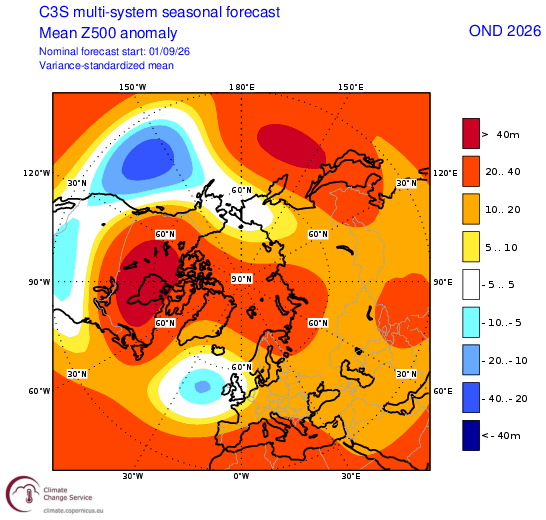
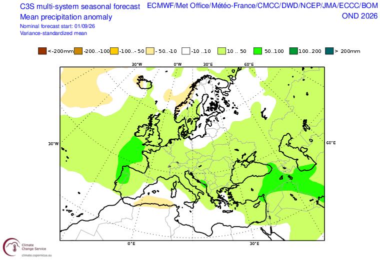
This increasing high pressure influence in the south later this month could continue into early October but there is quite a strong multi-model signal that the weather will turn increasingly unsettled through October, with the seasonal models forecasting for Atlantic low pressure to be in charge of UK weather through to January - looking at the multi-model 3-month ensemble mean anomaly for 500 hPa heights for the October-December and November-January.
October - December C3S multi-model mean 500 hPa height anomaly and precipitation
November - January C3S multi-model mean 500 hPa height anomaly
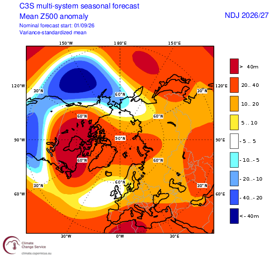
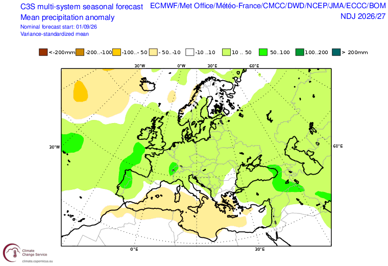
Historically, El Niño events have tended to be associated with milder, wetter and stormier conditions across the UK and northern Europe during late autumn and early winter - which is broadly consistent with the latest seasonal forecasts. However, El Nino is not the only driver of weather patterns that affect Europe, it is also strongly influenced by other factors, such as the North Atlantic jet stream, the sea surface temperatures of the Atlantic Ocean; the polar vortex and also the amount of sea ice around the North Pole.
February C3S multi-model 500 hPa height anomaly
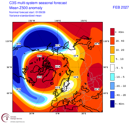
The multi-model C3S seasonal outlook also forecasts blocking (high 500 hPa heights) over Greenland area later in winter while lower height anomalies are more displaced to the southwest and a neutral heights signal across the UK. This suggests a greater potential for cold spells than in December or January, though with some unsettled milder weather too. So perhaps a greater chance for colder and perhaps wintry weather towards the end of winter, while December and January are likely mild and unsettled at times overall, December seeing higher rainfall and more stormy weather.
The good news is, following drought across much of England and Wales this summer, is that a wetter-than-average autumn and early winter across the UK as a whole is looking increasingly likely, but not guaranteed, but also warmer-than-average - likely thanks to anomalously warm oceans surrounding Europe after a record-breaking hot summer.
Loading recent activity...