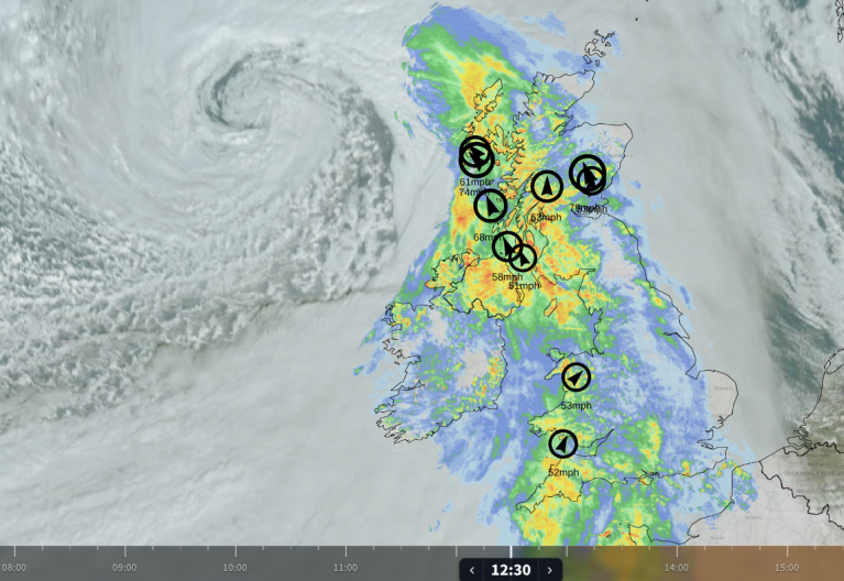
The warm air in the south is being cleared away by a cold front, and there is a hint of autumn in the air further north. It has been windy with frequent gusts. There has been a beautiful swirl of cloud on the satellite imagery to the northwest and now north of mainland Scotland. This has kept a feed of blustery showers rattling by and is directing cooler air towards the UK.
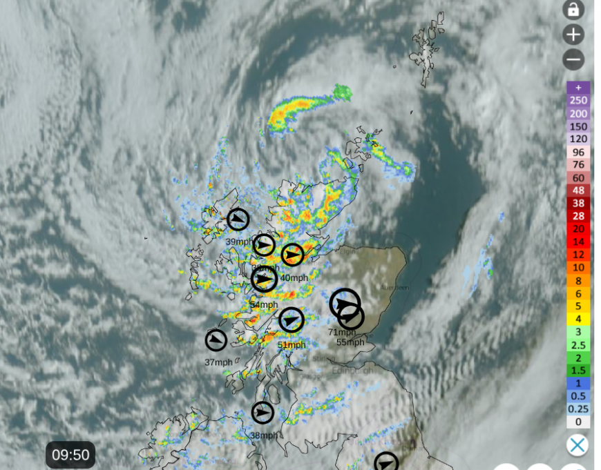
Netweather radar with satellite and top gusts at 09:50 on Tuesday 8th
Further south, there has been a mass of frontal cloud and a band of rain. London Heathrow reached 25.0C on Monday. Today the range across the UK will be around 15 to 19C, with 20 to 22C for a few spots in southern England.
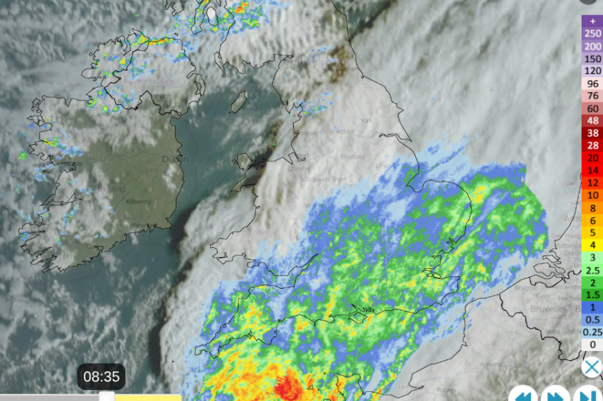
In the wind and showers, it will feel fresher even with more bright or sunny spells. Southeastern Britain will see more rain, which will be welcome by gardeners and growers. Heavy downpours look likely for Sussex and Kent around lunchtime as another small low pressure nips along the Channel. Northern France has yellow wind warnings today due to concerns of high gusts around this low centre.
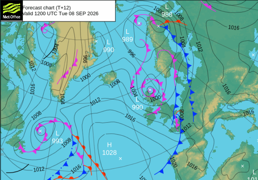
This might just need watching for areas east and south of Greater London into Kent and East Sussex through the afternoon, with some sudden heavy downpours and poor visibility on the road
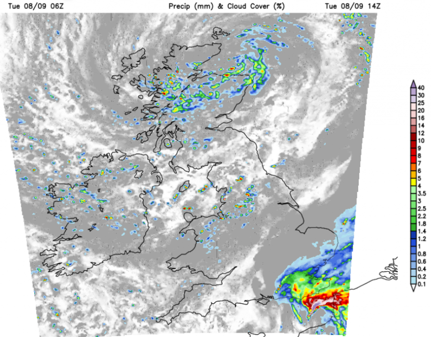
Elsewhere it will be a blustery day in the west to northwesterly wind with clusters of showers but also times of fair, sunny weather. There will be heavier showers for northern mainland Scotland with even hail and thunder possible around the Moray Firth, into Grampian by this evening. The low centre will roll away over the mid- North Sea with stronger winds for a time this evening for eastern Scotland and tonight for eastern England.
Wednesday
The Atlantic high pressure will build over the UK, allowing a dry and fine Wednesday. There will still be a few showers into north Wales and the West Midlands first thing, with breezy conditions for East Anglia and Kent in the morning and a scattering of showers. The theme midweek is for lighter winds, settled and sunny weather. The air will be cooler everywhere, but with more sunshine and calmer conditions it will feel pleasant.
After the quiet Wednesday, high cloud will begin to appear from the Atlantic, a sign of the next change. The midweek high pressure will slow the progress of the next incoming low pressure.
Thursday
There will be more cloud about on Thursday morning but breaks will appear, allowing sunny spells and the rain over Northern Ireland and along the west coast of Britain will be rather patchy to start the day. The winds will still be light but it will have been cool overnight for Britain. Eastern England should see more sunshine by lunchtime, but frontal rain will arrive in the west. There will be a blustery southerly wind, more cloud but also warmer air in the mix.
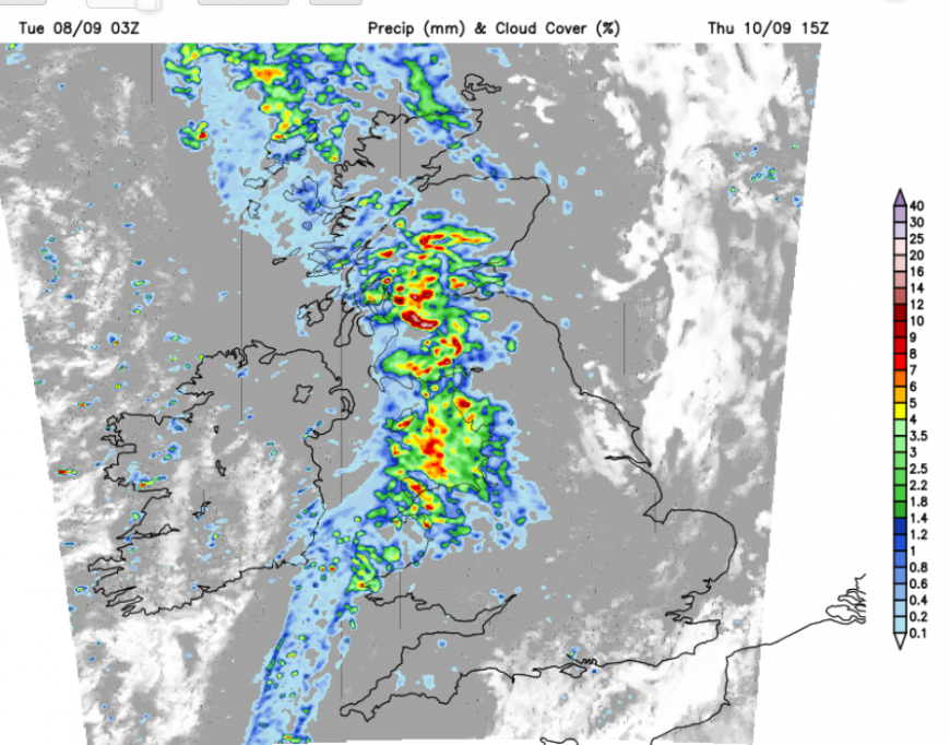
The frontal rain will become heavier and move steadily east and southeast through Thursday and overnight. It’s a changeable picture but there will be bouts of rain, which is much needed.
Loading recent activity...