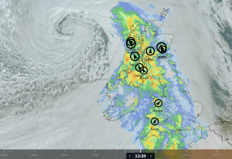
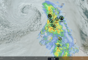
A band of rain now out in the Atlantic will reach the Outer Hebrides and Argyll around lunchtime, and the Central Belt by late afternoon. Rain is close to certain across Scotland, at above a 90% chance, from about one o'clock until midnight. Northern Ireland and the Isle of Man will be wet on and off from mid-morning, above an 80% risk. The heaviest will sit over Argyll, the Firth of Clyde and the western Highlands rather than over the cities, with nearly 18mm around Lochgilphead. It reaches the Borders and Galloway through the evening, and Cumbria and Tyneside late on.
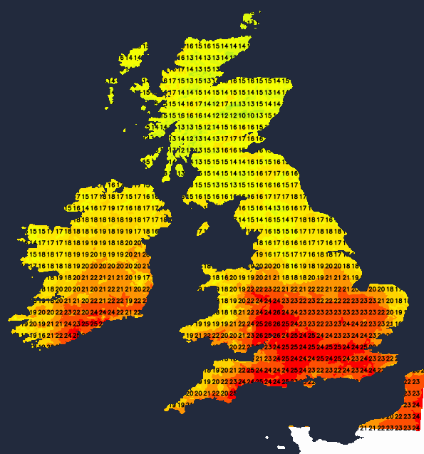
South of it, England and Wales will mostly dry, with some showers here and there in the north and west. The afternoon will be warm. Temperature wise, Wales splits, 21C in the north-east against 24C around the Severn estuary. Expect 26 to 27C on the English side of it, the warmest in Worcestershire, while the Potteries manage only 20C. The mid-twenties are likely in London, the South East and the South West, this afternoon, Scotland sits between 14C and 18C.
The rain clears into the North Sea overnight and Tuesday turns windier. An Atlantic low deepening north-west of Ireland packs more isobars across Britain, and for once the wind comes from one direction everywhere: a westerly. Gusts of 30 to 40mph are likely over eastern Scotland, the Fife coast and the Pennines. Caithness, Sutherland and Orkney will take more than 15mm through the day, heaviest late in the afternoon and evening; a wet day, not a showery one. Greater Manchester and Lancashire will be damp from dawn to midnight at a similar risk, though little accumulates. Lincolnshire and East Anglia carry about a 70% chance of a shower, while the far south holds on at 25 to 26C from the Solent round to Kent.
Wednesday will be a showery day. Showers will come through in batches with sizeable gaps between them - most likely and most frequent in the north and west, least likely further southeast.
Thursday is where the pattern moves. Overnight on Wednesday the isobars rotate from running west to east across the country to running north to south down it. Pressure builds from the Atlantic west of Ireland while that low goes through to Scandinavia, and by Thursday morning the wind over England and eastern Scotland comes from the north-east. Some more organised rain is likely to run west to east across northern England at first light, and by afternoon showers should be scattered almost everywhere. Some thunder is also possible where the showers gather.
Friday should be drier in most places, though nowhere certainly. A nose of high pressure builds in from the Atlantic over Northern Ireland and Scotland, the wind over England and Wales is a light north-north-easterly and north-westerly in Scotland, and the shower risk falls to 20 to 40%. The low twenties are likely to be the max by this point - quite different to what we've often seen of late.
Loading recent activity...