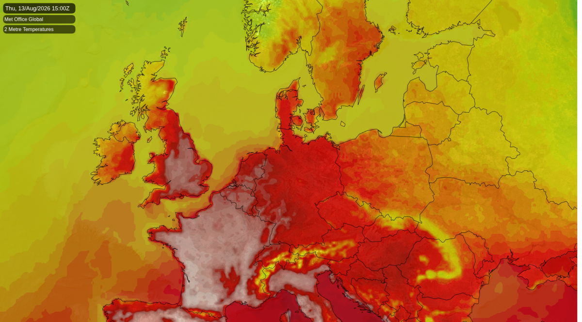
Charlwood had reached 33.6C by 11am, and the afternoon is still to come. Amber warnings of extreme heat run until 11pm tonight across seven English regions, after the Met Office widened the area this morning to take in Cheshire, Greater Manchester, Gloucestershire and Wiltshire. For inland areas within the warning zone, 36 to 38C is likely this afternoon.
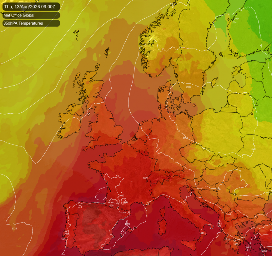
High pressure over Poland has extended a ridge west across the near continent, and the light southerly round its edge has spent days crossing warm land. That puts the heat inland, away from the sea: the west Midlands, Cheshire, the Trent valley and the Thames valley.
The rain that would matter is not coming in the short term. Drought covers all of Wales and almost three quarters of England, after the driest July since records began in 1836. Tony Grayling, who chairs the National Drought Group, said conditions will worsen until there is "significant and sustained rainfall". Nothing of that kind arrives before the weekend is out. There are shower chances, a 30% risk in the west Midlands on Sunday, but nothing to leave a mark.
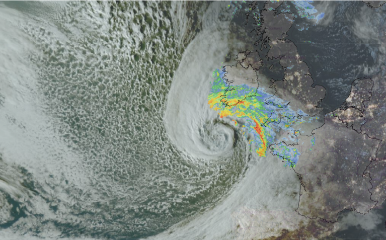
What rain there is falls where it is least needed. A band of rain lies across Wester Ross, Sutherland and Skye at first light, tracking north-east through the morning. Caithness, Orkney and Shetland take the heaviest of it at midday, with over 10mm around Wick, where rain is more than 80% likely. It clears into the North Sea by evening. The Forth valley has close to a 60% chance of a shower, less so south of Glasgow. Truro will manage only about 24C, and Stornoway about 18C.
Radar and satellite image at 1125 this morning
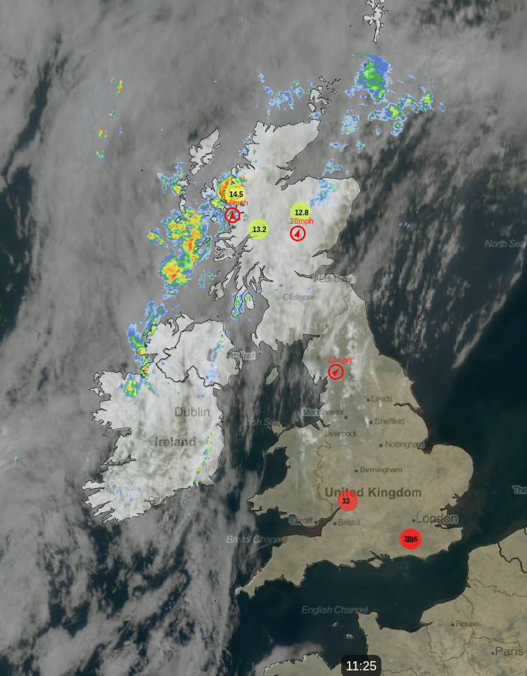
Northern Ireland has a yellow thunderstorm warning from 10am today until 5am on Friday. The air there turns unstable overnight, so a thundery downpour is possible in any county, though most places will miss it. Belfast should still reach 26C.
Central London may not drop below 23C tonight, the part of a heat warning that does the damage. Friday will start the unwinding. A col will open between the Azores high to the south-west and the high over Scandinavia, and the boundary between hot and cooler air will slide south-east. Kent and Essex will hold on to 33C. Crewe, at 36C today, will manage 27C. Showers should develop around dawn over Argyll, the Clyde and the central belt, with about a 40% chance of one.
Saturday should return the country to something closer to ordinary for mid-August. The warmth should shrink to a coastal strip: about 30C on the Sussex coast, 28 to 29C into Dorset and Essex, and 18 to 26C from the Midlands and Wales northwards. Scotland should get 14 to 20C. Kilmarnock could be nearly four degrees below average for the date. Showers are likely to run down the southern North Sea in the morning but stay over the water, leaving the Kent and East Anglian coasts most likely dry.
Sunday will be a touch cooler again. Southampton may reach 27C, Cardiff and Worcester 24 to 25C. Overnight into Sunday it is cloud, not distance from the sea, that decides where the cold sits. Where the sky clears, in the sheltered valleys of mid-Wales and the Marches, 6 to 8C is possible. Coventry, forty miles away under cloud, should hold 14C. Rain should edge into the north-west later, a 30 to 40% chance of a shower from Dumfries to Carlisle and Belfast.
Loading recent activity...