This weekend brings November to a close. That’s right, by Monday, it will be December. We’ve had a bout of Arctic cold with snow for parts of the UK. Midweek will turn milder with times of wet and windy weather as the frost risk retreats. It will return at the weekend. There are concerns for some heavy rain for England on Saturday but low confidence about the track of a small low pressure heading for southern Britain.
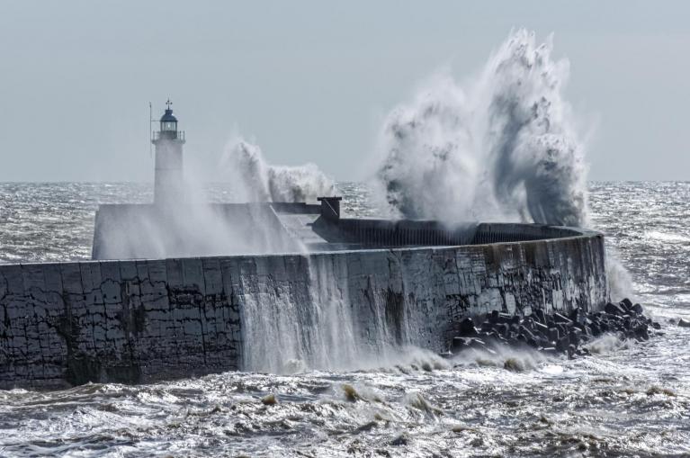
Before that, a large low pressure will dominate to the northwest of the UK in the middle of the week. There is a yellow wind warning for the far north and west of Scotland with gales and high gusts as it moves closer.
“Strong winds from Thursday afternoon through Friday morning may cause some disruption.” MO

Behind that cold front, temperatures will fall back to around average for late November on Friday. It will still be fairly mild in southeast England but elsewhere it won’t be as mild as on Thursday. If you follow that air flow back, around the low centre so it will be modified, it comes from the north. The low pressure will continue its progress eastwards towards northern Norway and colder Arctic air will head towards Scotland.
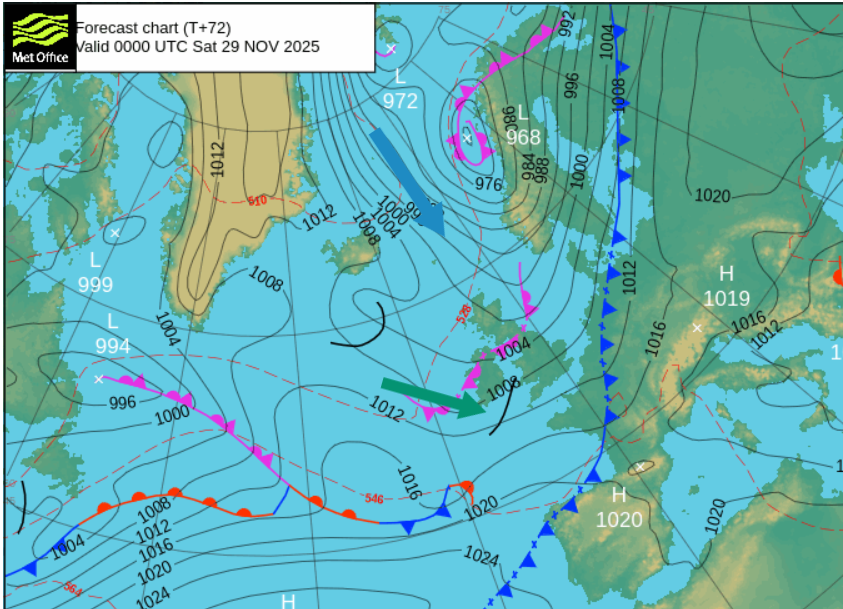
There is some uncertainty in the forecast for Saturday but southern counties of England could hold onto some milder air as temperatures fall elsewhere. There will be a wider risk of frost for the weekend.
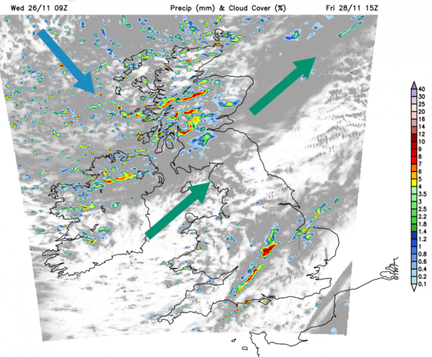
As the large low passes close to Shetland on Friday, it will be very windy. And feel cold in that wind. Stormy for northern Scotland early on Friday and very windy through the Central Belt, southern Scotland, the Irish Sea and Northern Ireland by day in a southwest wind. Exposed routes in northeast Britain will stay windy for the evening rush as the wind veers to a colder northwesterly into the night. There will be a band of heavy showers moving from Wales to SE England during Friday afternoon and evening as heavy showers continue for Scotland. These will begin to turn wintry over the Scottish mountains after dark.

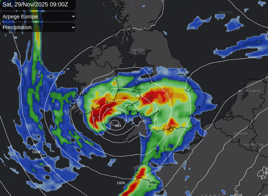
The UKV model has rain approaching SW England soon after midnight and progressing over southern Britain to The Wash by midday on Saturday. Winds will swirl around this little low with showery outbreaks into Wales, the Midlands, East Anglia and the Home Counties. There is some uncertainty about where the heaviest rain will reach. Cambridgeshire and Bedfordshire or perhaps further north into more of Lincolnshire.
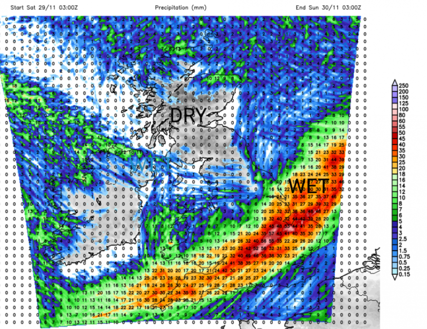
The ECMWF model takes the rain over southern Britain on Saturday morning and across to East Anglia. The GFS model has been singing its own tune with the little low running over Ireland on Friday night. This takes frontal rain over SW Scotland and the southern Uplands on Saturday morning and could hit the cold air with wintry precipitation. Trailing back from this would be frontal rain over England and Wales as precipitation spills over Edinburgh and the Lothians. The GFS has looked like an outlier but the Arpege model does take a little low towards the Irish Sea on Friday night, so further north than the UKV and ECM too.
If the rain stays over southern Britain, there should be sunshine in the cold air to the north but a scattering of showers, with rain, sleet and hail.
Of course, with uncertainty on Saturday, that lowers the confidence for Sunday’s forecast. However, the low pressure should be pulling away eastwards, taking the strong winds and rain with it. Under any clear skies, there will be a frost. This would leave a brighter, even sunnier time before the next Atlantic system arrives to end the weekend. It will feel chilly but could be a better day than on Saturday.
Loading recent activity...