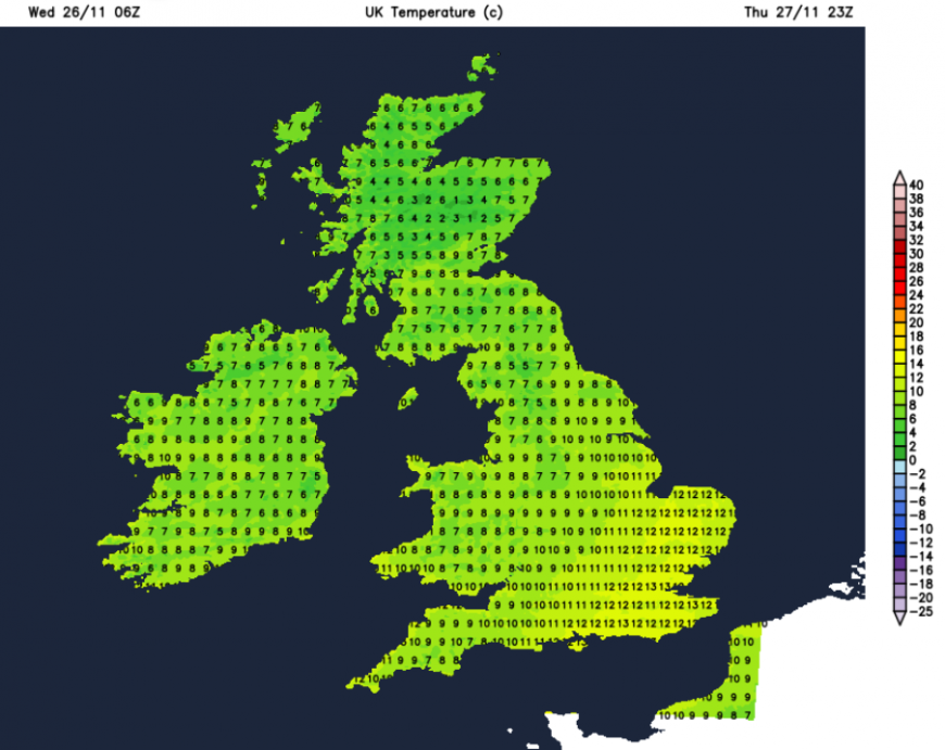
Parts of Britain started Wednesday with a frost and temperatures below freezing. There will be a marked change by Thursday morning when temperatures will be in double figures by 9am across the UK. We will lose the cold flow from the north as the Atlantic provides us with milder midweek air, blustery winds and bouts of rain from the west.
SE England will hold on to the cold air for longest today but will hold onto Thursday’s much milder air well into Thursday night. Cooler air will topple over the UK from the northwest during Thursday evening ready for air temperatures to be closer to average for Friday.
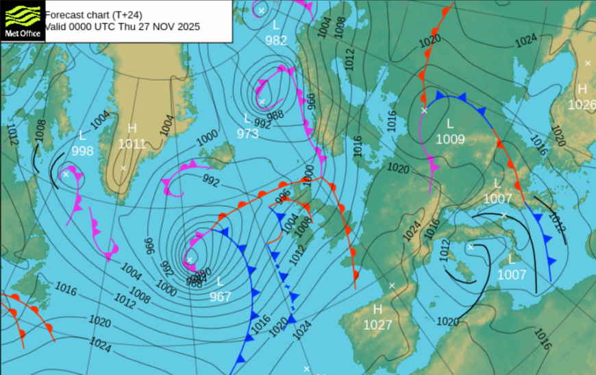
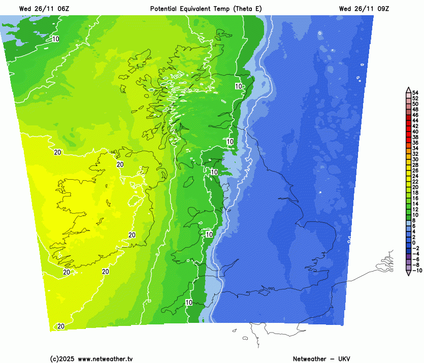
The main influence on our UK weather in the next few days will be a deepening low pressure which is heading south of Iceland. The band of rain over Northern Ireland and western Scotland on Wednesday morning is from its warm front. This is accompanied by a freshening southerly wind and gales for the Western Isles. It will be windy for northern Scotland too with lee gusts.
The Met Office Inshore Waters forecast for the Minch
Wind- Southwest 5 to 7, increasing 7 to severe gale 9, occasionally storm force 10 later.
Sea state- Moderate or rough, becoming rough or very rough, occasionally high and very high later in south.
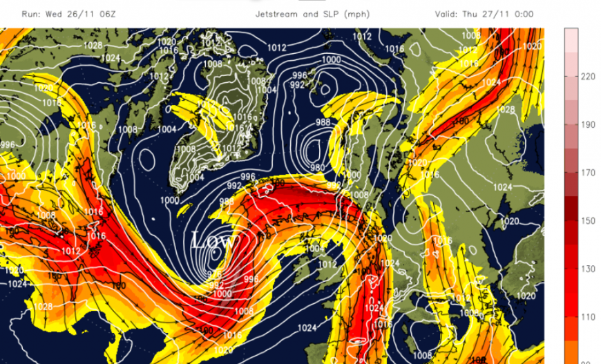
There are buckles in the jetstream with a strong core helping to develop this large low pressure as it moves northwards. From 996hPa at 00Z Weds it is forecast to deepen to 959hPa by 12z Thursday. Southeastern Iceland has a yellow warning for blizzard conditions in heavy snowfall with severe gales also possible on Thursday.
The next change for the UK will occur as the active cold front from this low pressure moves over the UK during Thursday and reaches London and the Home Counties during Thursday night.
Wind and Rain
Northwestern Scotland and Cumbria will see a fair amount of rain in the next two days. Flooding is not expected in western Scotland but the Scottish Flood Forecast mentions that “snow melt may cause some Highland rivers to rise on Thursday. Severe gales may lead to waves and spray along coasts in the north west on Friday.”
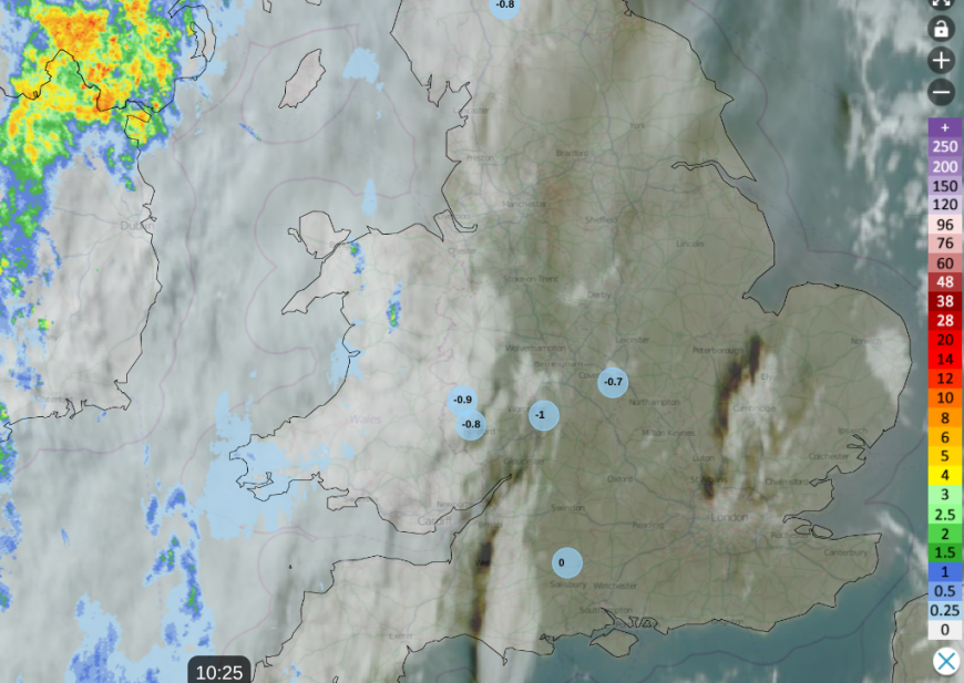
Netweather radar with satellite, showing shadows from the cloud north of London, incoming rain in the west but cold air for England
England has a glorious Wednesday morning, although its cold. There is sunshine, with little wind but the temperatures will really struggle, perhaps 4 or 5C at best. It will turn milder overnight. Wales will see increasing cloud from the west with patchy rain this afternoon. There will be a moderate southerly wind along the west coast but only light winds inland. Temperatures will vary from 7C for Powys and 11C along the coasts. North of high ground, Gwynedd could see lee gusts this afternoon.
The frontal rain will clear Northern Ireland this afternoon as the wind veers from the south to SW. Temperatures will stay in double figures into the night.
One band of rain will move across Scotland and northern England during the middle of Wednesday but the onshore SW flow will bring more rain to the west coast of Scotland, the Isle of Man and this evening to Morecambe Bay.
The warm front band will continue southeastwards over England this evening with clear spells for NE Scotland behind, and lighter winds. Most areas will be mild and cloudy tonight.
There is another inner frontal feature which will bring heavier showery rain to western Scotland and Cumbria during Wednesday night.
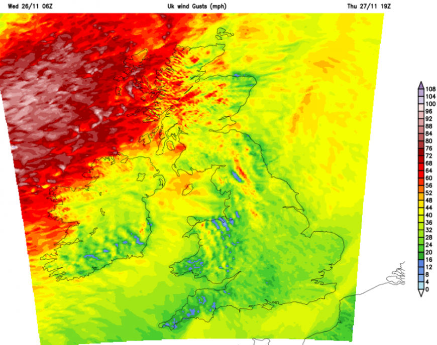
There will be a freshening SW wind early on Thursday for northern Britain and Northern Ireland and the cold front could bring some line convection over northern Britain around lunchtime. It is later on Thursday when gales are expected with a deterioration through the night and travel disruption seems likely by Friday morning in the northern half of the UK. Particularly to ferry services to the Islands. There are now wind warnings for the far NW of Scotland.
Loading recent activity...