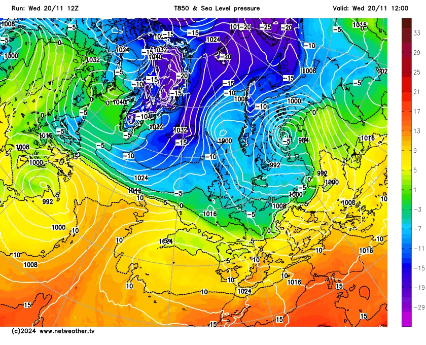
An unusual statistical quirk was that on 20 November 2025, in many ways the weather was strikingly similar to that of 20 November 2024. In the long-running Central England Temperature series from 1659, the mean temperature was provisionally 0.8C on 20 November 2025, the same as on 20 November 2024. On both days, we were in a northerly airstream which, by recent standards, was notably cold for the time of year. Air mass traces in both years indicated that the air mass that we got on 20 November was originating in the Russian Arctic north of Novaya Zemlya.
 20th November 2025
Overall, snow was not quite as widespread from this year's cold snap as last year's, because in 2024 there were also three notable frontal snow events - the one on 18/19 November that especially affected the Midlands, the one on the 21st in the south-west, and the one on the 23rd in Scotland and northern England prior to the arrival of milder air. The cold weather on 20 November 2025 was also preceded by frontal snow in some areas on the 18th/19th, particularly inland parts of Yorkshire, but the lying snow from it was not quite as widespread as on 18/19 November 2024.
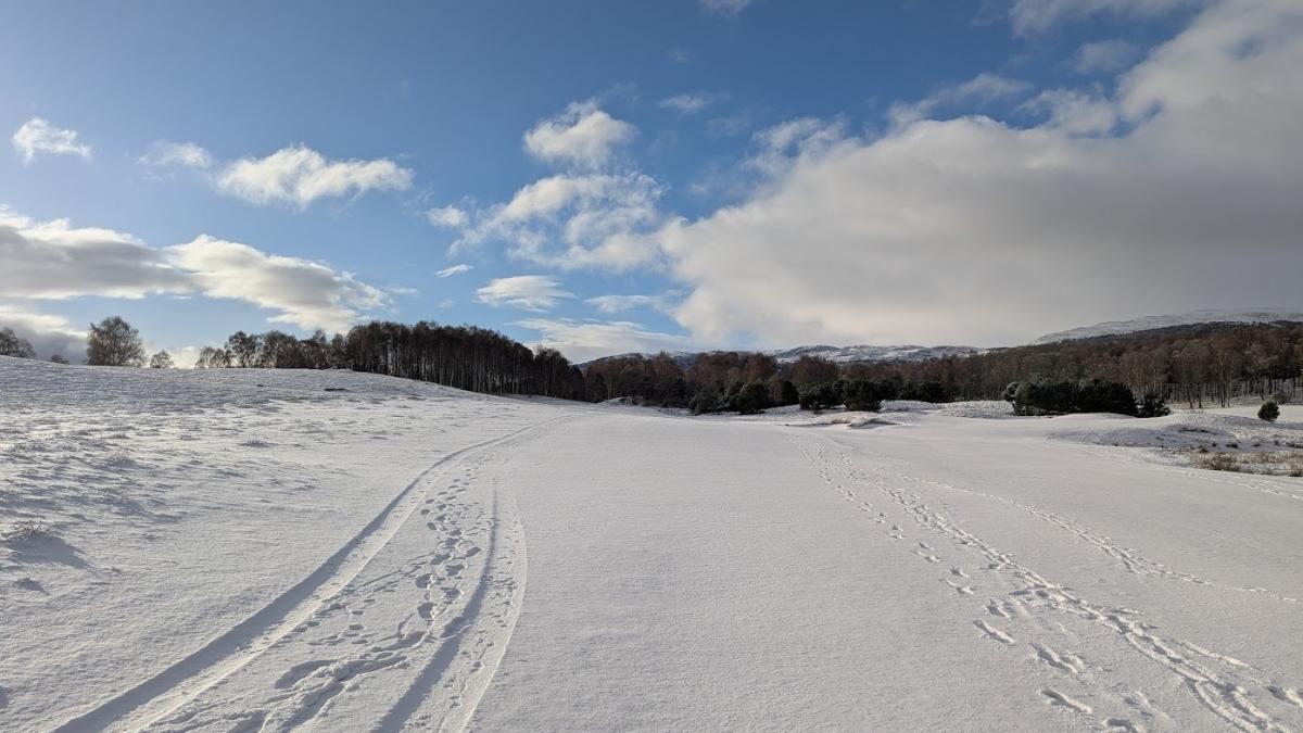
 20th November 2024
But for the second year running, on 20 November we ended up with lying snow penetrating to sea level in parts of Scotland and north-east England, widely as far south as Yorkshire, and with lying snow extending out to the beach in many coastal spots despite the relative warmth of the North Sea at this time of year. 20 November 2025 dawned with a snow cover over much of northern and eastern Scotland, a large area of Northumberland, Tyne and Wear, Durham, and east Yorkshire. Some of these regions saw deeper snow this year than last year, and there were a few areas that missed out last year that saw lying snow this year.
Although the November 2025 cold snap will not surpass 2024 for the title of "most substantial cold and snowy weather in November since 2010", it has a strong claim to rank in second place, and at least up there with the snow events of 30 November 2017 and 26-28 November 2021, as well as occurring earlier in the month. Lying snow events on low ground around 20 November used to be fairly common in most northern and eastern parts of the country, and have become rarer since the turn of the century, but it is notable that we can still get them in a climate that has warmed considerably since then.
Until quite recently, the ECMWF 42-day forecasts were persistently suggesting a lot of high latitude blocking to the north of Britain as we head towards mid-December, which would make cold winds from the north and/or east more likely to recur than average, bringing cold weather and potentially snow events. In the past week, this has shifted towards forecasts of a blocking high to the east, with Britain in a predominantly south to south-westerly airflow, low pressure systems attempting to push in from the west, and high pressure holding firm to the east and north-east.
Generally that kind of setup is less likely to bring cold snowy weather, although it does bring long-term potential for cold air masses to come in from the east should the blocking high to the east start to ridge westwards to the north of Britain, which could generate snowfalls as the cold air passes over the comparatively warm North Sea.
A big source of uncertainty regarding the December outlook is the likelihood of an unusually early sudden stratospheric warming event at the end of November, which typically disrupts the polar vortex (the region of low heights over the Arctic). This tends to increase the likelihood of substantial cold air outbreaks in the Northern Hemisphere, with parts of the polar vortex heading south into the continental land masses. This can bring cold snowy weather to Britain, as happened in the "Beast from the East" at the end of February 2018 and into early March, but in other cases the cold air outbreaks affect other regions and Britain's weather stays mild.
Ironically, on this occasion there is potential for this sudden stratospheric warming event to reduce the chances of cold snowy weather affecting Britain towards mid-December, sending a marked cold air outbreak into North America, which could power up the jet stream as the cold air heads out into the relatively warm North Atlantic Ocean.
This is also what happened in the unusually warm and, for most, sunny February of 2019, when there were a lot of signals for an "easterly" February, but a sudden stratospheric warming event triggered some exceptionally cold weather over Canada and parts of North America, which intensified the jet stream and contributed to us ending up with a blocking high over central Europe rather than over Scandinavia, and getting warm southerlies. But in certain circumstances, this scenario can also produce cold snowy weather in Britain with Atlantic lows colliding with cold continental air coming across from the east.
Thus, prospects from mid-December look rather uncertain, but in the nearer term it looks set to be milder and changeable for the next week or two with mainly westerly winds and any snow restricted to high ground.
Loading recent activity...