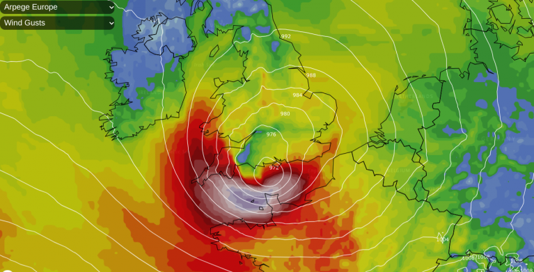
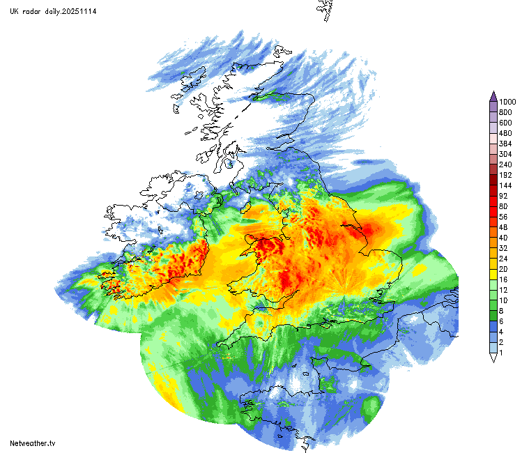
Many areas had an exceptionally wet day yesterday, associated with a named storm, Claudia, which has produced problems with flooding in some parts of the country, particularly in south Wales and the west Midlands.
The event was caused not just by a low pressure system, but by a combination of circumstances. A blocking anticyclone, associated with stable dry air, has been developing over Greenland, diverting the low pressure systems moving across the North Atlantic to the south. The depression named as Claudia then stalled to the south-west of Britain, attempting to push north-eastwards but grinding to a halt against the Greenland blocking high. This resulted in the low pressure system and its associated rain bearing fronts to be held in place for over 24 hours. Even today, we still have the associated rain band straddling part of the British Isles, but it is in the process of fizzling out.
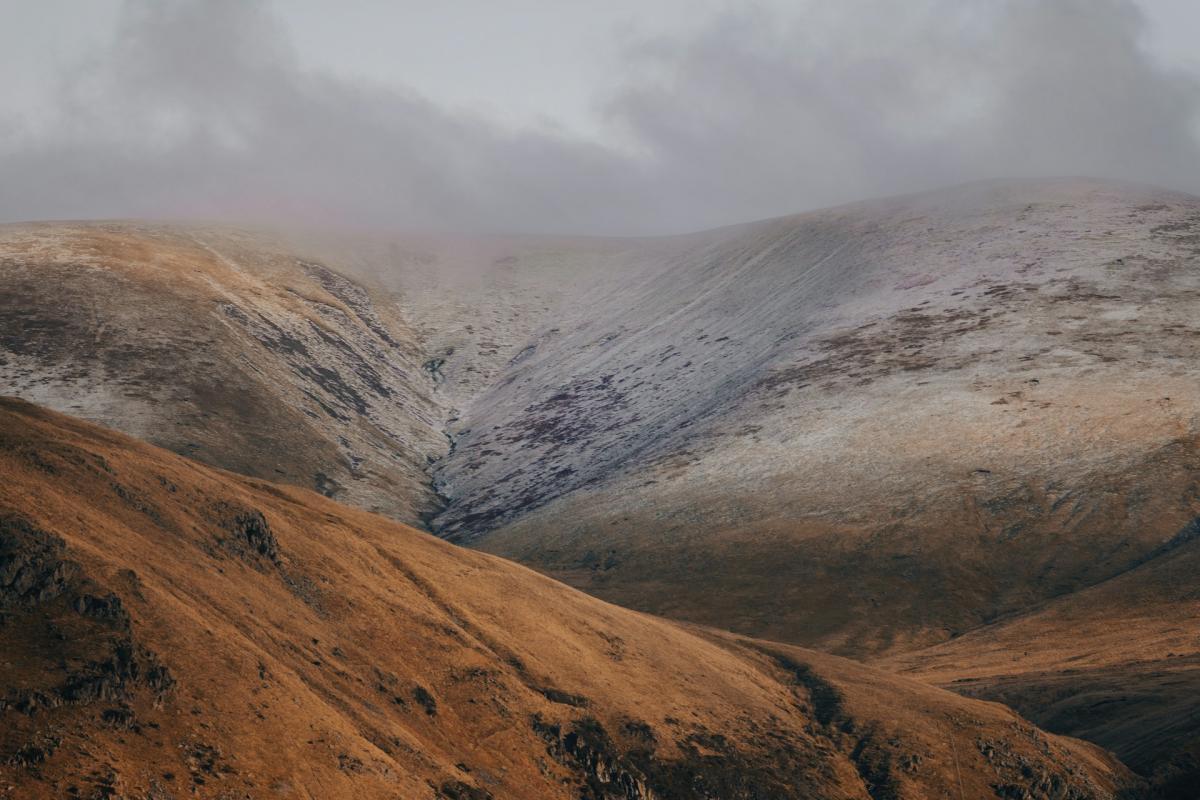
During the coming day, Storm Claudia will fill and drift slowly south-eastwards, allowing the Greenland high to become the more dominant factor in Britain’s weather, sending northerly winds our way and bringing a cold snap. It will be the second November in a row with a noteworthy cold snap around the 19th. But while there will be snow for some this time around, especially in Scotland, north-east England and on high ground further south, snow is not expected to be as widespread, or to stick around for as long on low ground, as we saw last year.
The northerlies will set in during this coming Monday, sending showers southwards down the eastern side of Britain, while central and western areas remain dry and sunny. Showers will generally be of rain in eastern England, with snow confined to high ground such as the North York Moors, but there is potential for sleet and wet snow to penetrate to low levels in north-east Scotland, where some colder air will come in for a time.
Fronts will move across the country on Tuesday, mainly bringing rain at low levels with snow restricted to high ground, but with significant snow possible over the higher ground of Scotland, but we could see sleet and wet snow penetrate to low ground for a time as the band clears south late on Tuesday and early Wednesday, particularly in inland parts of Scotland and northern England and north Wales.
There is uncertainty over where the main scoop of cold air will hit on Wednesday, but Wednesday looks likely to be the peak day for wintry precipitation at low levels, with a fair chance of snow falling, and maybe briefly lying, at low levels in parts of eastern Scotland and north-east England. Further south, wintry showers are possible to low levels as far south as Norfolk, but with lying snow likely to be restricted to high ground from Yorkshire southwards.
The northerly may continue until around midday on Thursday in eastern counties, creating the possibility of some parts of eastern Scotland (chiefly the north-east) and north-east England waking up to a covering of snow on Thursday morning, but high pressure looks set to move in from the west during Thursday, bringing dry sunny weather, and a thaw to areas that start off with snow cover.
Although lying snow on low ground in November has become less common since the 1990s as the climate has warmed, brief wintry spells in mid to late November have still been fairly common during the past decade.
In November 2015, during an otherwise mild, cloudy and wet month, northerlies set in on the 20th and 21st and brought a covering of snow to some eastern counties, followed by snow showers which brought a dusting of snow in places as far south as Norfolk, although it did not last long at low levels. November 2016 had an early snowfall in parts of northern England and also higher ground of the Midlands on the 9th, and wintry showers for some around the 18th. A northerly at the end of November 2017 brought lying snow to sea level in eastern counties from Norfolk northwards, especially from Yorkshire northwards, where places such as Scarborough and Sunderland saw lying snow out to the sea front for a time, and there was thundersnow in the Tyne and Wear area.
Cold snaps in the Novembers of 2018 and 2019 failed to give widespread snowfall at low levels, but after a mild one in 2020, the back end of November 2021 brought snow for some, with lying snow extending to near sea level as far south as Lincolnshire on the 27th/28th. November 2023 ended with a wintry spell, with parts of eastern Scotland and north-east England seeing lying snow extend to sea level.
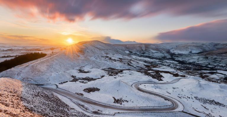
But the biggest November snow event since 2010 was the one last year, when much of the Midlands saw a lying snow event on the 18th/19th, east coast snow showers brought lying snow from Yorkshire northwards on the 20th, and then parts of the south and south-west, including the Exeter area, saw a surprise snowfall early on the 21st. Much of Scotland and northern England then had a snowy spell on the 23rd prior to the arrival of milder air. Parts of Ireland, including the Republic of Ireland, also had some early snowfalls.
Loading recent activity...