It’s Bonfire Night on Wednesday, the fifth of November but there will be firework displays later in the week as well. We will still have the mild southerly flow midweek with temperatures in double figures. The brisk winds should have eased slightly, which will please organisers or even just parents trying to handle sparklers and children.
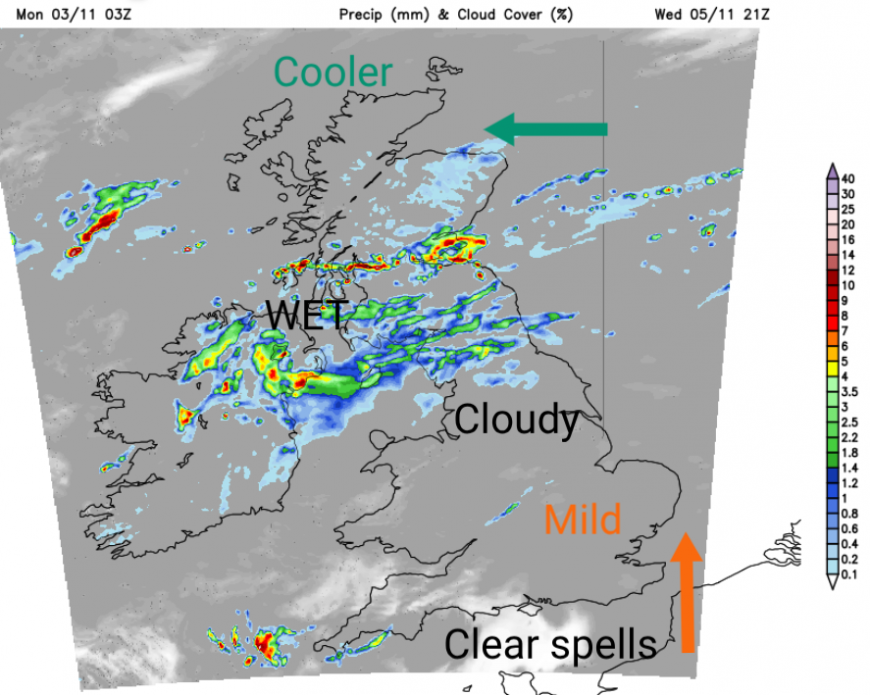
There is a frontal band heading northwards over the UK on Wednesday afternoon and evening. Ahead of this will be easterly winds with bright spells but a slightly cooler feel to the air, than the very mild start. To the south of the band, it will be a mild evening. Breaks will begin to appear in the cloud cover as the evening continues. The mild air will continue to feed in on the southerly winds.
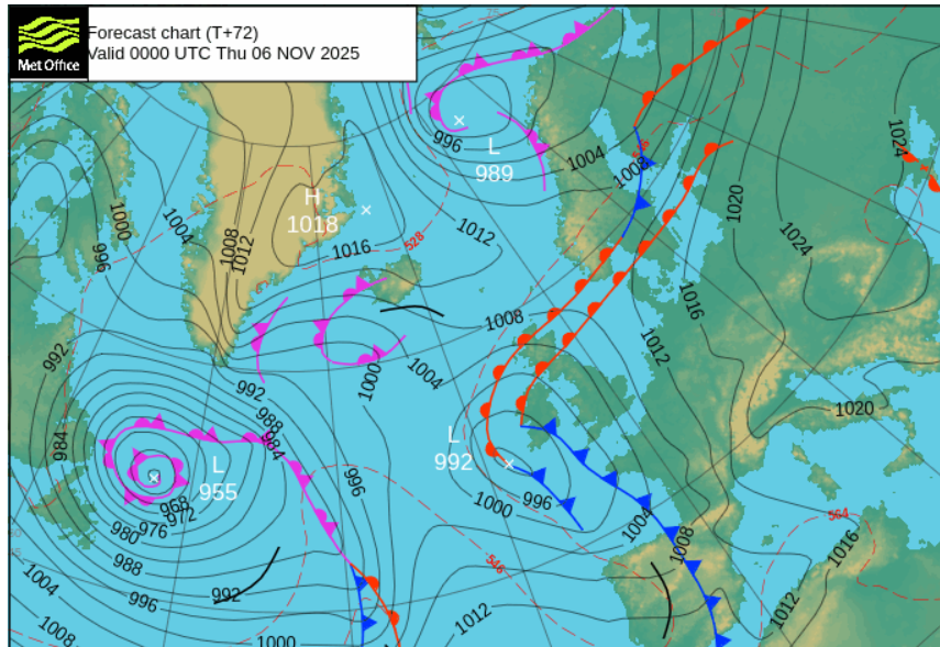
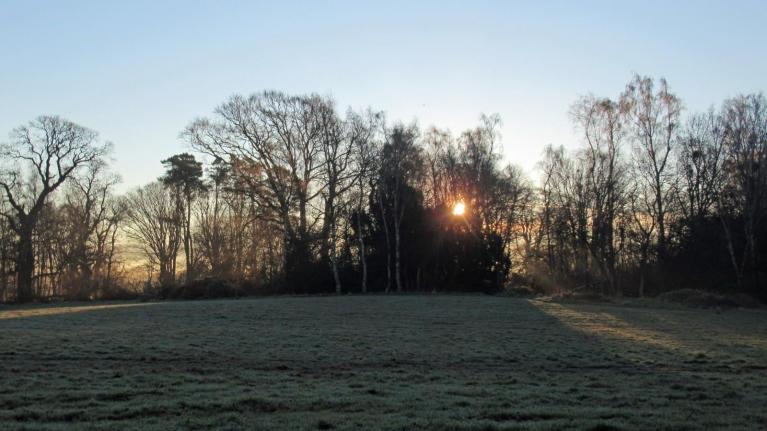
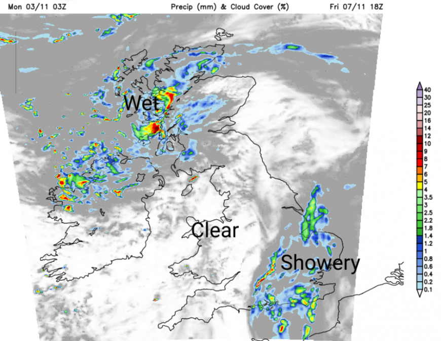
On Wednesday a low pressure will move west of Ireland. This helps direct the mild southerly flow but the warm front rain will move northwards. So if this band of rain is over you mid afternoon, it should have cleared by early evening. Southwest and western Britain will have had a wet start to the week, so it could be muddy or soggy underfoot. Current timings have the frontal band over the Irish Sea around 6pm with outbreaks of rain for Gwynedd, Lancashire, County Down and along the Scotland/England border. Early evening there will be a lot of cloud around making it difficult to spot the supermoon.
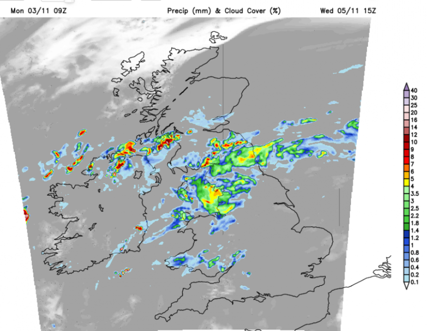
The UKV model moves the rainband over Northern Ireland, Cumbria and Northumberland into southern Scotland and the Central Belt through Wednsday evening. However the GFS model is quicker moving the rain northwards, wet by mid afternoon for Northern Ireland and SW Scotland and more of Scotland, Cumbria wet by early evening.
Both leave a good part of England and Wales (away from the northwest) dry for Bonfire Night although the ECM model keeps showers into the evening for western Wales.
There are signs on both models of showery outbreaks reaching Cornwall from the south as the evening progresses.
London - very mild with a light breeze. Dry, cloudy early on. Glasgow - chance of rain, feeling cooler in the breeze but 13C. Cardiff - mild and cloudy but fair. Leeds - mild and cloudy with a small risk of a shower.
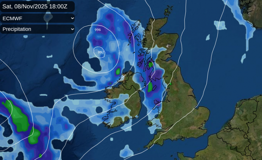
If you have a firework event later this week, say on Friday or Saturday there is more uncertainty around the forecast. Low pressures keep moving off the Atlantic and bringing bands of rain or clusters of showers across the UK. Trying to pin down the timings and locations of these, for Friday evening or Saturday evening, is not possible at this stage.
The model vary greatly which means there is low confidence.
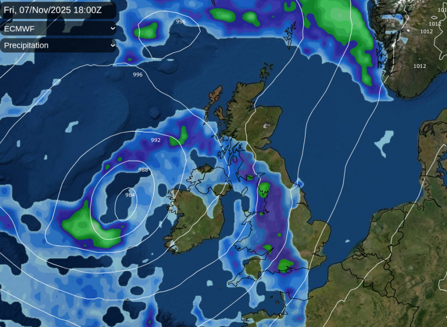
The ECM model shows a small low bringing frontal rain up to Shetland as another low moves to the west of Ireland. Currently this low is throwing its frontal rain right over the UK, so a band of rain to avoid on Friday evening.
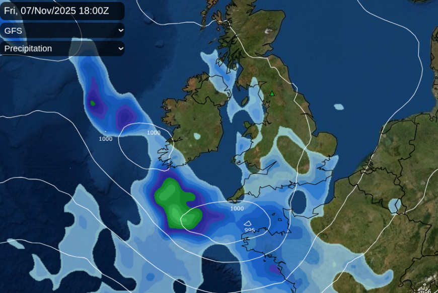
The GFS model has a more settled day, with some fine weather but a low pressure approaches southern England for Friday evening, again with rain. There could be potentially blustery winds in the Channel around this.
The UKV has a low over the UK with a breezy southerly flow. There are pockets of showery rain, one over southern Britain and another over Northern Ireland then western Scotland with a large gap inbetween where there would be a clear skies and a fine evening for fireworks.
It won’t be as mild as on Wednsday and Thursday nights but still not a frosty or icy evening. Also there could be too much breeze for any atmospheric mist and fog.
Updates will follow, for now there is the chance of rain but we need the models to firm up on where these small low pressure are heading.
Loading recent activity...