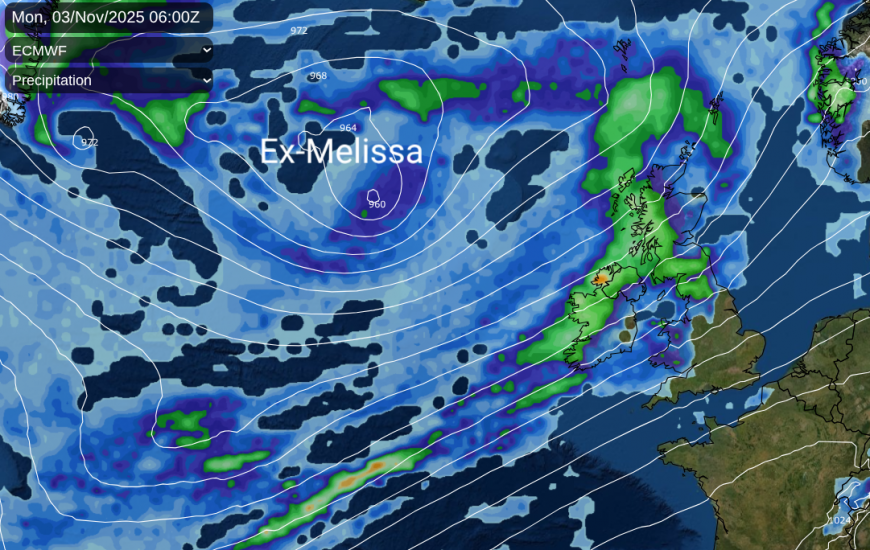
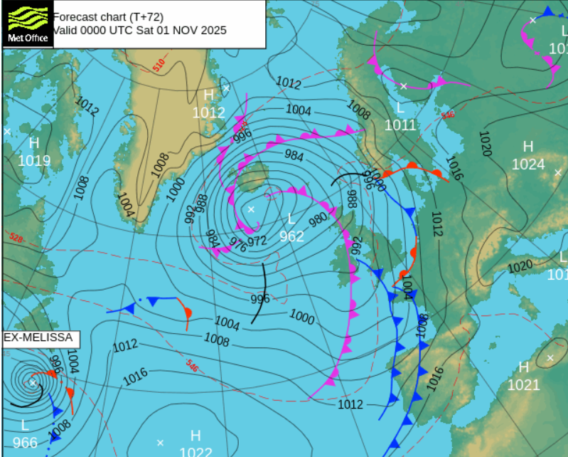
Whilst thoughts have to be with those affected by Hurricane Melissa in the Caribbean this week, it will take the extra-tropical remains of Melissa until the end of this weekend to reach the north Atlantic. The frontal rain from this greatly changed system should reach the UK on Sunday night or by Monday morning, but we are not expecting a hurricane! It will have transitioned from being a tropical cyclone to an autumnal Atlantic low pressure.
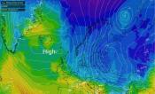
Before that, we have a different low pressure developing out in the mid-Atlantic. It will rapidly deepen today before swinging northwards, west of Ireland on Thursday, and will settle south of Iceland for the end of the working week. There will be other circulations nipping across the UK with bands of heavier rain and clusters of showers on Saturday. The ECM model is keen on a distinct secondary low for Saturday morning moving from the Irish Sea to the east of Scotland with a band of heavy rain wrapped around it. Behind that, it is the blustery westerly flow off the Altnatic with a scattering of showers but good sunny spells for the weekend.
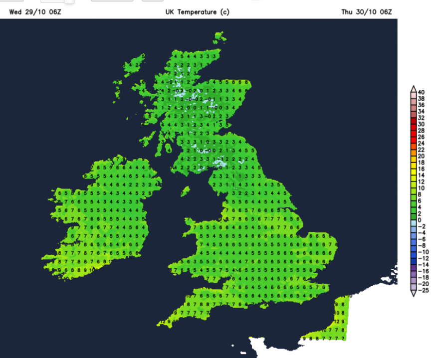
Wednesday night looks chilly across the UK thanks to clearing skies and colder air from the north. Temperatures will down into single figures with a widespread frost in the north. A frost in places further south. The winds will be light, away from the east coast of Britain, although the westerly wind will only ease for East Anglia and the Thames estuary on Thursday morning.
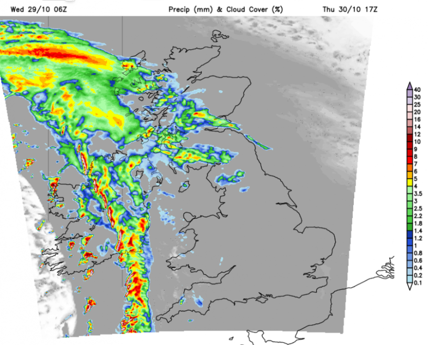
There will be a fine day for much of Britain with light winds, morning sunshine before increasing frontal high cloud arrives. Inland northern Britain could have some mist and fog to get rid of first thing but it will stay bright and fair for a good part of the day. Wales and southwest England will cloud over. Northern Ireland and the west coast of Britain will become windy during Thursday afternoon as the rapidly deepening low approaches. Rain from the warm front will accompany the strengthening winds with gales for the Irish Sea and the west coast of Scotland. Western Scotland could see severe gales and very rough seas later on Thursday. The SW gales will reach northern Scotland by Thursday evening.
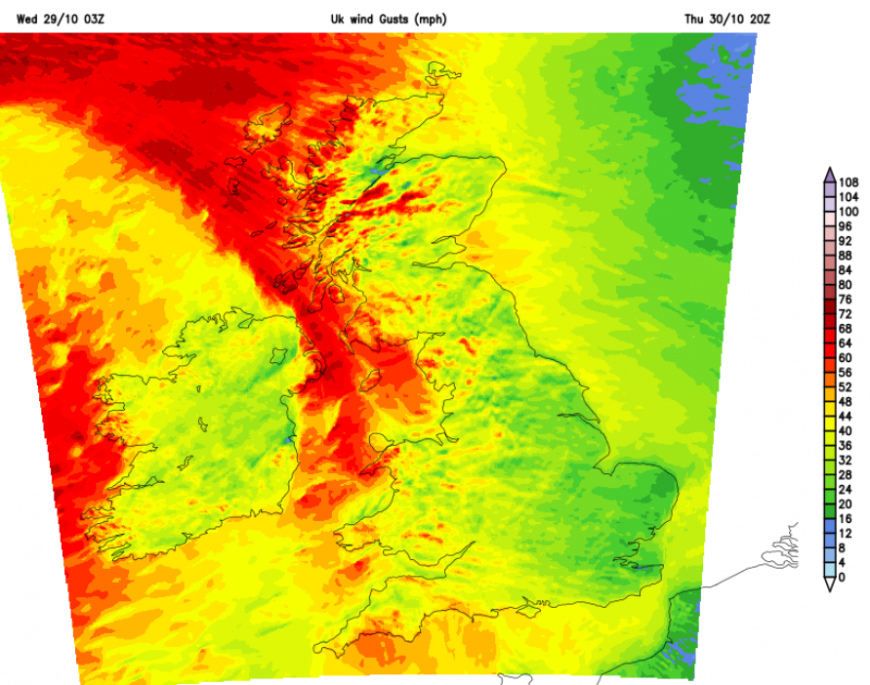
Everywhere will become windy through Thursday night with an active cold front moving across the UK. There will be a spell of rain with some heavy bursts moving eastwards, followed by clearing skies. It will be a milder night than tonight.
As the low centre parks itself south of Iceland, it will remain windy for the north and northwest of the UK. In the southerly flow, Friday will be the mildest day of the week with temperatures potentially reaching 18C in the sunnier spots for southern Britain. It will be a blustery day with bands or clusters of heavy showers from the southwest. These will include hail, thunder and lightning and hefty downpours. So some places will have a fine, sunny and mild day but you could see heavy showers. So beware.
Further clusters move through on Friday night, so those out for Halloween might be unlucky, although currently there is a bit of respite showing for Friday evening with clearer conditions.
Bands of heavy showers will be working their way across eastern Britain on Saturday morning with colder air from the northwest. Much of England will have a milder start. There should be a lot of bright or sunny weather across the UK on Saturday after the unsettled start, but the risk of a shower will remain. So keep an eye on the Netweather radar, if a downpour will make a difference to your plans. The mild air from Friday will be replaced by colder air from the northwest and that will be noticeable after dark, although the winds will fall light on Saturday evening. Showers over the Scottish mountains could bring a bit more snow.
Sunday will be similar with more clusters of heavy showers from the west and a mix of bright spells in between. It will feel chilly on Sunday morning, and there could be more showers about. There might be a brighter lull before the next system arrives (ex-Melissa) but there is uncertainty around its path to the North Atlantic and when its frontal bands might reach the UK, Sunday or Monday. It’s all quite autumnal, a bit chilly with the risk of rain but brighter gaps in between.
Loading recent activity...