The Spanish Meteorological Agency (AEMET) now name DANAs (Depresion Aislada en Niveles Altos) - cut-off upper-level lows that bring heavy rainfall and thunderstorms with flash-flooding. The cold air associated with these upper lows above the warmer Mediterranean Sea, especially in autumn and winter, when the contrast is greatest, can yield large amounts of instability, leading to extreme heavy rainfall leading to flash-flooding.

Dana Alice, the first on the new list of names, is affecting the southern and eastern Mediterranean coastal areas of Spain & Balearics during the second half of this week and into the weekend, with amber and red warnings in force for the risk of flash-flooding.
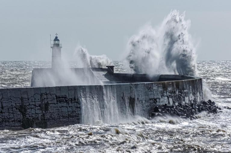
They have a separate system naming for squalls or Atlantic depressions (Borrascas) which bring strong winds and/or heavy rainfall.
Upper-level low (DANA) over Iberia and high to the north will pull in warm, moist and unstable air over Meditteranean coasts of Spain next few days.
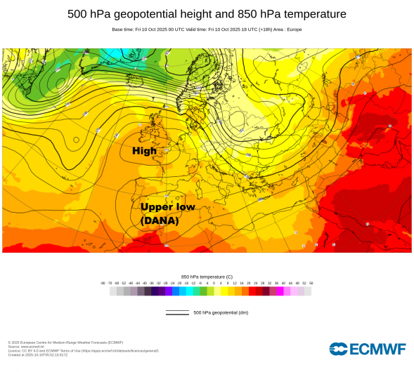
An Atlantic trough with an associated mid-level cold pool has advance eastward across Iberia since mid-week, the cold air aloft and several vortices or disturbances within it inducing strong instability over the western Mediterranean. At surface level, a blocking area of high pressure to the north of Iberia and low pressure over Iberia will draw an easterly and northeasterly flow that will bring abundant warmth and moisture to the Mediterranean coast. The instability and lift of this warm and moist air over higher ground along the coast will support very heavy and persistent rainfall affecting mainly the eastern third of the Iberian Peninsula and the Balearic Islands from Thursday through until Monday the 13th, due to the synoptic situation being fairly stationary, allowing to persist for several days.
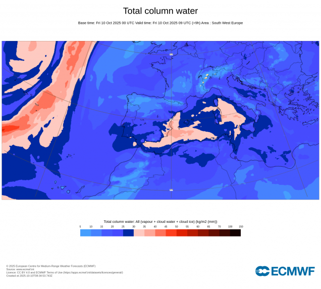
Total Column Water - identifies where there is greater potential for significant precipitation given development of convection or large scale uplift (e.g. fronts, low pressure centres or cyclones).
From AEMET:
The area with the greatest accumulations throughout the episode will be around Cabo de la Nao, particularly the coastal and pre-coastal areas of Valencia and Alicante, where rainfall could be locally torrential (over 60 mm/h). Heavy downpours may lead to local flash flooding in low-lying areas, streams, and gullies, so the potential danger level of this situation is high. During the entire period described above, rainfall accumulations of between 250 and 300 mm are possible in the aforementioned areas.
DANA Alice is forecast to bring heavy rain and thunderstorms along the southern Mediterranean coast, especially in Alicante and Murcia, where the Spanish Meteorological Agency (AEMET) has issued red alerts. The warnings will go into effect starting at 10:00 a.m. on Friday in the southern coastal regions of Alicante and Campo de Cartagena and Mazarron, where torrential rains leading to flash-floods are expected.
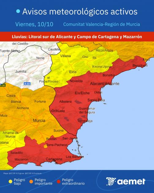
42.1mm has already fallen in Xabia, in the province of Alicante this morning. The province will be under red alert for accumulated rainfall of 180 mm in 12 hours from 10:00 a.m. until midnight. A red alert is also in effect in the Cartagena and Mazarron countryside.
AEMET state that the peak days of the storm are expected on Friday the 10th and Saturday the 11th, when northeasterly winds reach their peak intensity. Heaviest rainfall expected in Valencia, Alicante, and Murcia, where accumulations could exceed 140 mm in 12 hours, most likely in the province of Valencia. Storms are also expected to extend to southern Catalonia, northern Valencia, eastern Castilla-La Mancha, and Andalusia, primarily in the Baetic Mountains.
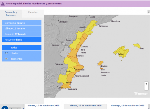
By Sunday the 12th, surface winds should ease, but unstable conditions are expected to continue with further thunderstorms. Heaviest rainfall most likely between Cape Nao and the mouth of the Ebro River, and could reach inland Valencia, southeastern Aragon, and the Balearic Islands.
Further showers could extend to the central part of the peninsula on Monday, although the most likely and intense showers are expected again in the Valencian Community and the Balearic Islands. After that, the flooding risk should ease with showers becoming less intense for the rest of the week along eastern coasts of Spain.
Loading recent activity...