High pressure is set to dominate UK weather to see out September. In contrast, southern Europe looks unsettled. Meanwhile, Super Typhoon Ragasa heads towards southern China, with Hong Kong going into shut-down.
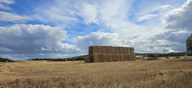
After some uncertainty over recent days, the weather models are now coming into agreement for high pressure to hold fast over northern Europe to see out September and see in October, with a continuation of mostly dry and settled conditions for the UK and Ireland - in contrast to the unsettled and wet start to the month.

In contrast, southern Europe looks to see unsettled conditions, with more thunderstorms and heavy rain forecast over the next few days for parts of Italy - bringing a risk of further flash-floods, while the remnants of Hurricane Gabrielle look to move into western Iberia this weekend.

High pressure centred over northern UK today will drift east to be centred over Scandinavia later this week, where it looks to stay put until the end of the month, thanks to high pressure building here at all levels of the atmosphere - creating a blocking high pressure system. This means that Atlantic lows and frontal systems will be generally blocked from moving in across the UK over the coming days, steered to the north towards Iceland. The exception will be a weakening front moving east on Saturday, which will bring some rain across the west before fizzling out as it bumps into high pressure to the east.

In contrast, a slow-moving upper low over central Europe this week will bring unsettled and stormy weather to southern Germany, the Alps, Italy and the Balkans - with a risk of severe storms bringing flash-flooding across Italy and the Balkan countries - where cold air aloft with upper low atop of warm and humid air drawn northeast from the still very warm Mediterranean will bring large amounts of instability to the region. The unsettled conditions here could last through the weekend and into early next week too.
Flooding in Lombardy in northern Italy yesterday

Meanwhile, Hurricane Gabrielle rapidly intensified into a major hurricane on Monday and is now a category 4 storm with sustained winds of 140mph. Gabrielle is moving northeast to the east of Bermuda at the moment, then is expected to track east-northeast towards the Azores, passing just north of the islands on Friday - where it is expected to undergo extratropical transition. The remnants of Gabrielle are then forecast to head into Portugal over the weekend, where the low looks to then weaken, but not before it brings some wet and windy conditions on its arrival across western Iberia. The rain and showers with gusty winds from ex-Gabrielle arriving on Sunday, then uncertainty how far east the low tracks across Iberia, but downpours with it may linger into early next week.

Yesterday, there were 3 major cyclones in the northern Hemisphere, with Typhoons Ragasa and Neoguri across the western Pacific and Hurricane Gabrielle over the western North Atlantic.
Typhoon Ragasa passed to north of the Philippines Luzon island yesterday, causing thousands of people to evacuate from the northern Philippines islands and claiming at least three lives. At Ragasa's peak intensity on Monday, maximum sustained winds near its eye topped 260 kph (162 mph), making it the world's most powerful Category 5 storm in 2025.
Forecast track of Typhoon Ragasa towards southern China over coming days

The typhoon has since weakened slightly but is still capable of wreaking havoc on the densely populated Chinese coast as a Category 4 typhoon.
Ragasa is now making its way towards Hong Kong, the southern parts of mainland China, and Taiwan. Hong Kong is preparing to shut down ahead of Super Typhoon Ragasa on Tuesday, with authorities urging people to stay at home, while most passenger flights were due to be suspended until Thursday. Hong Kong issued the typhoon signal 8, its third highest, which urges most businesses and transport services to shut down. Hurricane-force winds offshore and on high ground are forecast in Hong Kong on Wednesday, with heavy rain expected to lead to a significant flooding and also storm sea surge in the densely packed city.
Authorities in southern China have also activated emergency responses for the densely populated area due to the risk of flooding, strong winds and storm surges from Ragasa. Guangdong, one of the world’s most populous regions, is seeing schools closed and work suspended, some businesses shut, and public transport halted, including large cities such as Guangzhou, a city of 18.6 million people, and Shenzhen, home to about 17.5 million people.
Typhoon Neoguri has since weakened to a category 1 storm, with maximum sustained winds of 75mph and is expected to stay out over the open western Pacific several 100 miles to the east of Japan and not affect land.
Loading recent activity...