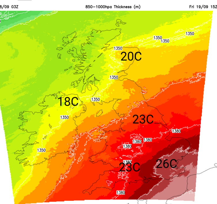
There will be quite a change through the weekend, especially for southeast Britain. Temperatures on Friday afternoon could reach the mid 20s Celsius with 25 to 27C possible for Greater London, the Home Counties or East Anglia in a southwesterly breeze.
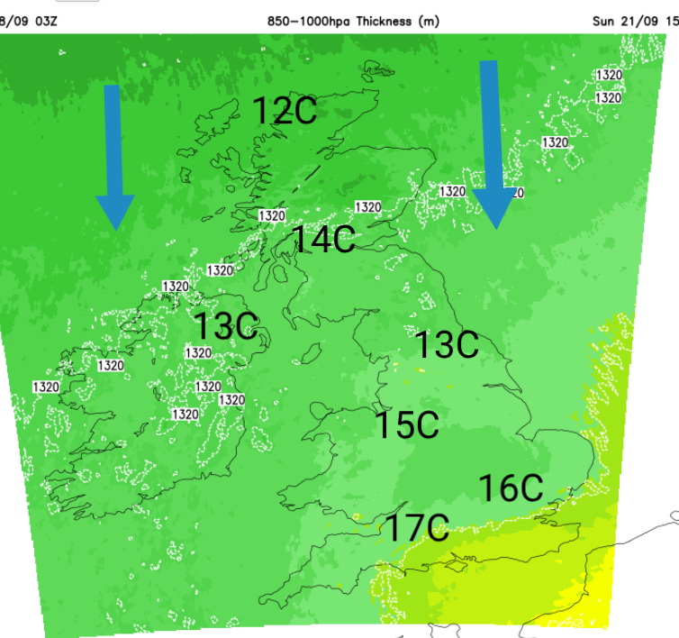
After a tempestuous Saturday, the UK ends up with a northerly flow. This will clear away any warmth and many areas will be around 14C with a nippy edge to the breeze.
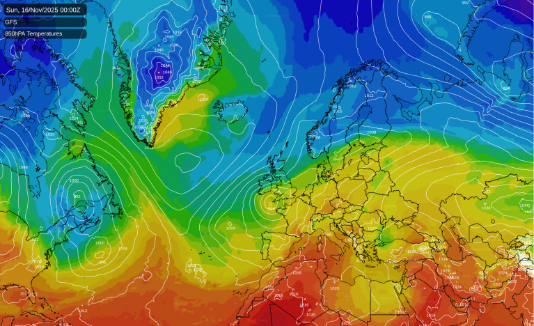
Friday afternoon will feel warm away from the windy weather in northern/northwest Scotland. The low centre will be to the NW of the UK, but its frontal bands will stretch across northern England through the Irish Sea out towards the Azores. Pulses of heavy rain will move northeastwards along this boundary during Friday with a definite zone of wet weather sandwiched between fine conditions, even sunshine.
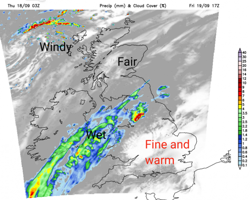
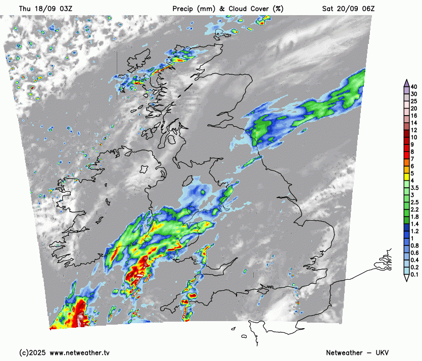
The UKV model brings rain to NW Wales, NW England, particularly Cumbria during Friday and into the night. Also, some reaching NE England and Pembrokeshire. This is a waving front, so rain could waver into SE Scotland, maybe SW England, but there will be a wet zone for some.
By Saturday, a new low centre will have developed, and this will introduce more rain along with strengthening winds. There are already early yellow rain warnings for this persistent, almost stationary band from the Central Belt down into western Wales. Looking at the warning matrix, there is a very low likelihood of medium impacts, “a small chance that heavy rainfall may cause some transport disruption and flooding.” MO
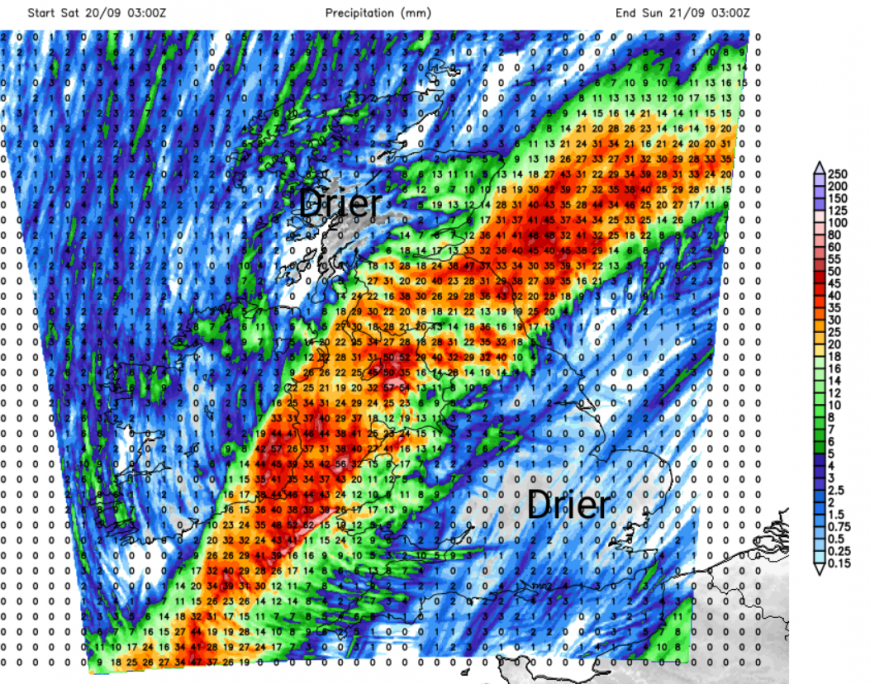
Through the afternoon and into Saturday night, the warning extends into the eastern counties of Northern Ireland again, with the possibility of high rainfall totals and travel disruption due to flooding. This might be delayed, allowing a better day for Northern Ireland. If you are near to, but not within, the warning area, just keep an eye on the wider area forecast. The models agree on the overall theme, although there are some differences in the deepening of the low and its progress northwards during Saturday afternoon.
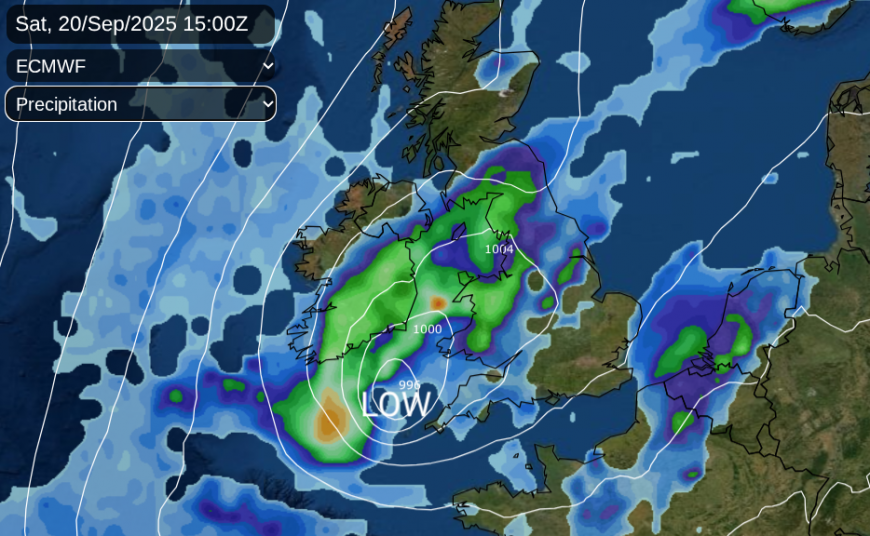
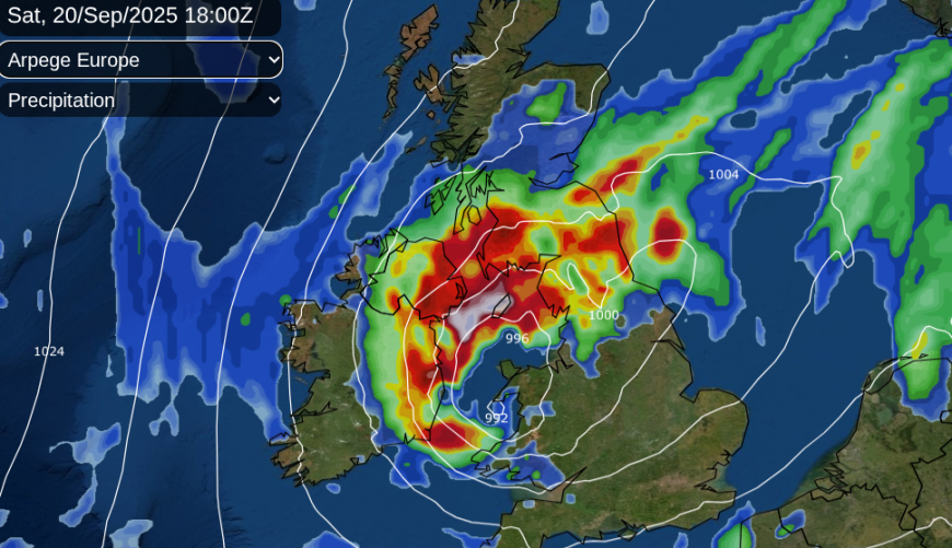
The UKV develops a vicious curl of gales around the low centre near SW England and the Bristol Channel before the weather turns more widely windy over much of the UK by Saturday evening. Either in a sunny, fresh to strong southwesterly or a wet and wild northerly. The GFS model doesn’t deepen the low as quickly but still brings strong winds to the south coast of Devon and Dorset by teatime and overnight gales for the North Channel and Solway Firth from the NNE. The ECM shows the tip of Cornwall with gales by teatime on Saturday, so something else to keep an eye on.
This swirl of rainbands and strong winds will edge eastwards towards the North Sea by Sunday morning. Behind there will be the colder northerly flow, which will be the main change for the new week. There will be scattered showers and bright spells as the main rain clears, and it won’t be as windy. Yet it will feel cool after dark.
Locally, this weekend could be wet with lengthy spells of rain and large puddles with a windy spell on Saturday. SE Britain ends the working week with almost a late taste of summer for Friday evening, a scattering of showers for Saturday morning and then windy but fine weather for the second half of the day.
Southwest Britain could experience some showery bursts on Saturday morning from the frontal band, followed by potentially very windy weather later, with clusters of heavy showers in the cooler north wind by Sunday.
This northerly flow will be extending down through Scotland on Saturday. Central parts of Scotland and also Northern Ireland will see fair, bright weather until the frontal band pushes northwards. Saturday evening could be rather grim for the southern half of Scotland, parts of northern England and Wales, particularly around the Irish Sea.
To the south of the frontal band there will be hefty showers, even thundery downpours for north Wales on Saturday afternoon, for northern England into the evening. There will be sunny fine weather over the Midlands and SE Britain but this unstable zone could produce some sudden downpours which would add more rainfall to existing surface water puddles.
Loading recent activity...