Well, what a Bank Holiday (where available). It was sunny with a sultry warmth. Wales and Northern Ireland both saw their warmest August bank holiday Monday on record. Hawarden, Flintshire 29.6C and Magilligan, Co. Londonderry at 24.5C. (Previously 26.5C in Gwent in 1991 and 23.8C in Co.Derry in 1983.) Although it wasn’t a bank holiday in Scotland, the equivalent day record was broken with 27.1°C at Charterhall in the Scottish Borders. In southwest England, temperatures reached over 29C.
“Jersey reached a maximum of 29.5°C this afternoon, under abundant sunshine and marking the hottest August Bank holiday since it started in 1971. A light southeast flow helped bring in warm continental air, keeping conditions hot and settled across the island. ” Jersey Met
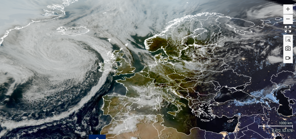
And all the time, a change in the weather was lurking out in the Atlantic, allowing a long weekend before the weather across the UK turns fresher and more unsettled during this week.
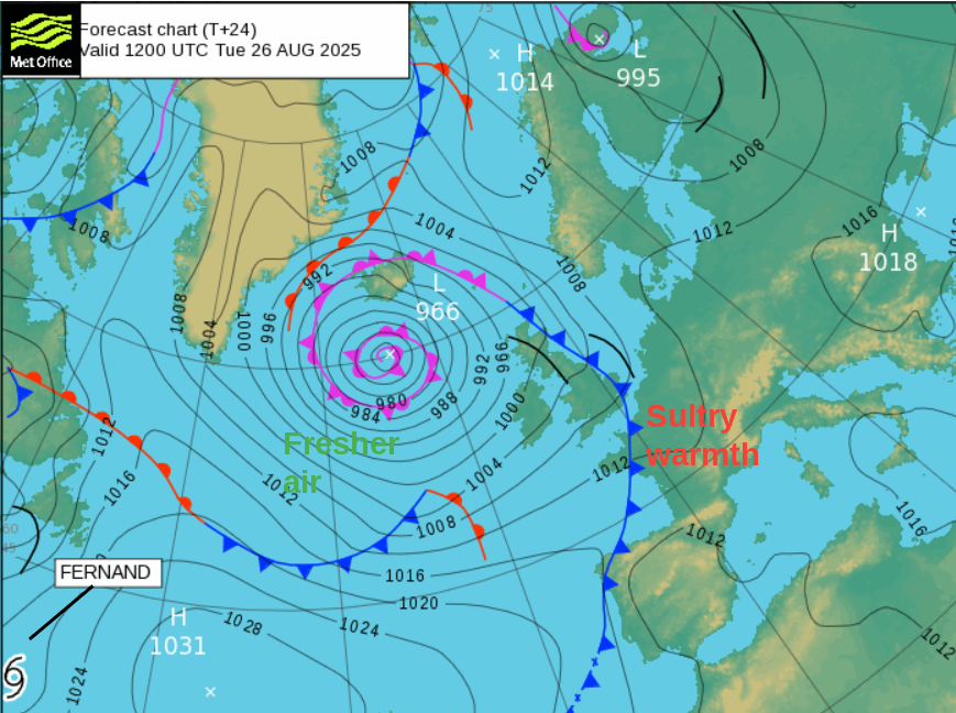
The huge swirl of cloud is the remnants of Hurricane Erin. This large low pressure dragged up very warm air over western Europe during the Bank Holiday weekend but a cold front is now making its way over the UK. High pressure remains over central southern Europe.
The UK’s southerly winds will veer to a westerly. There will be some rain along the frontal band, but not enough. Some heavier bursts for western Britain but the front will fade as it trundles across Britain. Just catching the eye on the western side of the Atlantic is Tropical Storm Fernand, well out at sea.
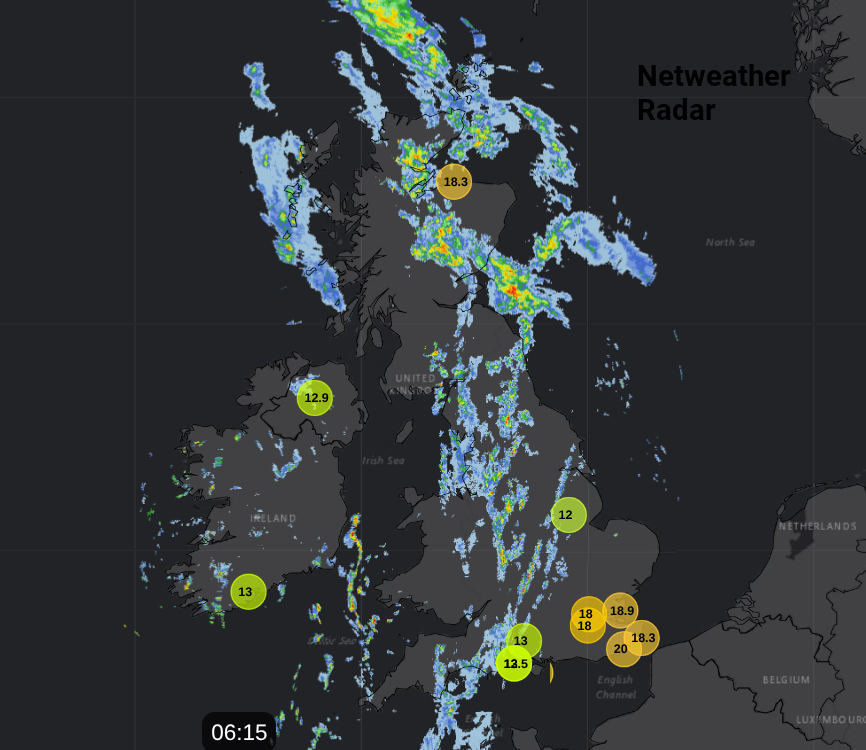
The frontal band will be fading early on Tuesday with just more cloud and a few showery outbreaks by the time it reaches eastern Britain. This first cold front will stir the air a bit with a difference for Northern Ireland on Tuesday. Temperatures will be around 17 to 20C. There will be a scattering of showers through the afternoon for Scotland and Northern Ireland with isolated heavy downpours. England will have another very warm day thanks to lots of sunshine and lingering heat from Monday. Temperatures will widely be in the mid 20sC just a bit lower for coastal counties of NW England. Wales will be around 19 to 23C so still feeling warm in any sunshine but feeling fresher by the evening.
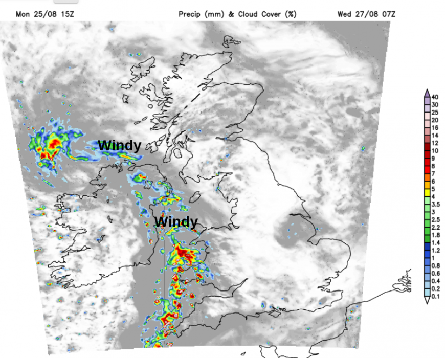
Even by the middle of the week, ex-Erin is anchored south of Iceland but another little feature will nip to the south and bring rain from the southwest to Ireland and the UK.
This next band will stir the atmosphere again with the highest temperatures in the east and the north, where the sunshine remains for longest.
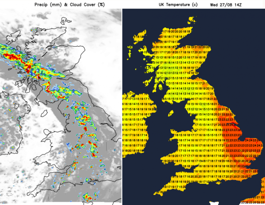
There will be some heavier rain passing by on Wednesday, welcome rain but it could include some thundery bursts too. This band will be more coherent than the one on Tuesday but again will fade as it reaches East Anglia.
Thursday and Friday look more mixed. There will be more showers, particularly for exposed western parts. Temperatures will just ease down through the week, getting closer to average. There will still be bright or sunny times when the temperatures will respond but the air will feel different, as will the evenings. There could be some heavier rain in the south by Saturday but there is low confidence around this. The remnants of Fernand will join the waving front across the Atlantic and add some tropical energy into the mix. On the latest run, this heads for the Bay of Biscay but we have seen solutions where it pulses further north, just something to watch.
Loading recent activity...