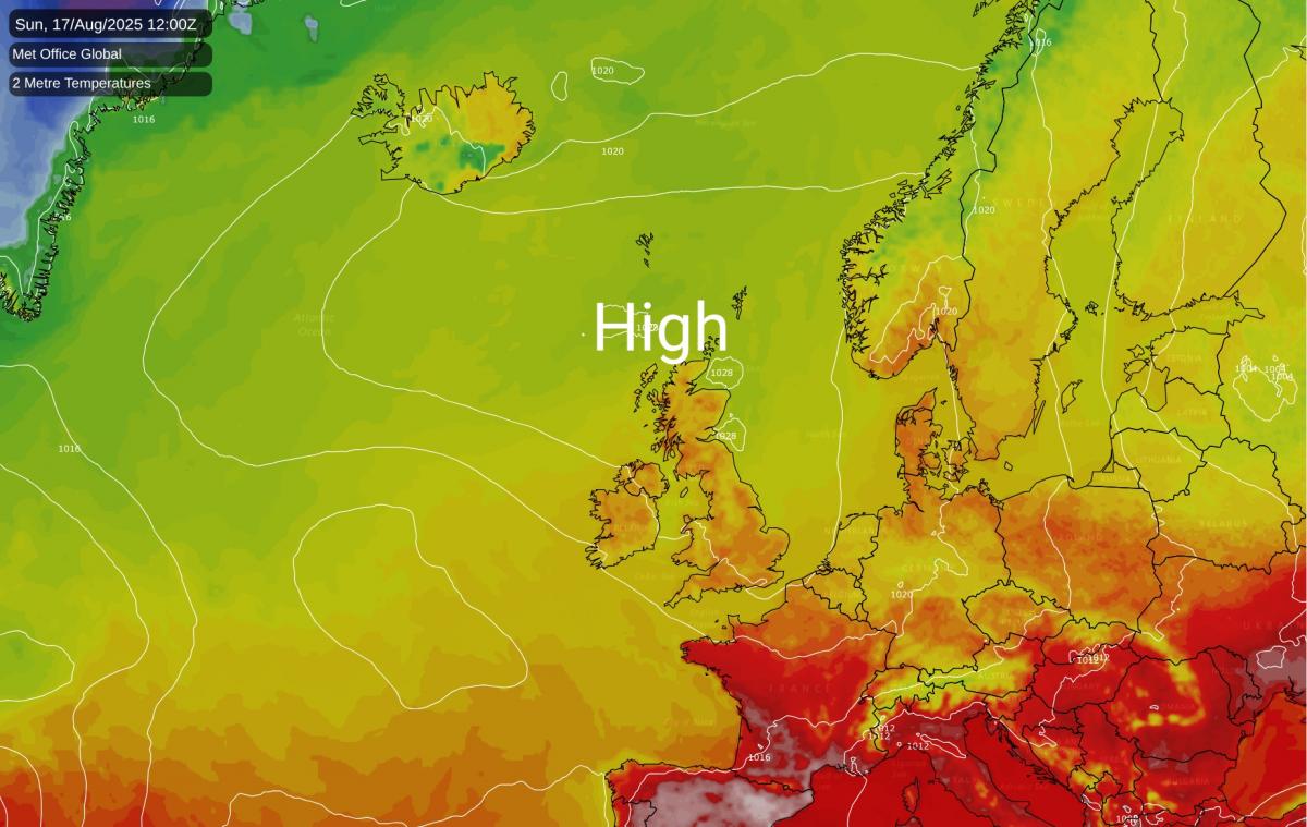
High pressure's precise position is key this week. It will drive a west-east split in conditions before a mid-week cool down, leaving the Bank Holiday forecast highly uncertain.
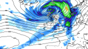
It is easy to see a high pressure area over the British Isles and assume a continuation of warm/hot and sunny weather for most or all of the country, but just slight variations in the positioning of the high pressure can make the difference between another warm/hot and sunny day, and thick stratocumulus and suppressed daytime temperatures.
In eastern Britain, an easterly or south-easterly coming in off central Europe at this time of year will often maintain sunny conditions for the east of England, due to the relatively short air track over the North Sea, though low cloud has a greater tendency to affect mainly coastal areas of eastern Scotland, and sometimes north-east England, where the track over the sea is longer. But a north-easterly tends to send the cloud into eastern England off the North Sea, and sometimes this spreads a long way inland, as we saw last night. Conversely, when high pressure is centred over southern Britain, giving westerly winds, it tends to be western and especially north-western areas that sees a lot of stratocumulus coming in off the eastern North Atlantic, while the east and south tend to be clear and sunny for most of the time.
During the next few days, Britain’s weather is forecast to feature a west-east split for much of the time. High pressure will generally be centred over north-western Britain, and the resulting north-easterly winds will keep bringing stratocumulus into eastern Britain, bringing cloudy and relatively cool weather, especially near North Sea coasts. This cloud will tend to retreat during daylight hours with many areas seeing some sunshine coming through, but it is possible that in some spots, again especially near North Sea coasts, some days may be cloudy throughout.
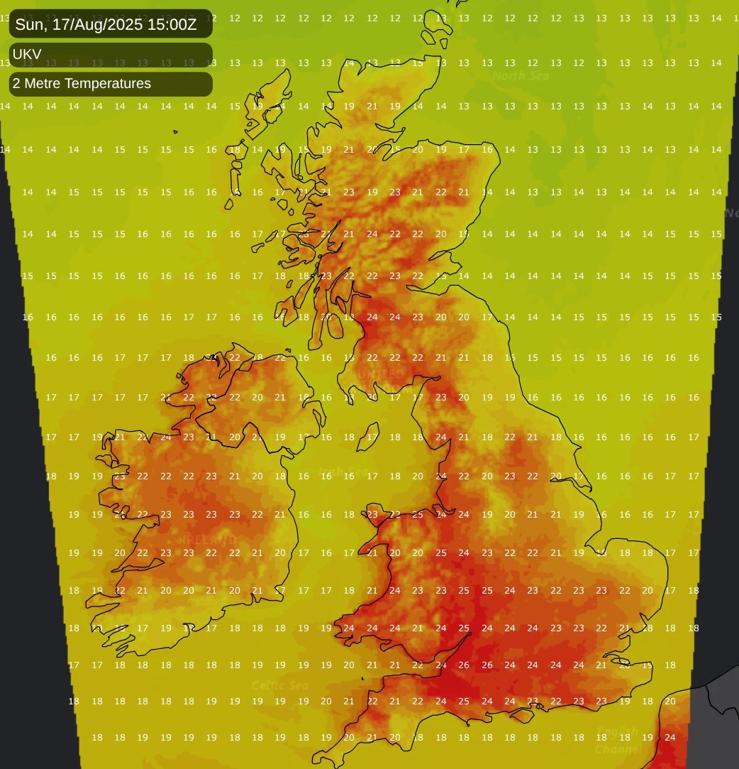
Sheltered western counties will see more sunshine, with North Sea cloud sometimes advancing into western areas (as we saw on Saturday), but in the west it will tend to dissipate more quickly than in the east, resulting in longer sunny periods. It will also remain warm or hot in western areas until Monday, with potential for temperatures to reach the high 20s Celsius and possibly nudge 30C in parts of Wales and the west and south-west of England. In western Scotland, too, temperatures will be well above the long-term average, peaking in the mid-20s Celsius in many areas.
A cool down is forecast to start on Tuesday, when although high pressure will remain dominant, colder Arctic air will spread in from the north. It will remain warmest in the south-west, where temperatures will continue to reach the low to mid-20s Celsius during the mid to latter part of next week, but it will become rather cool for a time in the north and east. A general west-east split in sunshine amounts is likely to continue.
Much of France, Spain and Portugal has been seeing exceptional prolonged heat during the past fortnight, which has contributed to widespread problems with wildfires. Britain hasn’t been immune to wildfires either, with some notable ones in London and Edinburgh recently, but they have been happening on a larger scale further south in western Europe, especially in Spain. Temperatures have reached as high as 43C in parts of France, and there has been a notable increase in the frequency of temperatures of 40C and above in France since the start of the 21st century. This heat will persist until Monday, but with some cooling off in north-eastern France, but as the northerly sets in, cooler weather will spread into these regions on Tuesday. It will remain hot in the southern half of Spain and Portugal, but not quite as hot as it has been recently.
It looks probable that high pressure will drift back eastwards through next weekend and into early next week, and that we will see a breakdown to changeable westerlies afterwards. But there is considerable uncertainty over how quickly the high pressure will move away eastwards, and this has potential to make a big difference to the weather over the Bank Holiday weekend, especially in eastern and southern Britain. Some model runs have westerlies pushing into all parts by Bank Holiday Monday, which would result in changeable and breezy conditions, with rain bands moving from west to east at times interspersed with brighter showery weather. But others have the high pressure staying close to the east and south-east, which would produce more of a northwest-southeast split, with the east and south of Britain becoming warm and sunny, while the breakdown would start to take place in the north-west of Britain. What doesn’t look likely is any exceptional heat, because with northerly winds affecting much of western Europe mid to late next week, it will take a while for hot air masses to re-accumulate in France and Spain, and so while any southerlies around the Bank Holiday weekend will still be warm, they won’t be outstandingly warm.
Loading recent activity...