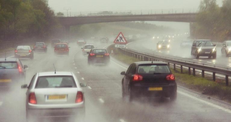
The weekend brought heavy and thundery downpours with muggy, close conditions and at times, dank, murky low cloud. There were concerns for flash flooding as the intense downpours fell on hard, dry ground in SE Britain on Saturday, and Northern Ireland had an amber warning for heavy rain for the start of Monday morning. Eastern counties of Ireland, including Dublin, continue with their orange warning into Monday afternoon as an occluded front remains overhead linked to Sunday’s low pressure.
“Persistent and heavy rain with a chance of thunderstorms.” Met Éireann Weather Warning
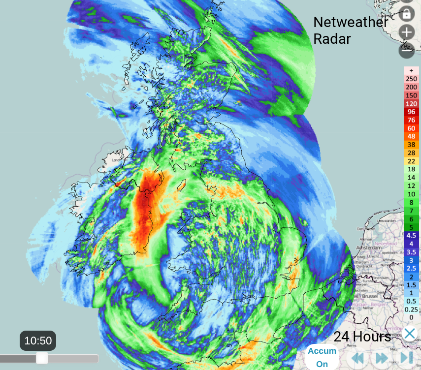
The accumulated rainfall totals for 24 hours show the heavy rain over County Down and eastern Ireland
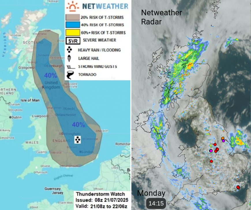
Monday brings the risk of further thunderstorms. Convective forecast
‘heavy showers and thunderstorms to develop (away from NW Scotland and the far west, further south - where the frontal zone will bring more in the way of cloud and rain). Breeze convergence will develop towards the eastern side of Britain, which will focus thunderstorm development. Showers/storms more scattered elsewhere.’
The Convective Forecast shows much of England and Scotland at risk of heavy downpours, even thunderstorms. Warm in any sunshine with a frontal band of cloud and rain wrapped from Devon to Dublin, along the Great Glen, also moving north away from Norfolk.
There will be heavy downpours, the risk of lightning, hail and sudden gusty winds and again the risk of localised flooding on Monday. There have been several reports of Funnel Cloud sightings on Monday. Below from the Netweather forum, by member Rufus Butterfield Doncaster/Lincoln area

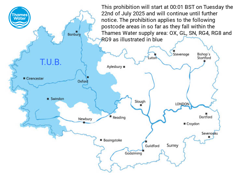
There was an inch or two of rain over the weekend, welcome rain given the current water situation. The West and East Midlands officially entered drought status last week. Some postcodes in the Thames Water region will see a hosepipe ban begin on Tuesday, 22nd July as their Temporary Usage Ban (TUB) begins.
Summer rain is not enough; it is the dry weather earlier in the year that has created the strain, and the increased usage when hot weather arrives. Eastern Scotland remains in moderate water scarcity
“Recent heavy rainfall has been insufficient to allow for recovery in water scarcity across most of the country. River flows remain very low across much of the east of Scotland and ground conditions … are extremely dry in the north-east, especially.” SEPA
Monday
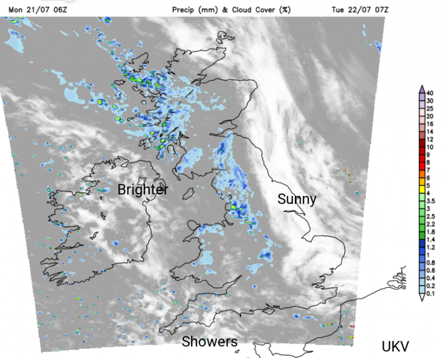
Frontal rain will clear from Norfolk, drifting away northwards. Western Scotland is in for a soggy day with over 70mm of rain falling in the NW Highlands from the same frontal band bringing the wet weather to Belfast and Dublin. There is a Met Office yellow warning for heavy rain over W/NW Scotland, which “may cause some flooding and travel disruption.” Over much of Britain, there will be a mix of sunshine and instability, allowing the showers and thunderstorms to develop.
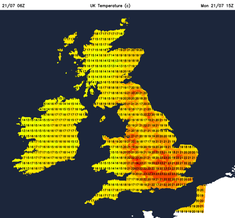
This week won’t see a return to heatwave conditions but in any sunshine it will feel very warm. The air will often be from the Atlantic, and there will be some cloud around. Shetland has had a warm start to the working week with nearly 20C before 10am on the most northern isle of Unst. The average temperature is closer to 14C in summer. London could see 25C on Monday. If the frontal cloud in the west breaks up then temperatures will rise quickly.
Tonight
The rain will continue for western Scotland with the old occluded front fading from Ireland as showery rain reaches SW Scotland, the Lake District, down through Merseyside and Wales. It will be a mild night.
Tuesday
Tuesday starts with sunny skies and fine weather for eastern Britain, brighter skies for Northern Ireland and a band of cloud and outbreaks of rain in-between. This stubborn frontal zone will continue its progress eastwards over Britain on Tuesday. Ahead of this in the sunshine, temperatures will rise into the mid 20s Celsius. It will be another mixed day with a good scattering of showers, more cloud about but still glimpses of strong July sunshine allowing the temperatures to jump from 19 or 20C to between 24- 26C.
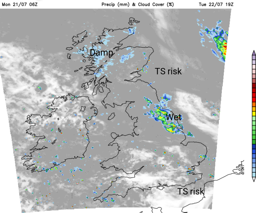
Eastern Britain and southeastern Britain look most likely areas to see thunderstorms again by Tuesday afternoon. By Tuesday evening, an area to the lee of the Pennines looks wet in the westerly flow. Over Yorkshire, down to northern Lincolnshire with other pockets of heavy rain developing over SE Scotland and spreading down into northern England by Wednesday morning. A northwesterly flow will make the middle of the week feel a bit fresher as southern counties of England see more sharp showers.
More storm chat in the Netweather community forum
Loading recent activity...