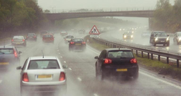
The end of this week will present a frustrating mix of heat, humidity and high temperatures in any sunshine but also the risk of heavy downpours and thunderstorms. There will be some parts of the UK with a higher risk of rain and others that should see lengthy fine, dry even sunny times. However, the showers remain hit and miss, but intense where they do develop. That is tricky if you have outdoor plans. For anyone heading to the high ground or a golf course, beware of this lightning risk. Temperatures on Friday could reach 30 even 31C in London. On Saturday, southern England could still reach 28C.
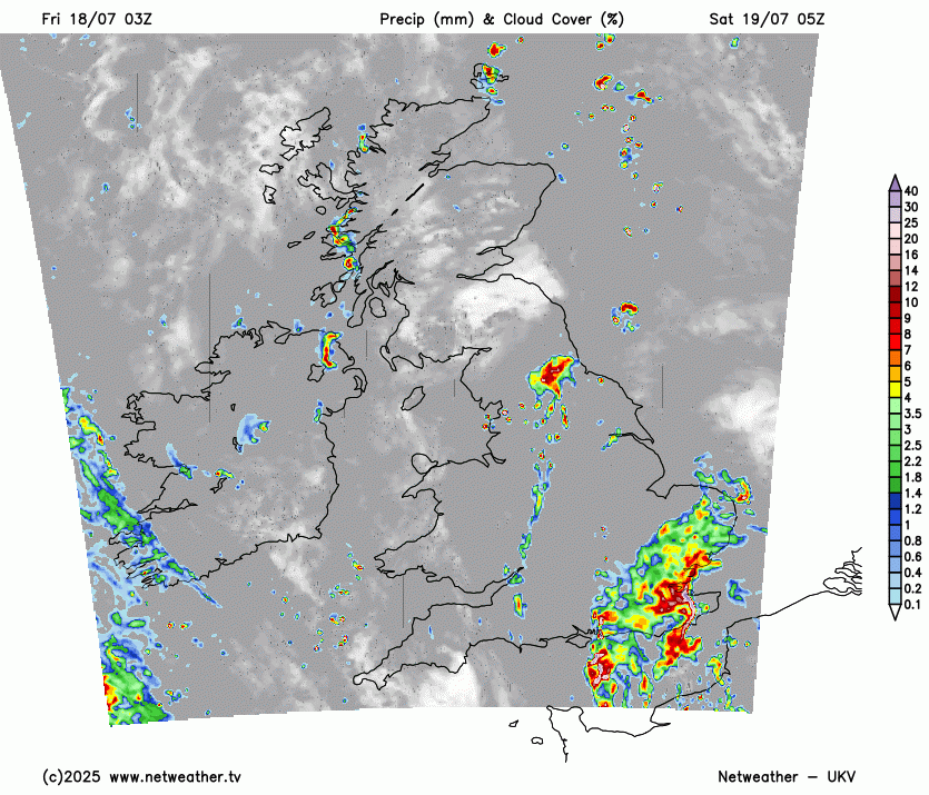
The UK Met Office has highlighted an area of eastern/NE England for the focus of storms on Friday, continuing into Friday evening. There will be patchy rain, more cloud and other showers, linked to old fading weather fronts running north-south over central Britain and Northern Ireland. Grampian and Sutherland could also see sharp downpours today.
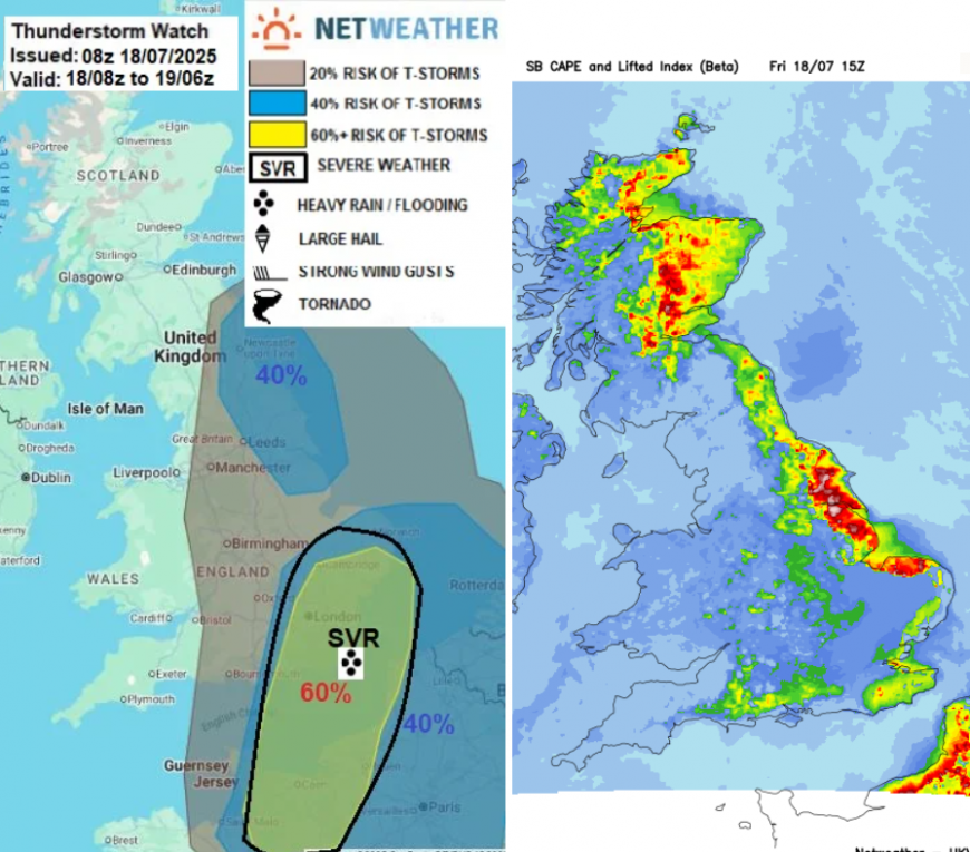
Severe Thunderstorm Watch
“Sea breeze convergence zone is forecast to develop across E England…to support the development of heavy showers and some thunderstorms this afternoon and evening, more particularly across NE England. Although vertical shear will be weak, storms may organise along breeze convergence to bring large rainfall totals in a short space of time - leading to localised flash flooding. Frequent lightning and isolated large hail may also occur, given high CAPE forecast.”
By this evening, eyes turn to the English Channel with Amber warnings for northeastern France for thunderstorms and flooding. For Friday evening, there is a yellow warning for SE Britain from the Met Office before midnight as showers head for Kent
Yellow “Scattered showers and a few thunderstorms may cause some impacts later on Friday evening”
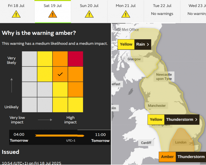
This then escalated to an Amber warning for parts of southern/southeastern England, including London and the Home Counties, for Saturday morning.
Amber “Torrential rain, with thunderstorms in places, could lead to some significant surface water flooding during Saturday morning”
The Severe Thunderstorm Watch above highlights areas at risk
“of large rainfall totals in a short period of time - leading to localised flash-flooding, exacerbated by dry/hard ground leading to fast-runoff. Also, storms may produce frequent lightning, hail and gusty winds. A severe watch area has been delineated for SE England / East Anglia for the risk of heavy rain causing flooding”.
There could be 50 to 100mm of rain starting before people are awake on Saturday. So, prepare now, just think about what you could put into place now (whilst it’s light) in case flooding does occur.
There is a wide area of England under Thunderstorm risk with a yellow warning from the Met Office during Saturday. Some areas will see heavy downpours and lightning, while others miss the showers and storms.
It will remain warm and humid, feeling muggy and close. The thundery rain will reach southeastern Scotland on Saturday morning with plenty of rain coming into eastern Scotland this weekend. It will be welcome rain with ongoing water scarcity issues for these parts but a shame its at the weekend.
The rain moves over Grampian and the far north of Scotland later on Saturday with another bout during Sunday. There is a yellow warning for rain here Saturday into Sunday morning with the risk of flooding.
There will be a gap on Saturday between the thundery rain over England, heading north into eastern Scotland and frontal rain that will reach SW England later on Saturday. In this gap, there will be drier conditions and very warm sunshine.
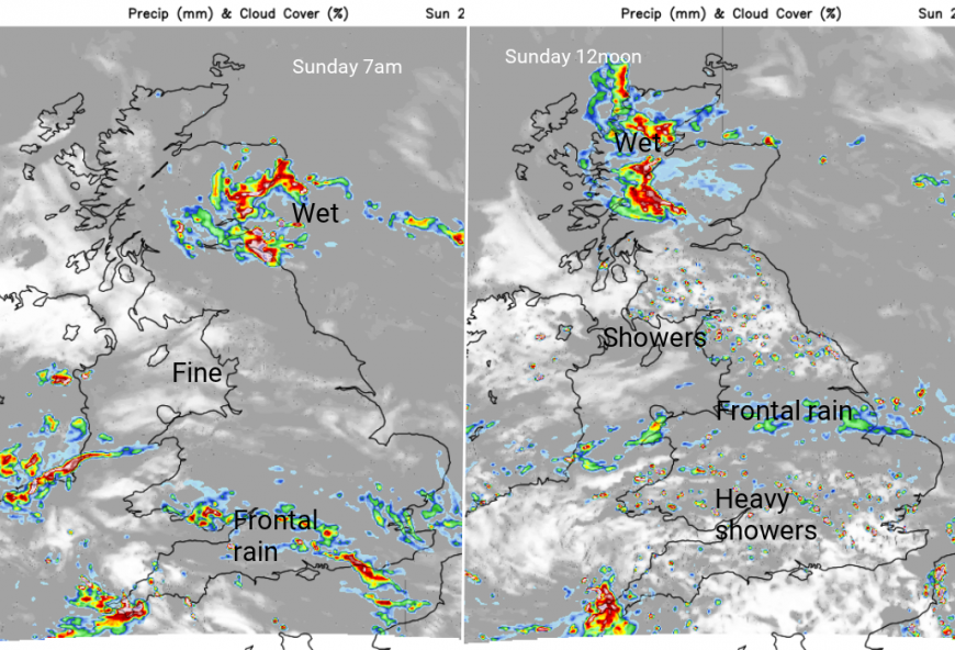
Sunday will be very mixed. Heavy and persistent rain for eastern Scotland moving further inland and westwards. The brighter gap for a time before a rash of showers develops. The frontal rain and cloud edge up through Wales and southern England, with sunny spells and sharp showers developing. Again with the risk of hefty downpours and lightning.
You might be lucky and stay in the warm, muggy sunshine but plan that there could be heavy rain, even a thunderstorm.
Loading recent activity...