A heatwave will affect most parts of the UK to end the week and over the weekend, before easing early next week, as low pressure and a cold front moves in from the west. However, high pressure may return across the south, along with hotter conditions.
The third heatwave of the summer starts today and will be longer-lasting and more widespread than the last two, lasting between today and Monday. We may even see the first 30C of the summer in Scotland this weekend.
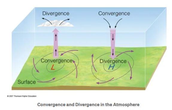
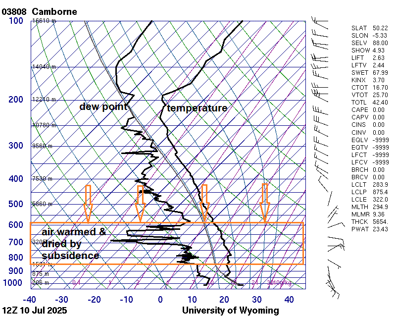
A mid to upper-level ridge of high geopotential heights will build north from Spain over the next few days, while a ridge of high pressure has built northeast towards the surface from the Azores over the last few days. Convergence and then cubsidence of air from aloft in association with the upper ridge will create increasing warming at the surface over western Europe, as air descending from aloft compresses as it reaches the surface.
Upper level ridge builds northeast across the UK next few days, with convergence of winds aloft leading to subsidence of air which will warm as it descends and reaches the surface
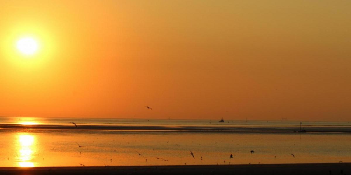
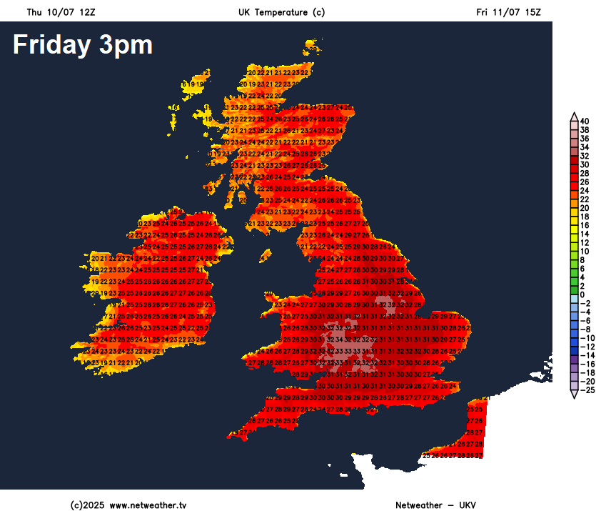
Temperatures are likely to reach the low 30s across central and southern England Friday to Sunday, peaking between 33-35C on Saturday, high 20s widely elsewhere, even in lowland Scotland, with 30C possible in the central belt or northern Highlands on Saturday. Cooler around coasts - with onshore sea breezes developing.
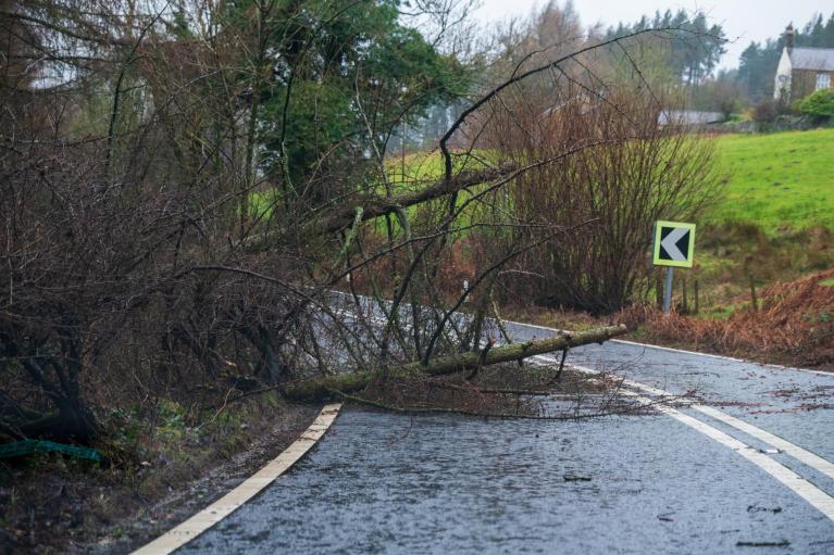
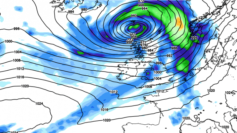
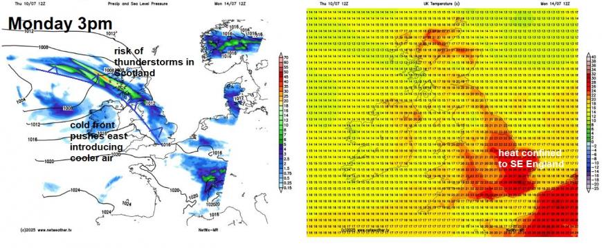
The heat looks to subside as we go into early next week, as the high pressure retreats northeast over Scandinavia and low pressure systems lurking to the west of Ireland over the Atlantic start to push a cold front eastwards on Monday, confining the heat towards SE England and East Anglia. The cold front bringing a band of showery rain, locally heavy and thundery, from the west. Rainfall amounts look patchy and slight towards the south, with the cold front weakening here as it moves into higher pressure, a greater risk of heavy thundery downpours developing across Scotland and northern England - as the cold front moves in Monday afternoon - during peak heating and with greater forcing aloft will be available too.
After Monday, it looks like a ridge of high pressure will try to build back in across the south on Tuesday, but at the same time, an area of low pressure could pass close to or over northern areas, bringing showers or longer spells of rain. How far south the showers/rain extend is uncertain this far out.
12z GFS shows little rain across England and Wales between now and the end of next week
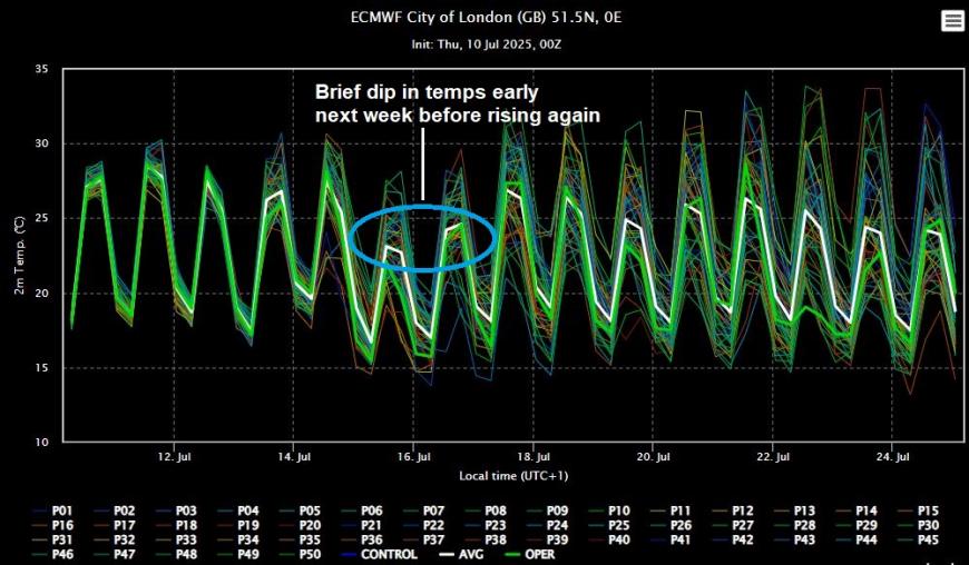
Despite recent model runs, including some of the overnight runs, painting an unsettled picture next week, a look at the 00z ECMWF ensemble clusters suggests that the majority of the ensembles indicate that high pressure may hold on across southern areas Tuesday - Thursday, while northern areas remain changeable nearer low pressure, with rain or showers at times, especially wet in the northwest. The drier and more settled conditions in the south expanding further north towards the end of the week. This could mean heat may return across the south next week after a brief dip in temperatures earlier in the week.
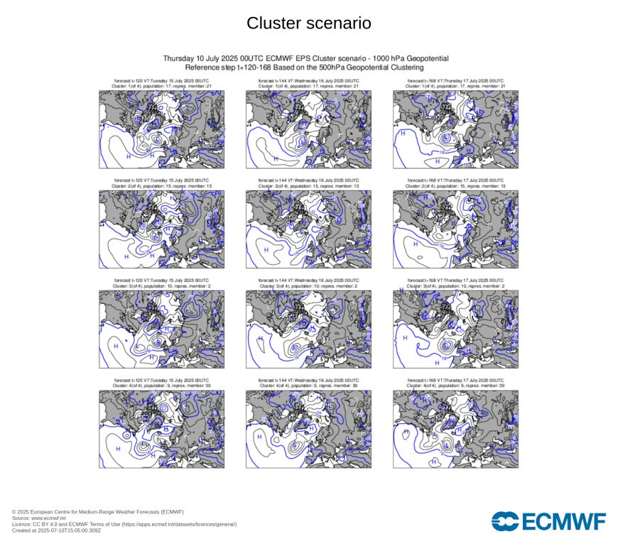
By no means is the continued mostly dry and settled conditions guaranteed to continue through all of next week too across southern areas, I’m not entirely convinced the models have a good handle on different areas of low pressure. There is a low to east of the UK early next week, while a low moves in from the west and phases with it over the UK, followed by another low moving in from the southwest mid-week. The interaction and track of these lows have been causing some differences between models.
But it seems favoured for now for high pressure to try to push northeast again across England and Wales next week, after a brief incursion of low pressure from the west early in the week.Whether low pressure has another attempt to move back later in the week remains to be seen.
Suffice to say, parts of southern, central and eastern England may see little or no rain between now and this time next week.
Loading recent activity...