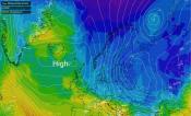
We end May on an unsettled note this week, with areas of low pressure moving east off the Atlantic bringing spells of rain and showers across all parts. Summer looks to start in a similar vein, with low pressure in charge during much of the first week of June, but what can we expect for the rest of summer?
Low pressure in charge through to at least the 6th June, though after that there is a signal for high pressure to build in from the Azores
Since mid-May, global seasonal weather models have signalled significant changes in atmospheric circulation in the Northern Hemisphere - reflecting a global regime shift, which strongly influences the type of weather we can expect in the coming weeks.
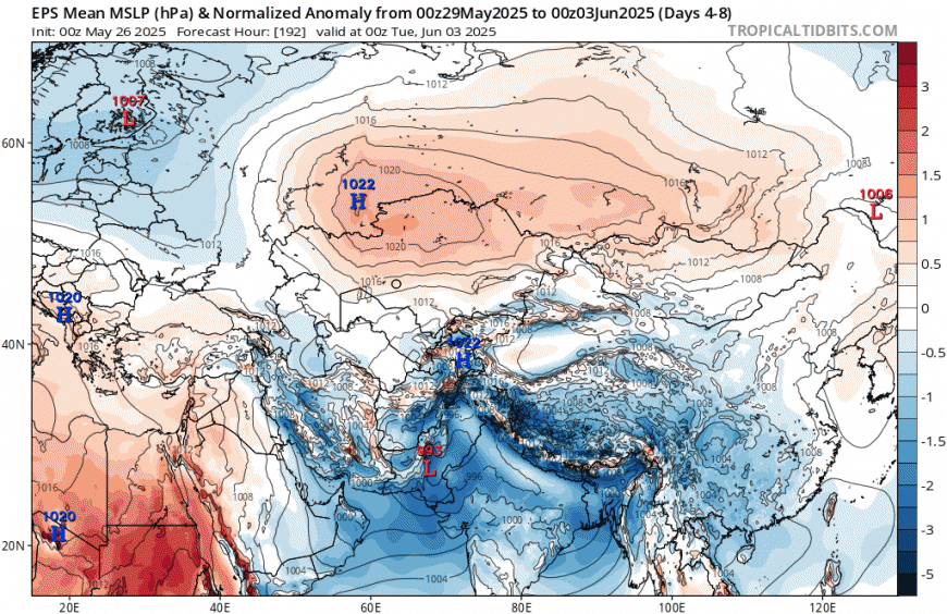
This shift is likely partly linked to an earlier than normal onset of the Indian Monsoon, observed around May 18-20. The Indian Monsoon releases a large amount of latent heat into the atmosphere. This warming promotes the sustained establishment of high pressure over eastern Eurasia. This is marked by a move from an EAMT- to an EAMT+ regime. This terminology (East Asia Mountain Torque) refers to a change in the configuration of air masses around the Himalayas. This altering of the upper-level circulation results in the North Pacific jet stream extending, causing a global shift in the areas of lower and high pressure areas.
EAMT+ leading to higher pressure over Eurasia caused by early onset of Monsoon over Indian subcontinent causing lower pressure here has caused a shift in global pressure patterns recently
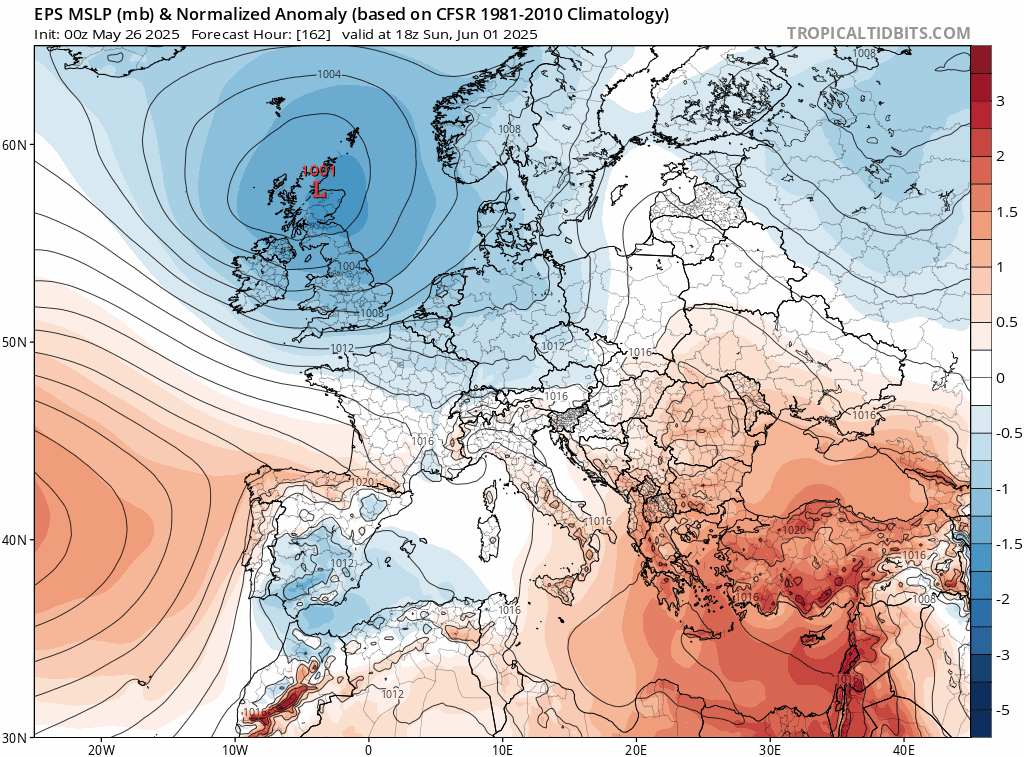
This shift in global scale patterns will affect Europe too, leading to changes in atmospheric circulation to end spring and start summer. The high latitude North Atlantic blocking high-pressure system, present almost continuously since February, bringing exceptionally dry conditions to the UK all spring, has now been replaced with lower pressure at high latitudes and a subtropical high-pressure belt moving upward in latitude. This resembles a more typical Northern Hemisphere summer pattern, which favours a southwesterly flow, with drier and sunnier conditions in southern UK, more mixed and wetter conditions for northern UK. But with the Atlantic immediately to our west anomalously warm -expect above average temperatures throughout summer.
All seasonal forecast models predict that summer will be warmer than average for the UK. The average results of eight different models predict for the 3 months:
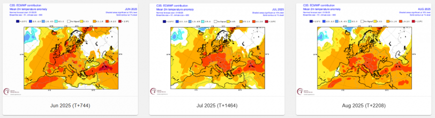
A June that is warmer than average across the country, with an average temperature 1-2°C above normal nationwide.
A July that is warmer than average across the country, with an average temperature 0.5 to 1°C above normal for northern UK, 1-2°C above normal for southern UK
An August that is warmer than average across the country, , with an average temperature 0.5 to 1°C above normal for northern UK, 1-2°C above normal for southern UK
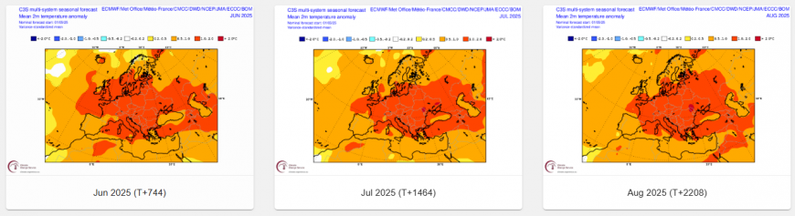
The European model (ECMWF) for June projects 1-2°C above normal for most of England and Wales, Scotland 0.5-1C above. For July, 0.5 to 1°C above normal for most of the UK, apart from southern England & East Anglia – which are 1-2C above. For August, 0.5 to 1°C above normal for most the UK, Scotland around average.
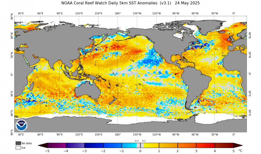
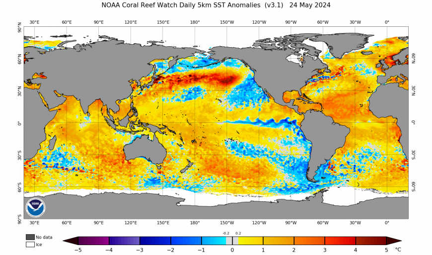
There are a few other clues that are already evident that may be an influence. One that stands out at the moment is the anomalous warmth in the Atlantic immediately to the west of Europe. Air temperature anomalies during the European summer can be predicted by studying the heat of the Atlantic Ocean. However, the Atlantic Ocean has been experiencing record-breaking warmth over recent summers too, though the Atlantic to the west is probably the most anomalously warm area of sea in the world, warmer than this time last year in the same area. So is likely to have some influence on air temperatures.
Current SST anomalies
SST anomalies around this time last year
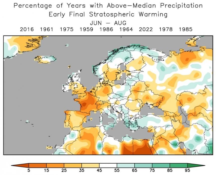
Another clue is the very early Final Stratospheric Warming on the 9th March, where the zonal (westerly) winds collapse and shift to an easterly regime until autumn. When this phenomenon occurs early in the year, as is the case this year, it can have repercussions on atmospheric dynamics in the months that follow. The recent years of 2016, 2022, 1985, and 1986 all experienced an early FSW, and were marked by dry summers in southern UK to average rainfall in northern UK.
Anomalous warmth this summer is likely to be exacerbated by a very dry spring, with dry ground conditions leading to higher temperatures when there is sunshine. Add to this the anomalous warmth from the Atlantic to the west.
But a forecaster must be careful not to draw hasty conclusions – as current trends are can’t be relied on for a forecast for 3 months ahead. But all the signals currently observed converge toward a anomalously warm summer accompanied by sustained warmth, after perhaps a slow start with unsettled conditions persisting in early June.
Anomalous warmth looks a good bet then, the only major question mark remains how much rainfall? Quite critical this summer for farmers, growers and the water industry, given how exceptionally dry spring has been.
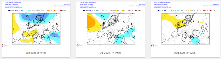
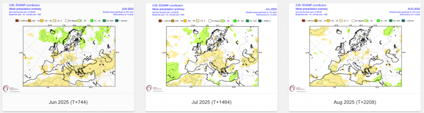
Some beneficial rain looks likely in early June, but high pressure could dominate more in summer thereafter, looking at ECMWF seasonal forecast, more particularly in the south, bringing the risk of below normal rainfall here. However, the projections from ECMWF and C3S (multi-models) is quite weak, with average the greatest signal, but hint of drier in the far south.
There will be the possibility, should this be the case, of thunderstorms here that are able to alleviate the drought already prevalent in northern Europe. This will rely on troughs of colder air aloft and associated low-pressure areas breaking through or in between the likely ridges of high pressure extending from the Azores at times through summer. Rainfall is signalled to be more average across northern areas, thanks to Atlantic fronts moving through at times, so hopefully the drought conditions from spring will be redressed here through summer.
There other clues too, which will also be covered in more detail in the UK summer forecast 2025 to be released soon, these include El Nino Southern Oscillation (ENSO) impacts on the global patterns. Currently, the US Climate Prediction Center predicts an ENSO-neutral, which currently present, to be favoured to continue through the Northern Hemisphere summer 2025 (74% chance during June-August), with chances exceeding 50% through August - October 2025.
Loading recent activity...