Early next week may see some scattered showers in places, drier for all for a few days, before turning unsettled across all areas through the Bank Holiday Weekend with rain or showers, perhaps lasting until the end of the month.
There’s blue skies and the sun is shining again across many areas this afternoon, as it was yesterday, despite cloud spreading west overnight across England as far as Wales to bring a cloudy start.
Sunday looks a similar day, cloud may roll west across England from the North Sea overnight to bring a grey start, especially towards the east, but cloud should break up to lead into another fine day with plenty of sunshine.
However, cloud may thicken from the northeast to bring a few showers across southern Scotland and NE England during the afternoon. This is related to a shortwave upper trough moving southeast from Norway arriving in the northeast during the afternoon, introducing cooler air and creating lift to allow a few showers to develop.
Shortwave upper trough moves SE from Norway to the UK on Sun & forms slow-moving upper low over UK early next week
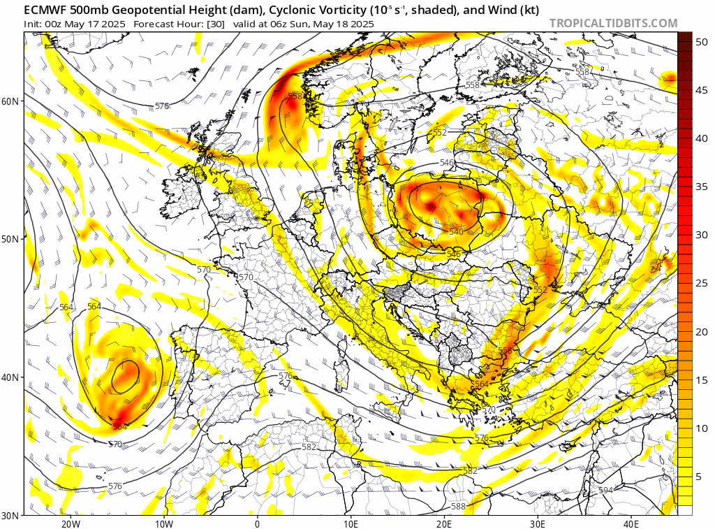
This shortwave trough arriving from the northeast on Sunday will go on to form an upper low which will become slow-moving across the UK early next week. Colder air arriving in the mid-levels from the northeast associated with the upper low will create steeper lapse rates with surface heating. Surface moisture won’t be particularly rich, given antecedent cool and relatively dry northeasterly flow. However, some greater moisture aloft will mean showers are likely to develop Monday and Tuesday with surface heating leading to rising parcels of air, some locally heavy, with hail (given cold air aloft) and the odd rumble of thunder.
Cool mid-level temperatures will create steep lapse rates and CAPE that will support heavy showers to develop in places on Monday and Tuesday
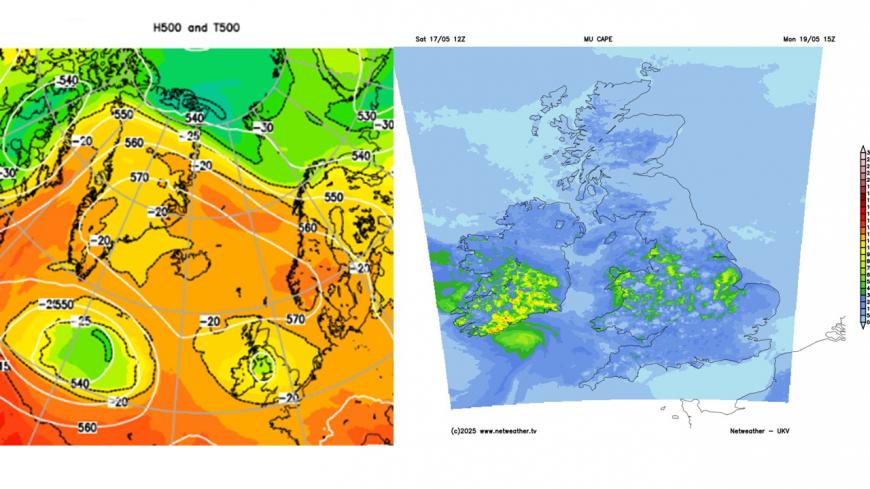
The distribution of showers developing on Monday and Tuesday is somewhat uncertain still, with some divergence between models. Northern and central Scotland along with eastern England look least likely to see showers develop and staying dry – thanks to higher pressure towards northern Scotland and cool, dry and stable air blowing off the North Sea towards eastern England.
On Monday, SW Scotland, NW England, Midlands, Wales and central southern & SW England look most favoured for scattered showers to develop, with isolated thunder and hail possible with heaviest showers. On Tuesday, heavy showers and thunderstorms develop again but perhaps more focused towards Wales, SW England and southern Ireland. However, this distribution of showers is not definite and may change.
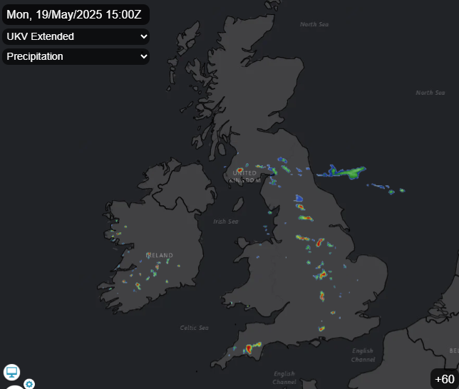
Monday 3pm UKV
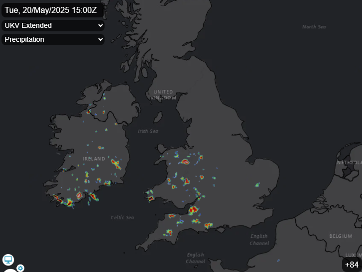
Tuesday 3pm UKV
On Wednesday, the upper low moves south with cooler, drier and more stable air moving in from the northeast across lower levels, so convection / showers appear unlikely, perhaps a few showers across southern most counties.
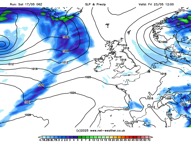
A ridge of high pressure looks to build back in on Wednesday and Thursday, so most areas dry with sunshine. However, a more substantial and country-wide change to more unsettled conditions looks to take over for the Bank Holiday Weekend. The change will be heralded by rain arriving from the west across Scotland and Ireland later on Friday, as a frontal system moves in off the Atlantic. The rain then spreading southeast across most parts Friday night and Saturday morning, followed by sunshine and showers for the rest the weekend and the Bank Holiday Monday, though some longer, more organised areas of rain may also spread in from the Atlantic across some areas too, but confidence is low on detail for now, suffice to say it will turn unsettled and windier next weekend, including the Bank Holiday Monday.
Turning unsettled for the Bank Holiday Weekend and likely to remain unsettled into the following week
Staying unsettled until the end of the month according to ECMWF ensemble mean
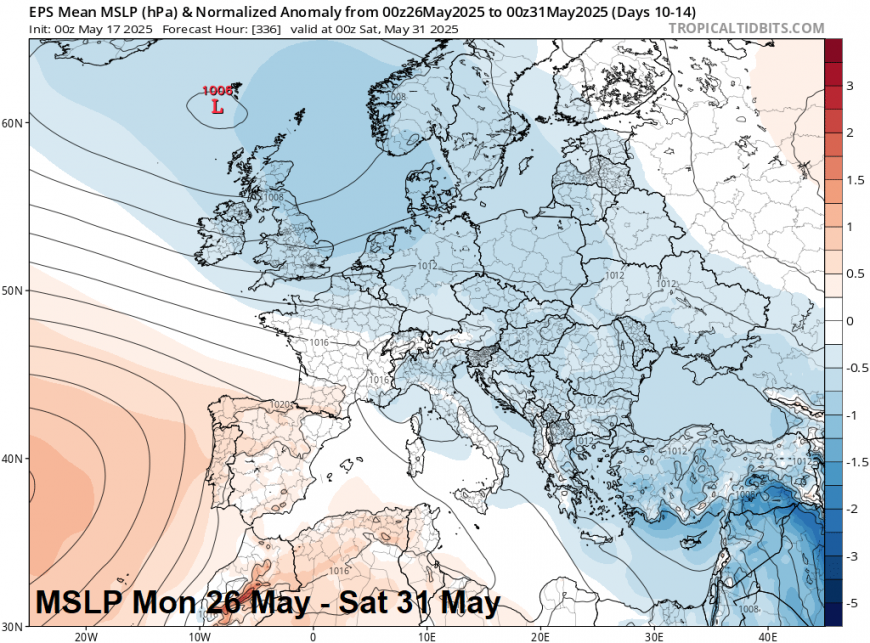
The unsettled conditions may continue until the end of the month and into the start of June too, looking at ensemble guidance from the major weather models, with the flow generally cyclonic and from the Atlantic (westerly) – with further rain or showers and windy at times.
Loading recent activity...