Dry weather will continue well into next week. The fire risk continues. Much of the UK will be warm and sunny, just with overnight cloud from the North Sea
More dry weather coming up for this weekend. Eastern areas will feel cooler in the breeze off the North Sea with early low cloud but the warm sunshine will soon get to work. Many parts of the UK will be fine and bright, often warm and sunny.
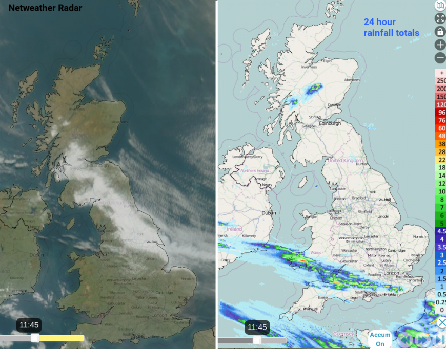
There have been interruptions to the fine, dry weather for parts of the UK. Scatter heavy showers and thunderstorms brought a dramatic transformation to parts of southern Britain earlier this week but it was a temporary change. There has been low cloud off the North Sea, the haar or fret, for northeastern Britain and a cold front diving southwards also bringing more cloud for Wednesday morning.
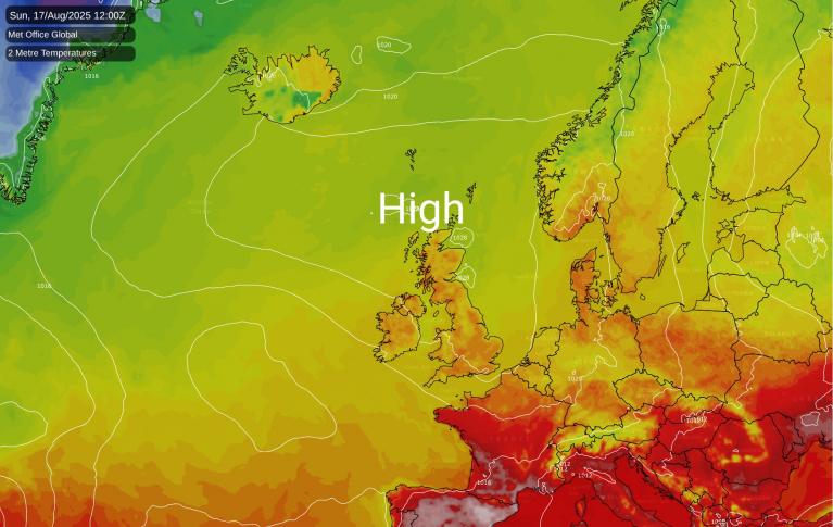
High pressure re-establishes itself over the UK with a cooler, fresher airflow from the Norwegian Sea, coming from the northeast and working its way well inland. Night-time temperatures will fall away and the murky low cloud from the North Sea will continue to feature. However, further west the sunshine and warmth will persist. As will the high risk of fires spread, should they start.
The high pressure continues to act as a block, against incoming Atlantic weather fronts but as it is centred between Scotland and Iceland, the flow isn’t going to warm and humid as it was by the end of last weekend. We are relying on the heat of the strong sunshine. Temperatures this week could still reach 20 to 24 or 25C with blue skies and light winds. If you are stuck under the low cloud with a breeze off the sea for eastern England then 12 or 15C will be more likely. But this early morning murk soon lifts and the sunshine does its work
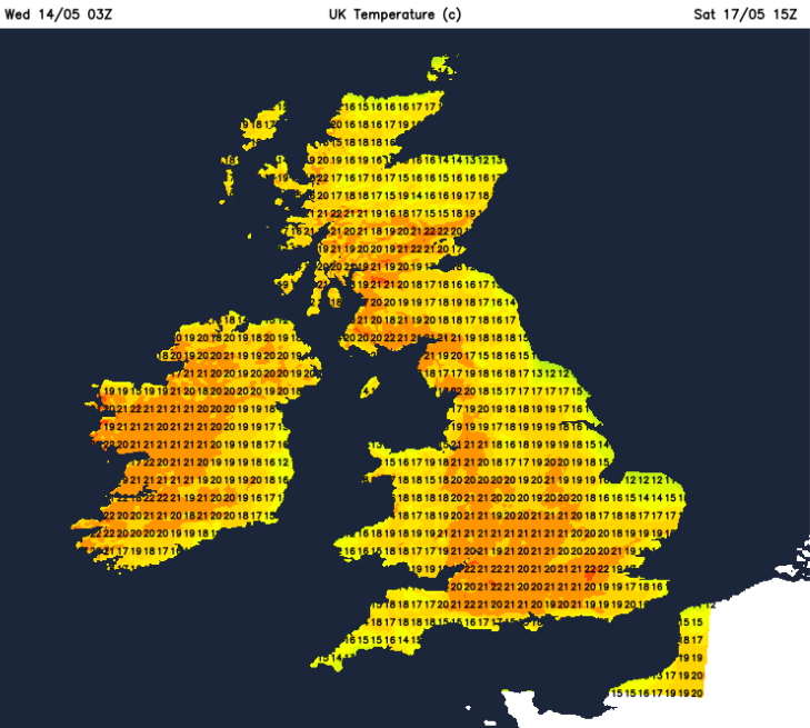
The weekend does look dry. Many parts will see more glorious sunshine and fine conditions. Saturday could start off grey and cloudy for much of England and inland Wales with a north to northeasterly breeze coming down the North Sea. It soon brightens up allowing the temperatures to shoot up.
Again on Saturday night, the low cloud will encroach inland with a grey start on Sunday for Aberdeenshire and a good part of England, especially for eastern and central areas. This soon thins and breaks.
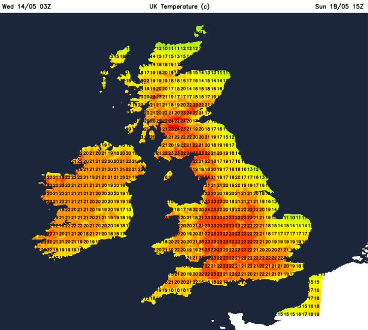
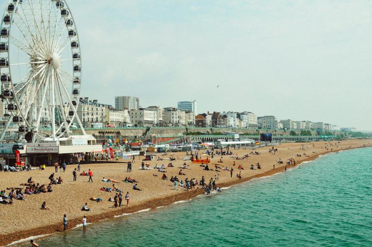
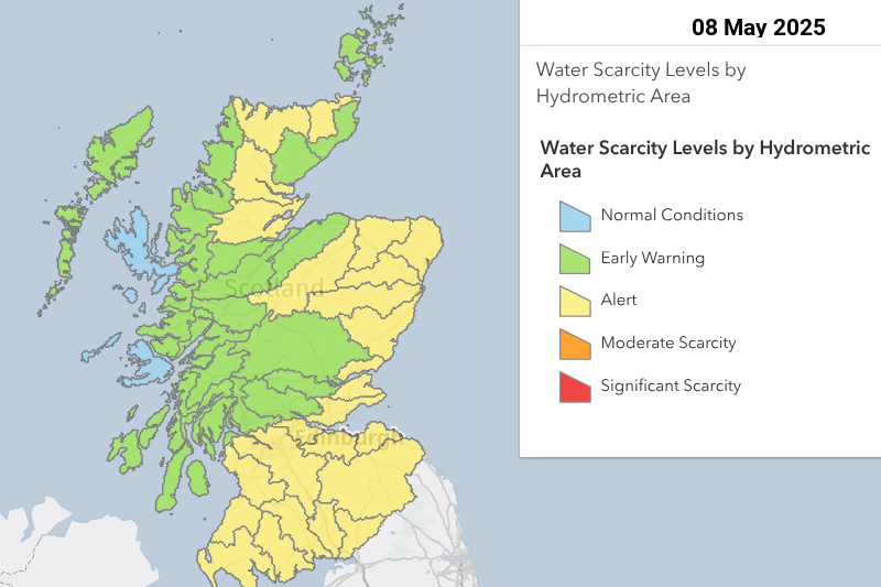
Whitby will feel cool in the shade or breeze with an air temperature of 13C. Cambridge up to 18C this weekend. London could see 23 or 24C and Cardiff up to 22C. Western areas just carry on enjoying sunny dry and warm weather. Belfast 22C and Glasgow could be even warmer, up to 24C so quite the weekend. The lack of rain continues and concerns must be increasing for water companies.
There have been more fires starting and burning, some over several days. These draw fire service resources to areas of scrubland, heaths and hillsides. The Fire and Rescue teams still need to attend fires in buildings and other incidents as part of their emergency response. The conditions across much of the UK is still very dry underfoot, there is very little rain forecast and there is plenty of vegetation lying on the ground as fuel. The conditions are ripe for wildfire spread, once one starts.
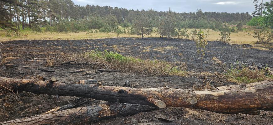
The public are again being asked to think when outdoors, to not light campfires or take disposable BBQs, to take great care with cigarettes and not to use naked flames whilst these conditions persist. Also if people do see a fire, please report it by dialling 999. Too many reports are much better than no-one bothering.
Loading recent activity...