There are changes afoot for the weekend which seems a shame when the weather has cheered up. Warm air from Africa and Iberia will reach the UK on Thursday lifting temperatures into the high teens. Scotland and Northern Ireland will feel pleasant in the sunshine but not quite the warmth of more southern areas. A southeasterly flow off the North Sea will keep northeast coasts feeling cool too. Friday will be warm but with more of a breeze and increasing cloud through the day.
This signals a change for the weekend. For the start and middle of this week, we have seen clear blue skies, bright sunshine and increasing warmth each day. The nights have been cold and frosty but we lose that chill after Wednesday night in the north.
The High pressure dominating our settled UK weather will drift towards SE Europe. West of Iberia is a low pressure, a named storm , Martinho. This is not part of our UK storm naming group but is affecting Portugal and Spain midweek, adding to recent rains and existing flooding problems but also increasing reservoir levels. The low pressure will begin to throw cloud and rain towards SW Britain and southern Ireland by Friday. You might notice Saharan dust as well.
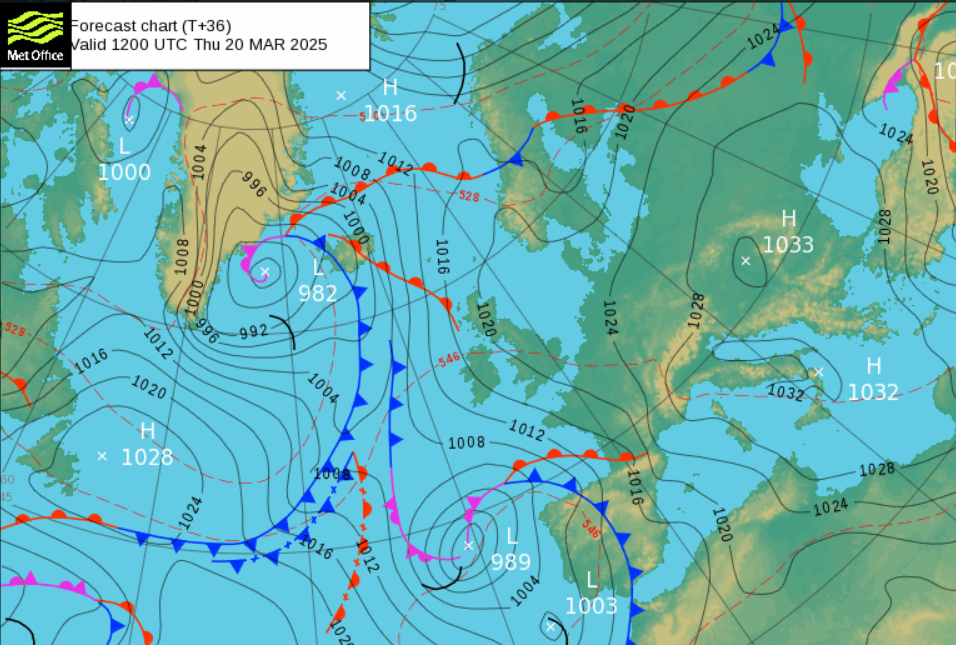
During the weekend there will be a frontal mess sliding off the Atlantic over Spain, France and the UK. A lengthy front linked to a low centre near Iceland will only creep towards NW Scotland by Saturday. Another low centre will spiral up from the Bay of Biscay and throw bands of rain over the West Country, Wales and the Irish Sea on Friday evening.
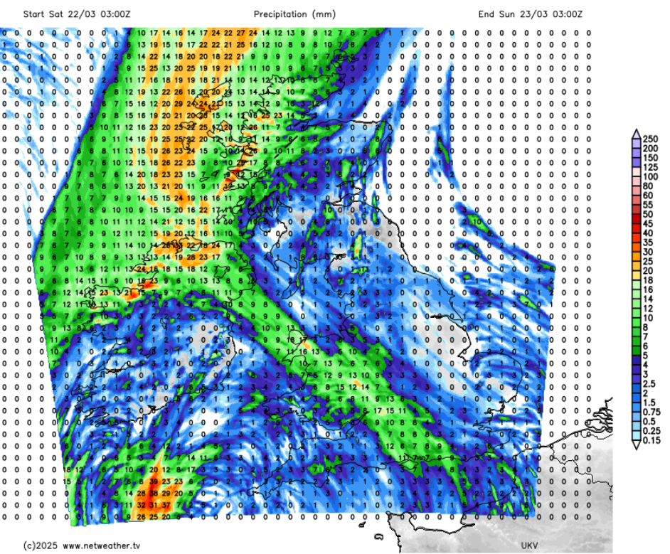
Ahead of these will still be dry but cloudy. Gradually through Saturday further bands or cloisters of showery rain will arrive from the southwest, perhaps with a few sharp showers mixed in. Eastern Britain will be mostly dry and temepatreus across teh UK will be 13 to 16C. The long frontal band linked to the Iceland low will reach Northern Ireland and the NW Highlands during Saturday night and make some progress eastwards on Sunday. There is lower confidence about where this band will end up. Behind the band, there will be brighter, clear conditions but in colder air from the northwest.
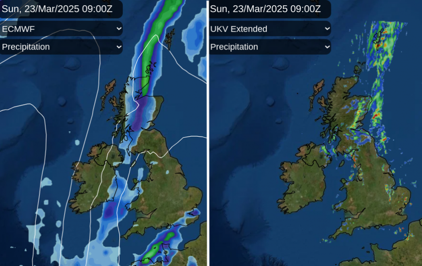
For both days at the weekend don’t rely on Weather app timings of when it will rain or be dry. There will be drier, brighter gaps but also these outbreaks of rain. Southern Britain could see some well-scattered sharp downpours on Sunday but with fair, bright weather for most. Temperatures on Sunday will be around 11 to 14C, so a gentle decline.
Loading recent activity...