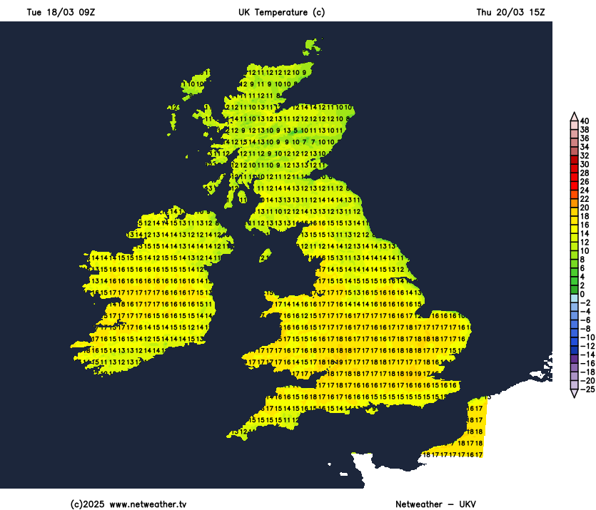
It will finally warm up this week as easterly winds are replaced by southerly winds, perhaps reaching the high teens on Thursday – thanks sunshine and a gentle southeasterly flow, with temperatures reaching as high as 19-20C across southern and eastern England.
Turning more unsettled from Friday and through the weekend, as low pressure moves up from the southwest and showers spread north across the UK. But a brief unsettled spell seems likely, before high pressure builds back in across the north next week, with potential for cooler or even chilly conditions to return and persist through early April too.
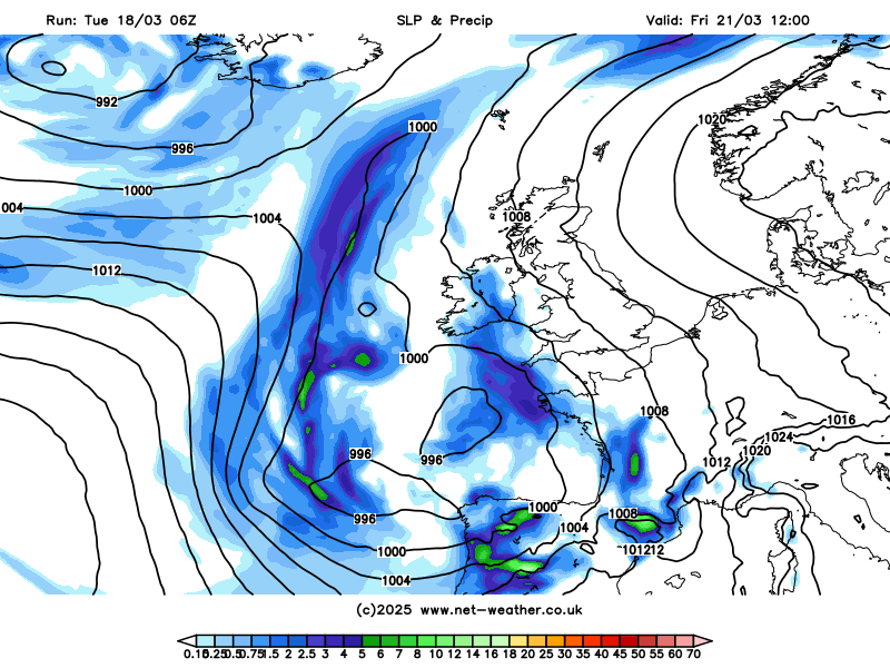
After a dry weekend and much of this week too, it’s likely to turn more unsettled from the south during Friday, as a new area of low pressure swings in from the Atlantic towards northwest Iberia on Friday, then extends northwards across the west of the British Isles over the weekend as quite a complex system with more than one circulation
The low pressure system moving up from the southwest into the weekend will throw weather fronts north - bringing showery rain north across UK from Friday afternoon, after a dry start. Further showers moving or developing northwards over the weekend too, perhaps thundery in the south, but with some drier and brighter or perhaps sunny interludes in between. It will be much milder than of late though.
Showers look to ease later on Sunday and into early next week though, as the low pressure system moving in close to or over the southwest of the British Isles this weekend sinks southeast towards France into early next week.
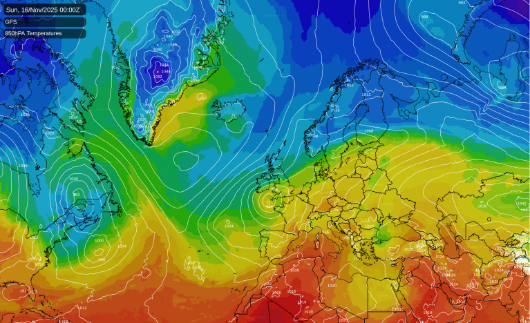
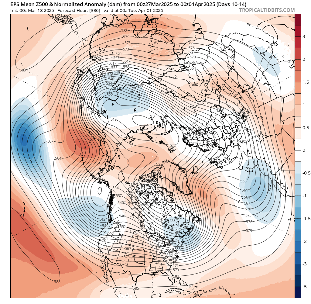
However, there is increasing divergence from the models into next week, the 00z ECMWF shows high pressure builds in from the west off the Atlantic for the rest of the week, with a return of more settled conditions again, away from the southeast – where showers are possible for a time. While the 00z/06z GFS has an Atlantic frontal system move through early next week, bringing a spell of rain east across all parts, followed by a ridge of high pressure building in from the west for a time, before Atlantic low pressure and fronts move back in from the west from Thursday.
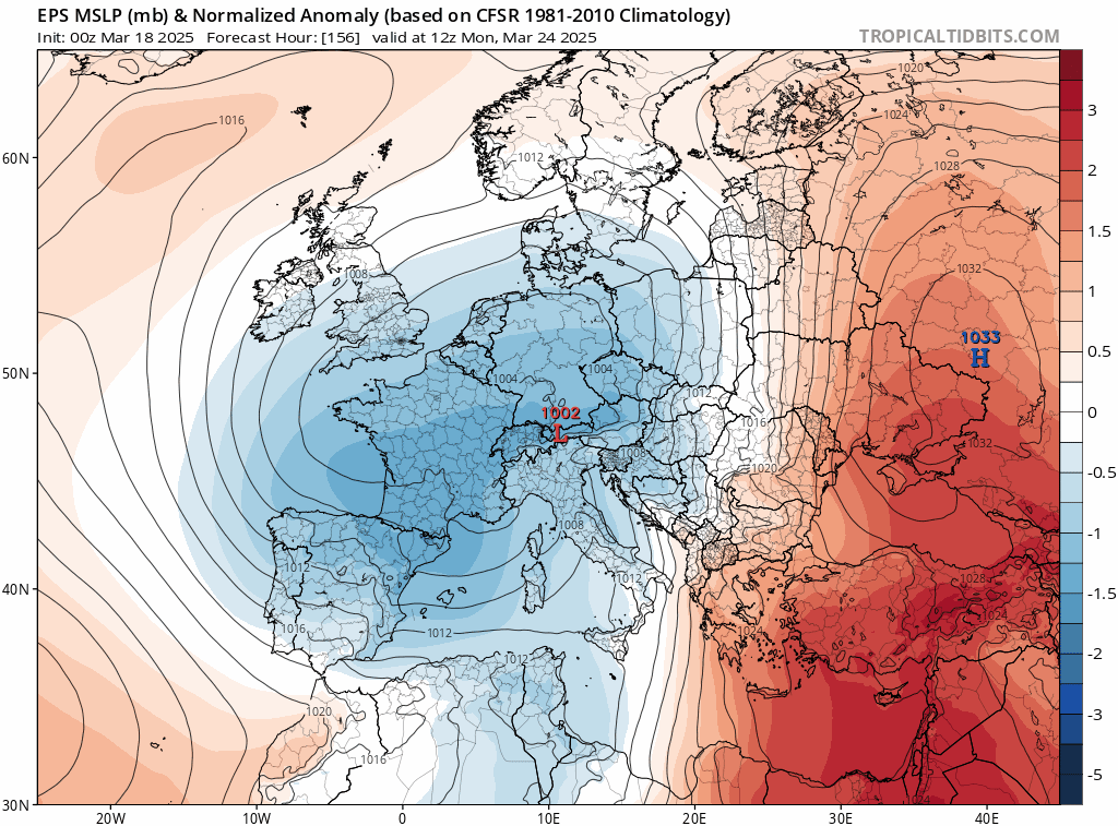
When there’s such uncertainty a week or more away, forecasters turn to the model ensembles for guidance on a possible route forward. ECMWF mean and ensemble clusters with highest number of members show high pressure towards the northwest and low pressure over mainland Europe, supporting the high resolution run. However, the GFS ensembles mean, although has a ridge of high pressure over the UK first half of next week, does bring troughing east off the Atlantic and unsettled conditions later next week.
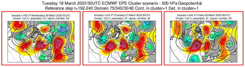
Blocking (red), NAO (green), Atlantic Ridge (purple) most represented below through to early April
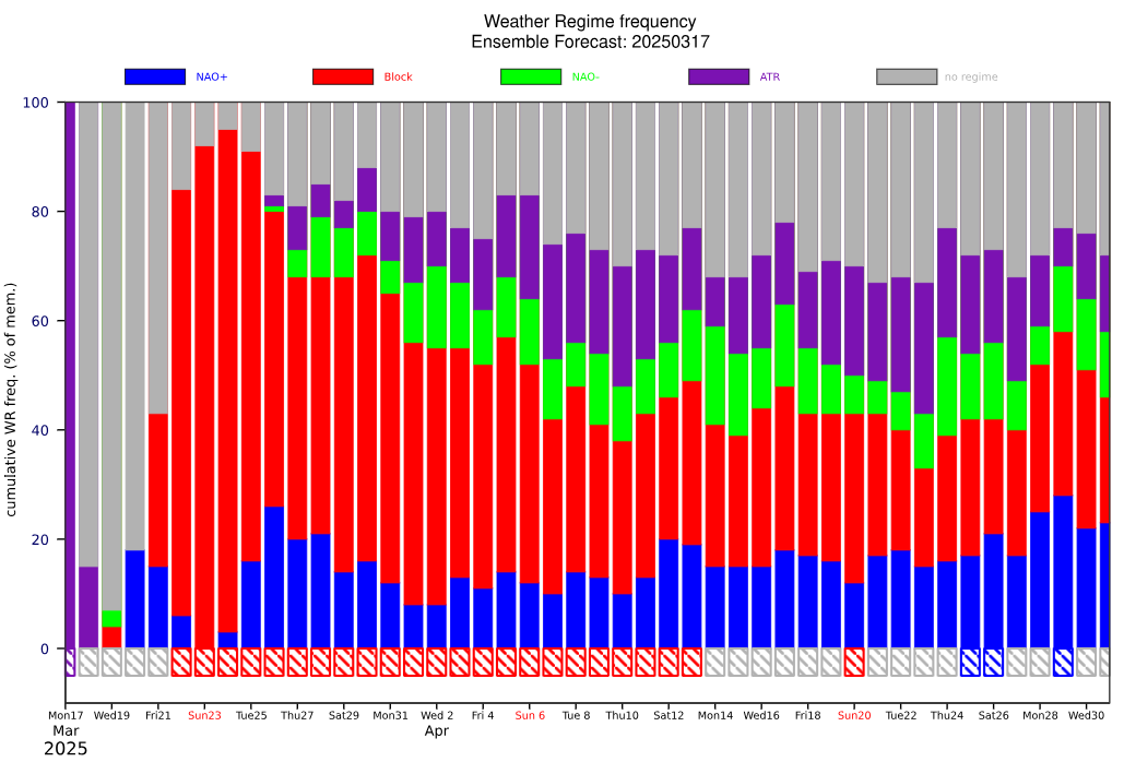
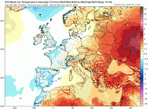
Looking further ahead, ECMWF ensembles mean has a fairly strong signal for an Atlantic ridge / Greenland high in the last 5 days of March into first few days of April. This would pull down a cool/chilly flow from the north. GFS ensembles flatter with the Atlantic ridge, so a more westerly flow. If ECMWF is more on the money, it looks remain mostly dry next week and also to the end of the month, resulting in a very dry March. England and Wales have only seen roughly 20% of the March average rainfall, this unlikely to rise much.
Also, the unusually early Final Stratospheric Warming on 9th March may start to impact the troposphere, where our weather happens, to end the month or in early April. The reversal of polar stratospheric winds to easterly, perhaps now persisting until autumn, is only slowly working its way down from the top towards the bottom of the stratosphere, with signs that it may reach the top of the troposphere to end the month. If the reversal propagates down into the troposphere, this may lead to high latitude blocking with lower pressure over Europe (near or south or southeast of the UK). Some hints of this from extended range of the ECMWF output over recent runs.
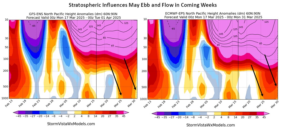 Image from StormVista models
So, there is a risk of chilly end to March and perhaps cooler than average start to April, as the slow propagation of the final stratospheric warming promotes high latitude blocking. This leading to a pattern with a negative North Atlantic Oscillation - with higher pressure over Iceland and lower pressure over southern Europe, with winds from the north and/or northeast and east, that’s certainly hinted at by ECMWF for now. Whether this theme continues out to Easter Weekend is too far out to have any confidence in for now though.
Loading recent activity...