
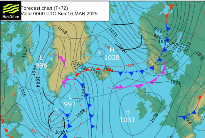
It’s looking dry this weekend but chilly. The cold air will stay with us well into next week. This means that the risk of frost remains, and there could be patchy ice where any daytime showers have passed by. Last weekend there was warm air from the south and temperatures rose into the high teens. This weekend we have a completely different air mass with origins in the Arctic.
In the shade, after dark and when exposed to the wind, you will recognise that colder source and pull your coat tighter. However, as high pressure builds at the weekend, it will often be calm, fair and occasionally sunny. We are beginning to feel the strength of the sun’s rays as we move into springtime, but Sunday does look more cloudy.
This weekend daytime temperatures will be around 8 to 11C but where the skies remain cloudy, it will feel more like 5 to 8C.
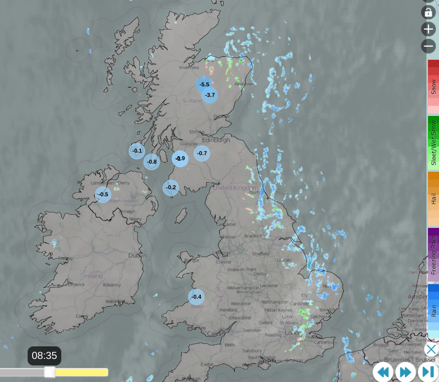
Netweather radar from Thursday 13th am showing lowest ten temperatures and mixed showers over eastern Britain
Friday evening
All through this week there have been showers from the North Sea bringing passing icy downpours to Britain with a mixture of rain, sleet, hail and even occasionally snow. Even Cheltenham race course saw snow early on Wednesday in a heavier band. This scattering of showers will continue by day on Friday but ease down on Friday night.
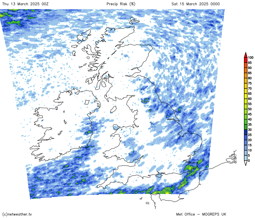
The MOGREPS model shows the risk of precipitation, of showers from the North Sea during the night. There will be a moderate northeasterly breeze through the Strait of Dover The Kent Downs might see a temporary covering of snow by night if these showers pep up, perhaps some passing wintriness for High Weald too. The skies will clear and the winds fall light for Northern Ireland and Scotland closer to the centre of the high pressure.
Saturday
It will be a chilly start across the UK but especially so for the Essex coast, around the Thames estuary and coastal Kent. Here we have colder air and a light to moderate north/ northeasterly wind making it feel colder. There will be some convective infill of cloud during the day but it remains fair and bright with sunny spells cheering the day and bringing some welcome warmth. Belfast up to 9C and Birmingham 8C.
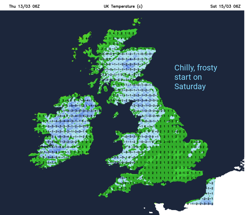
A weak weather front will bring cloud to northern Scotland with a little patchy rain. There will still be breaks in the cloud for southwestern Scotland and Northern Ireland but the cloud will reach down into northern England by the morning. Southeastern Britain will be cold with a widespread frost and temperatures in some spots down to -4C.

Sunday will be another fair day with more cloud than Saturday. There will still be bright spells and even sunny ones but it will feel cool when it clouds over. Again a few showers will appear for eastern Britain, some for northern Scotland, even a few reaching the north coast of Northern Ireland. Mostly it will be a dry, calm day but often feeling cold. Manchester and London up to 10C. Glasgow at 11C on a quiet day.
After last weekend’s taste of warmth and spring sunshine this weekend maybe a bit of a disappointment. However, it’s not blowing a gale or chucking it down with rain. It will just be a bit nippy but it is only mid March. Hopefully the sunshine will break through any cloud cover and that will feel fine.
Loading recent activity...


