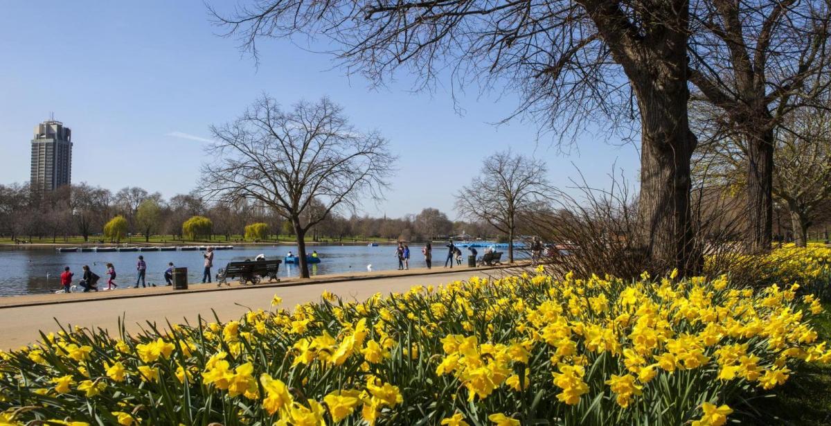
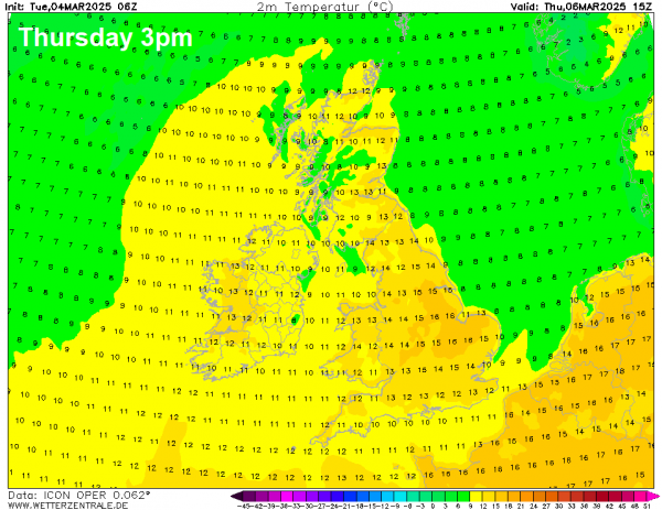
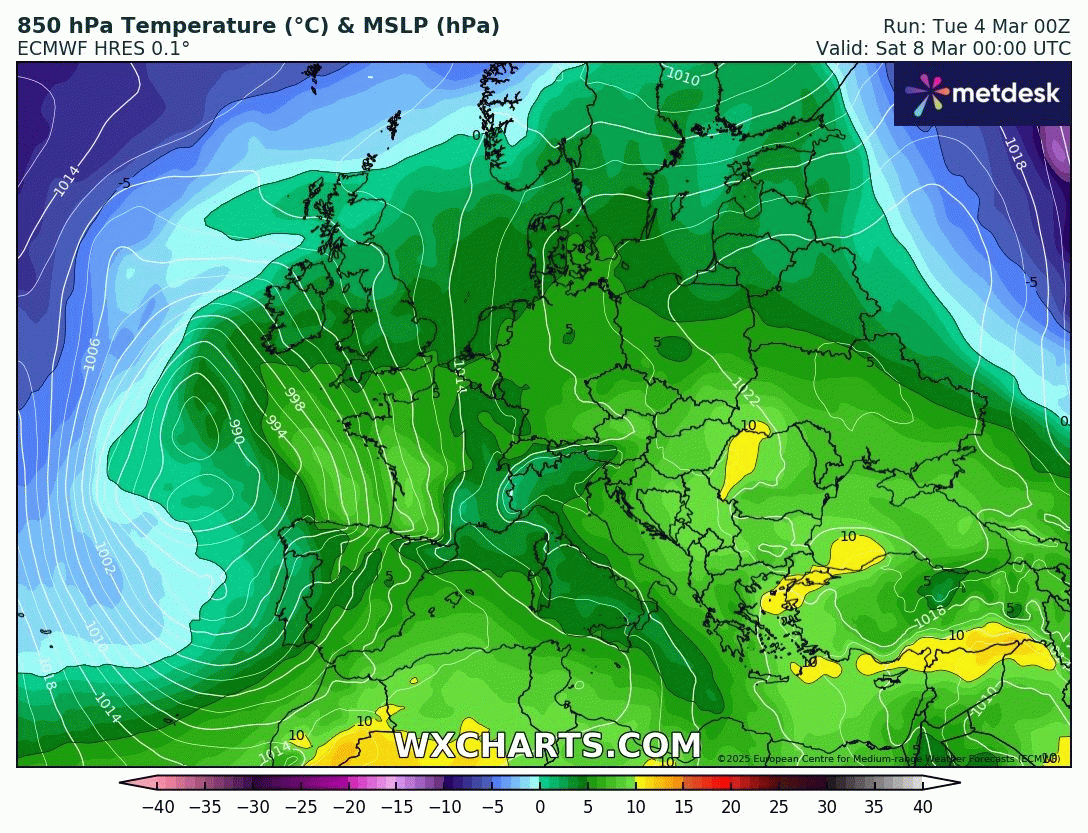
Temperatures fell to -6C at Benson Oxfordshire last night and widely below freezing elsewhere across the south. One more night of frost in the south tonight, perhaps falling as low as -4/5C again, then the rest of the week is looking generally frost-free across the UK, as a southerly flow develops - bringing in milder air. Temperatures will be on the rise, as a result, temperatures somewhere across eastern England could reach 16-17C on Thursday.
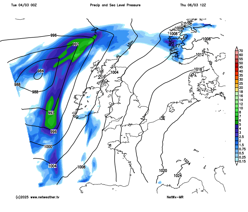
However, it will also briefly turn more unsettled, with showery rain spreading north on Thursday and Friday across many parts - as two separate areas of low pressure move in to the northwest and southwest.
High pressure looks to build back in from the northwest over the weekend and into early next week, so unsettled conditions will ease away to the west and southwest over the weekend, most places away from the west and far southwest becoming dry and settled again, could be very mild for early March on Saturday too with any sunshine, with temperatures again reaching 16C or more.
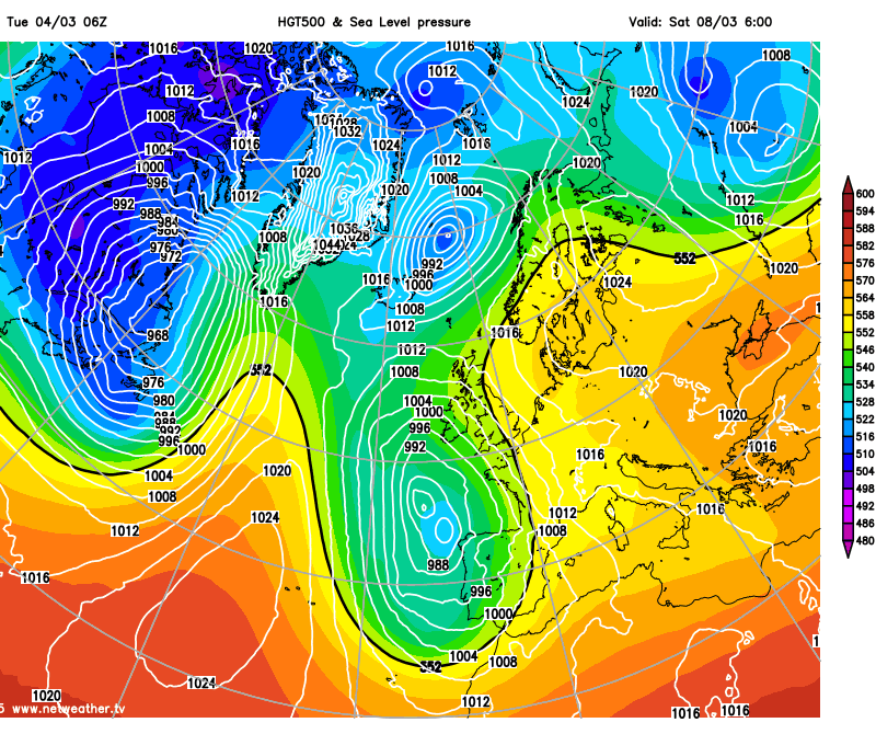
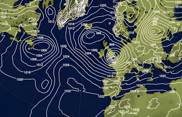
But don’t be fooled by this early spring warmth on offer, because changes are afoot that may mean winter bites back next week. A blocking high pressure system looks to establish close to the northwest of the British Isles next week, as the upper flow becomes increasingly wavy and disrupted over the North Atlantic, with the jet stream eventually displaced to the south of the UK over southern Europe by the block of high pressure building near Iceland.
With high pressure close to the northwest and low pressure systems tracking east off the Atlantic way to the south over southern Europe, winds looks to turn northeasterly - which may pull in colder arctic air lurking over Scandinavia by mid-week - which may bring a cold snap and perhaps even some wintry precipitation in places. Certainly it looks like a return of overnight frosts are possible if skies can clear.
Also next week, high up in the atmosphere, major changes are forecast to occur in the stratosphere which could have consequences for our weather later this month and even into April - should these changes work down and affect the troposphere, where our weather happens, too.
Current forecasts from Numerical Weather Prediction models point to a significant stratospheric warming over the next 7 days, potentially leading to a full split and collapse of the stratospheric polar vortex by mid-month. It looks to be a Final Stratospheric Warming (FSW) - i.e. as the first date that the daily-mean westerly winds at 60N and 10-hPa altitude fall below 0 m/s, so turn easterly, and do not return to a westerly state for more than 10 consecutive days. The mean date for a FSW is 12th April, but they can occur as late as early May, with easterly winds after the FSW until the autumn when the polar vortex appears again.
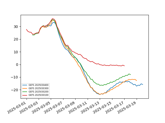
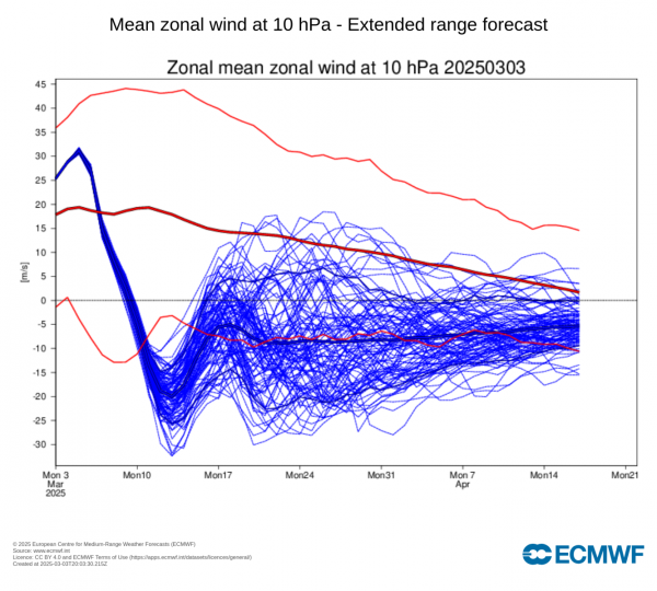
The latest 00z GEFS mean shows a reversal of winds at 10 hPa around 10th, next Monday, EPS mean similar too. The major warming is being forced by planetary wave no 1 pushing poleward over Alaska / eastern Siberia - causing a displacement of the Stratospheric Polar Vortex towards NE Europe before then, though not translating down to the troposphere. But the stratospheric polar vortex then goes on to split after mid-month.
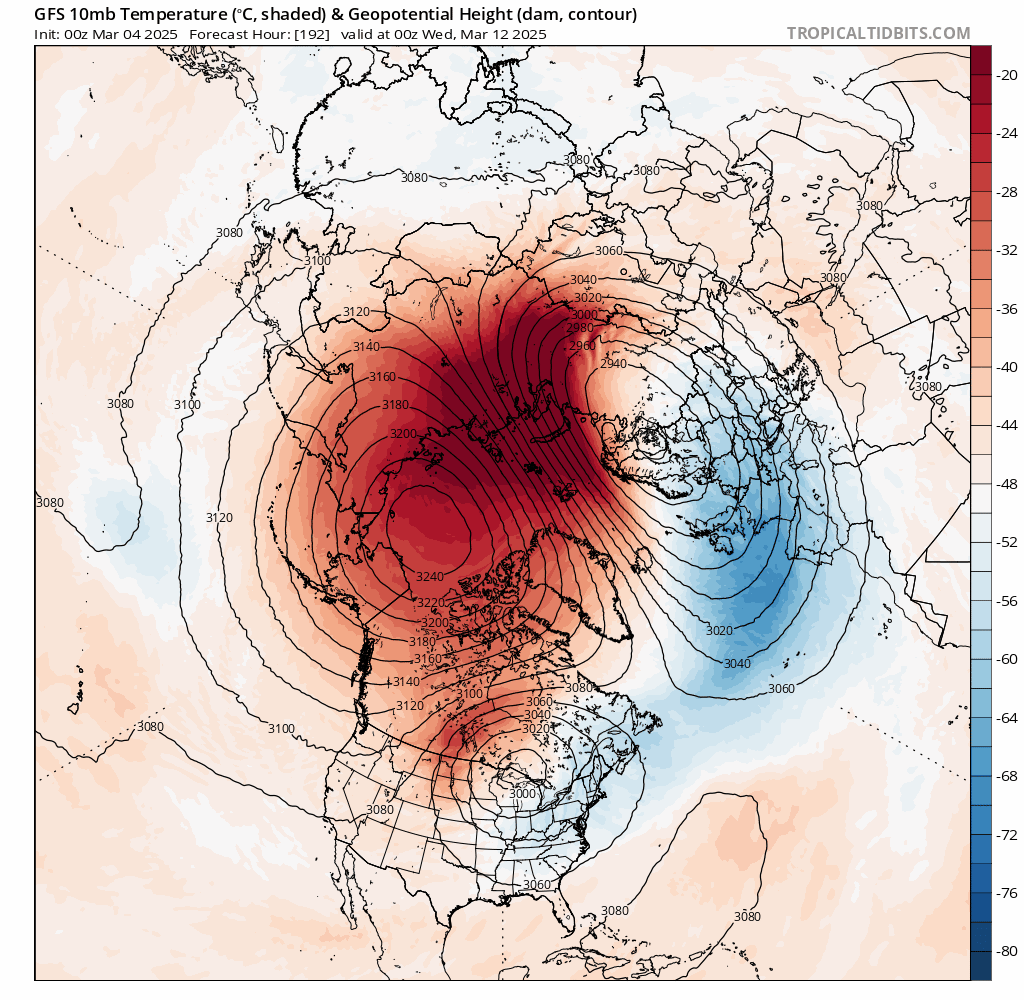
However, there is uncertainty over whether the reversal of winds in the stratosphere, typical from the FSW event will propagate down to the troposphere – where our weather happens. Should the reversal move down, it could allow pressure / heights to rise in the higher latitudes beyond March 20th. Perhaps re-inforcing blocking high pressure that may already be present around Iceland / Greenland should it persist beyond next week, or a re-emergence of blocking high pressure here or to the northeast of the UK.
Around two out of three major Sudden Stratospheric Warmings / Final Warmings lead to a Negative North Atlantic Oscillation (-NAO) which is often associated with blocking high pressure at higher latitudes of Greenland and/or Scandinavia – which forces the Atlantic storm track further south and also causes cold air to push south into Europe, including the UK.
It usually takes a week or two for the reversal to propagate from the stratosphere to the troposphere, so effects may not occur until early April. Sometimes it can be a more rapid response in the troposphere. Though there is no guarantee that cold air will reach the UK. However, there is an increased chance of colder conditions in late March and perhaps early April too following a Final Stratospheric warming.
Loading recent activity...