Continuing on the cold side but cloudy again over the weekend and into early next week, with rain, sleet and hill snow in the north. However, it looks to turn milder later next week, perhaps very mild, but also wet in the west.
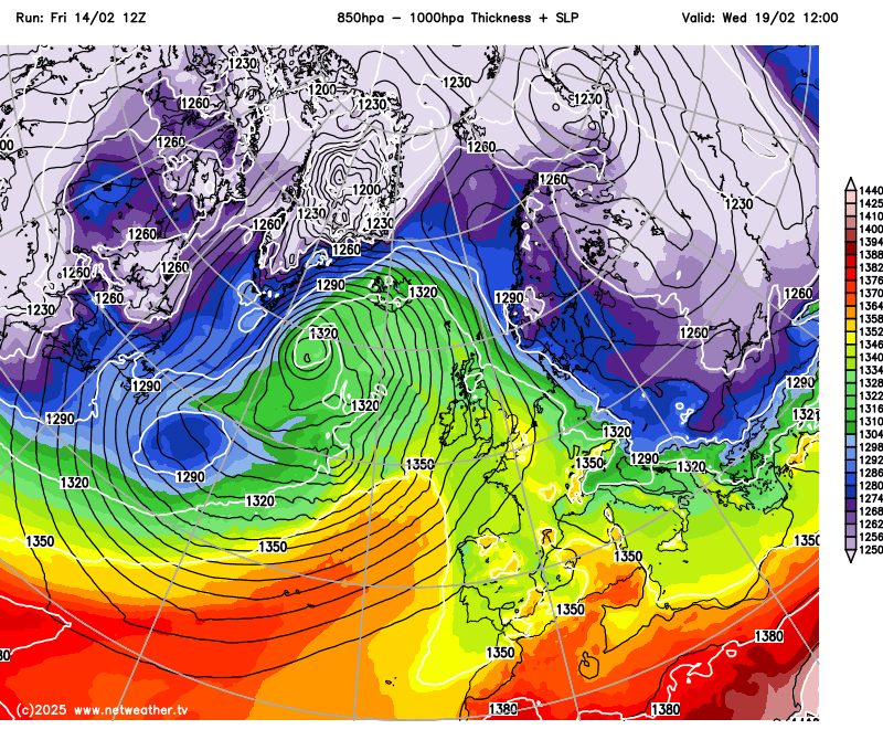
The weather models have certainly taken forecasters on a roller coaster ride since the beginning of the month, with a few high-resolution / operational model runs throwing out the Beast from the East, while other model runs and, generally the signal from the ensembles, has been more subdued and forecasting a gradual warm-up next week.
The chilly easterly or northeasterly flow this week has been plagued by persistent cloud across many areas. Fortunately, the flow has veered southeasterly, which is bringing clearer skies to southeastern and eastern areas of Britain today, but this will also lead to a risk of frost overnight under clearer skies. However, it will be cloudier with some rain towards the west, as we start to see a change from the Atlantic, with frontal systems moving in.
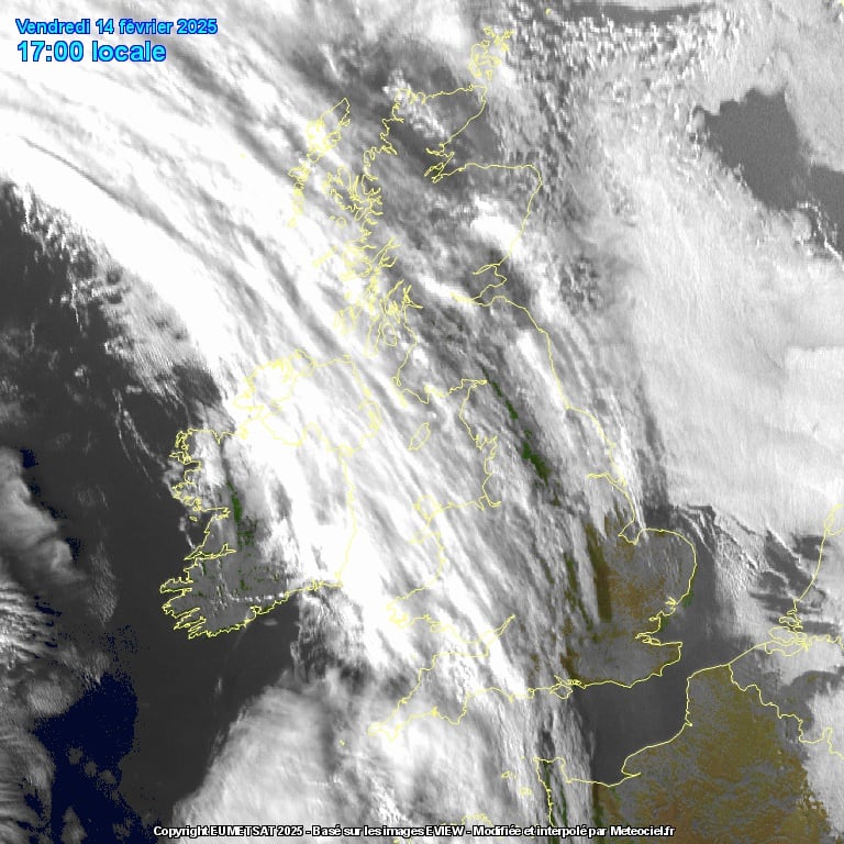
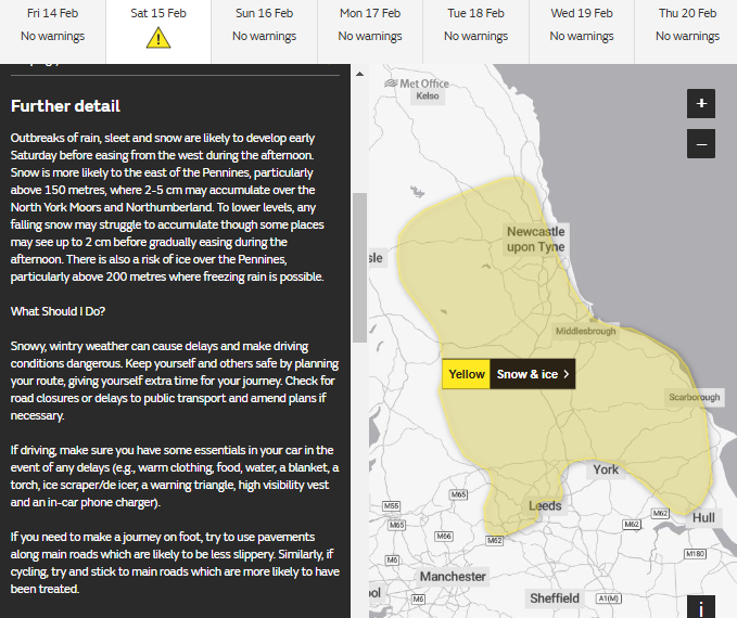
Frontal systems then look to cross much of the UK on Saturday, bringing thicker cloud and some outbreaks of rain for a time, falling as snow or even freezing rain as it crosses over higher ground in the north and bumbs into colder air, particularly Northern England, where it could give a few centimetres in places over the Pennines, but generally not enough to bring any problems away from higher ground.
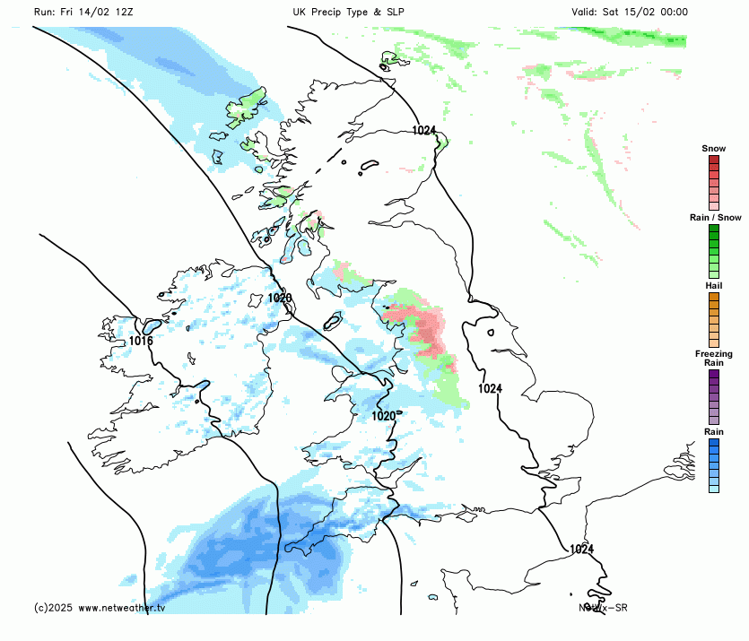
But the Met Office does have a snow and ice warning in force across northern parts of England, generally to the east of the Pennines, between 0600 – 1400 on Saturday. The warning states 2-5cm of snow may accumulate above 150m over the North York Moors and Northumberland.
Southern England will become drier and brighter late afternoon. Remaining on the cold side away from the far west – where milder air will erratically move in.
Weakening fronts become slow-moving across the UK on Sunday – so it’s looking a largely cloudy day with patchy mostly light rain, sleet and hill snow – but not amounting to much. Further rain and hill snow spreading northeast across northern and western areas on Monday, mostly cloudy but drier elsewhere. Brightening up from the south on Tuesday, with any rain and hill snow becoming confined to the far north. Still on the chilly side.
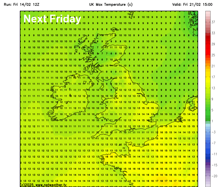
With the flow turning more southerly from the middle of next week, it looks to turn increasingly mild – with temperatures rising into double figures on Wednesday away from Scotland and NE England – which will hang onto chillier southeasterly flow. By Thursday afternoon, most areas of the UK perhaps into double figures, Friday and Saturday could see parts of England reach 14-15C, maybe locally higher, based on current model predictions. This is well above the average high for the second half of February.
So it could turn very mild later next week, with mild conditions perhaps continuing for a while through late February. The highest temperature recorded in February was 6 years ago on 26 February 2019, when 21.2C was recorded at Kew Gardens (London). We probably won’t get as warm as that, but it could be a very mild last 7-8 days of February.
However, the warmest February on record, for England and Wales, was last year. The average temperature in England for February 2024 was 7.5°C, topping the previous record of 7.0°C set in 1990. Wales saw an average mean temperature at 6.9°C for the month, marginally ahead of 1998’s record of 6.8°C.
The UK average temperature is currently 3.7C, -0.4C below the 1991-2020 average, England average temperature is currently 3.9C, -0.8C below the 1991-2020 average. However, it is likely that the rolling average temperature will rise above the long-term average later next week and beyond, based on current model output.
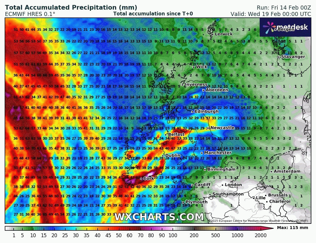
Another thing to note is that has been a dry month so far. England and Scotland have both seen 42% of their average rainfall, while Wales has only seen 18% of the average for February. Parts of the west will be redressed though through next week, potentially seeing a period of high rainfall, as Atlantic fronts become slow-moving across the west – prevented moving east by high pressure to the east and southeast. Eastern areas will likely be much drier though – so here could end up much drier than the February average by month’s end.
Loading recent activity...