This week it’s all about the easterly flow. Or at least an easterly component to that flow, with the surface winds veering from a northeasterly to easterly then southeasterly. It’s not exceptionally cold easterly, not a Beast from the East, not a snow-bringing monster easterly crossing the comparatively warmer North Sea, in a repeat of 2018. And yes, that event was seven years ago.
It’s not mild out there. If you are caught in an icy spell of rain and the east wind it will feel cold. We talk about ‘Rather Cold, Cold and Very Cold' as official categories in winter (there are also 'Normal, Mild and Very Mild' but not for this week). Not 'Cool or Warm' in the winter months and never “warm temperatures”. These are numerical values. It’s been tricky to narrate this easterly setup as many people are looking for news of snow and it is February after all. This is not exceptional cold air from Siberia although there are signs of a pool of much colder air gathering over Russia and eastern Europe by next week.
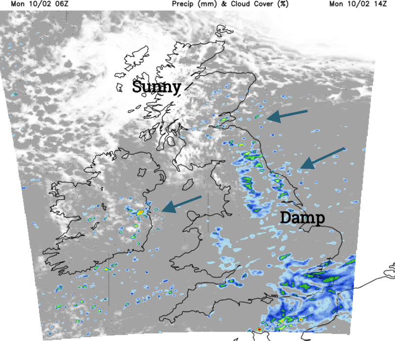
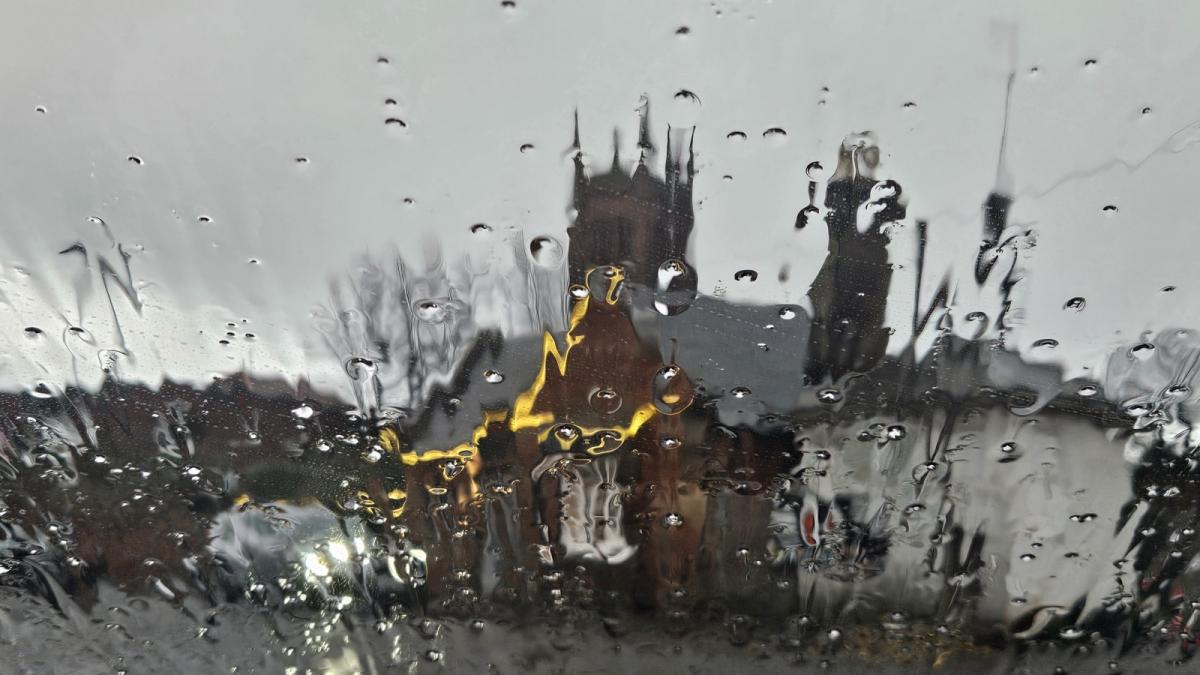
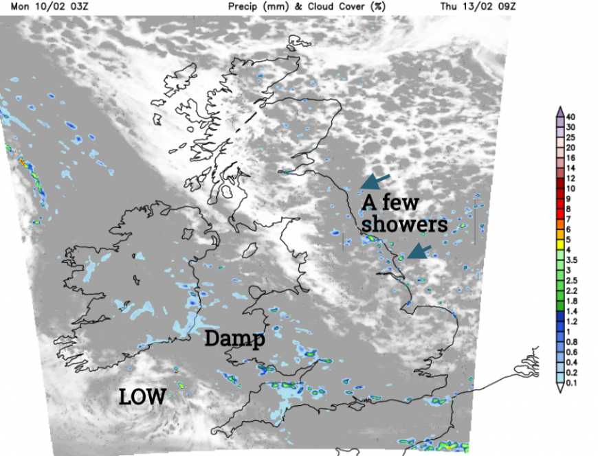
The grey, damp easterly continues if you are in England and Wales, and at times eastern Scotland. The gloomy blanket of cloud feeds in from Europe, bringing murky conditions with rain and drizzle. For eastern Scotland, there are occasional outbreaks of icy rain and sleet that seem more showery in nature. If you are out in the breeze off the North Sea and that wet weather, it will feel cold but it’s not the deepest chill that February could throw at us.
In shelter from this damp flow, there will be brighter skies, even sunshine for western Scotland, and Northern Ireland although Belfast stays grey at only 6C but will feel more like 2C. Across Britain, daytime temperatures will be around 5 to 7C.
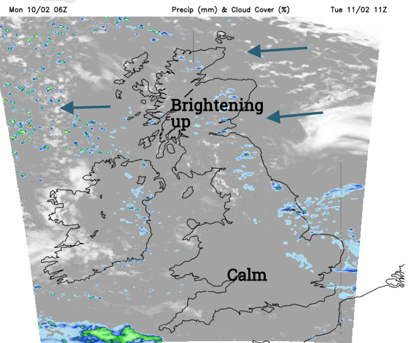
Occasionally over the next few days, the blanket of grey will thin and break allowing welcome brightness and hopeful sunshine. Appearing for northwestern parts of the UK on Monday. Only glimpses for the extremities of western Britain on Tuesday but brighter for mainland Scotland by the afternoon. Wednesday should see more breaks in the cloud cover across Britain but still a grey flow for northeast England, Yorkshire and also over Northern Ireland.
By night, the areas that have seen clear skies or cloud breaks will be the regions with temperatures dipping below freezing. Northern Scotland looks clearer and cold on Tuesday night but there will be a light to moderate easterly wind which will keep the frost away for most. Over the next few nights, inland temperatures will dip to near 2 or 3C.
What about snow?
As this damp weather reaches inland there will be a bit of sleet and snow over the Pennines, Peak District, North Yorkshire Moors and Southern Uplands. Lunchtime outbreaks on Monday will turn wintry as they reach the Welsh mountains but this won’t amount to much. As showery outbreaks continue inland for eastern Scotland tonight and early on Tuesday there will be snow for the Scottish mountains. Not enough to get excited about for those already on half-term holidays. Anywhere that sees precipitation off the North Sea this week could encounter sleety bits or icy rain, maybe the odd flurry of white flakes. As frontal bands graze SW Britain midweek there could also be a slight covering for the Welsh mountain tops.
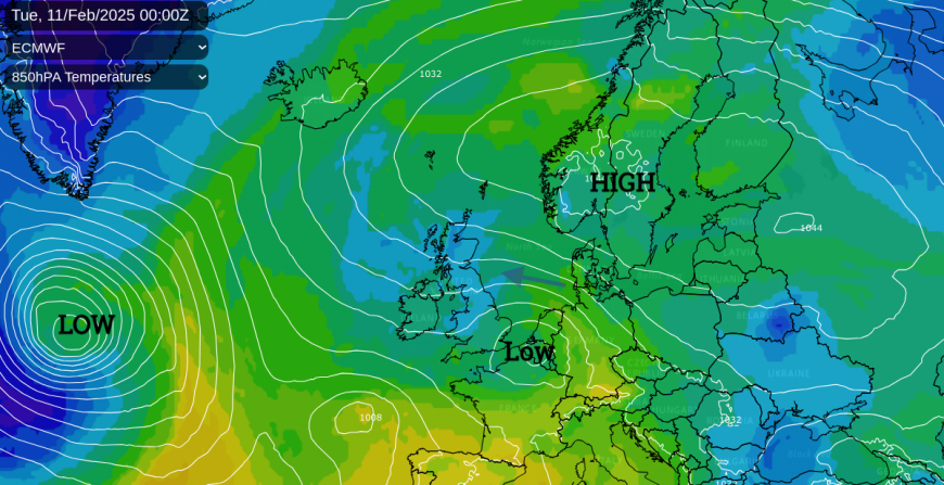
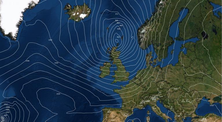
We start the week with high pressure over Scandinavia, the Scandi High, which can direct intense cold from Russia right across Europe. High pressures can get stuck or just move slowly and so attract names like Scandi High, Greenland High or the Azores High. Low pressures have to work around these sedate large shields, nipping to the north or south or getting stopped in their tracks.
A small low over France will move towards the Low Countries and southern North Sea on Tuesday and will throw more damp weather into eastern Britain on Monday night and Tuesday. Another low sidles in from the Atlantic with weather fronts reaching SW Britain and Ireland midweek but this just brings a bit more rain and thicker cloud. Later this week, a larger Atlantic low forms well out west but its progress will be slowed by high pressure to the north of the UK.
The Monday Scandi High slides away towards the Black Sea which allows colder air into NW Russia and Finland. High pressure forms to the east of Greenland and this helps the flow of colder Arctic air into Russia, down to Ukraine, and it sits there through the weekend getting colder.
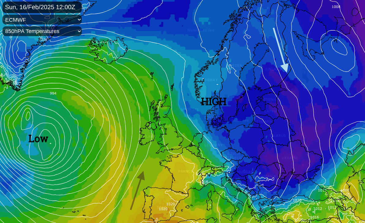
Our current easterly flow doesn’t have an exceptionally cold source. The air has meandered across central Europe with a more southeasterly influence. The pool of much colder air will be forming at the weekend and taking hold over Russia and eastern Europe next week. There is uncertainty for the UK, balanced at the edge of two regimes. A bit far from the reach of this growing Russian cold but still enough blocking to resist, or just slow down, any return of a milder Atlantic flow next week. It’s enough to feed the excitement in the Model Discussion chat in the Netweather forum. For those wanting real-life UK sledge action for the February half-term holidays, sorry there is no snow certainty yet.
Loading recent activity...