A rather quiet, mixed weekend with a good deal of cloud but hope of brighter breaks at times. It's worth looking at the night sky to see a few planets when good breaks appear.
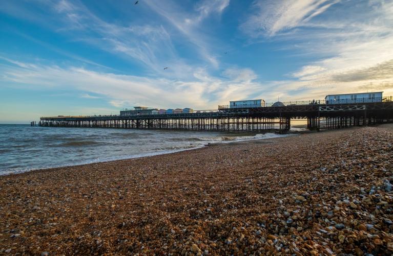
Storm Eowyn was nearly a week ago and there is still debris and broken trees strewn about or being cleared away. The end of this week looks much quieter.
There has been cold Arctic air over the UK for the middle of the week and it has felt chilly at night when skies have been clear. By day there is sunshine until an Atlantic weather front arrives on Thursday night, hitting that cold air with a mixture of rain, sleet and wet snow for high northern hills. Southeastern Britain will still have frontal rain early on Friday morning before it fades away by lunchtime leaving a quiet end to the working week. The weekend weather is rather quiet but there will still be the risk of frost under any cloud breaks.
A bundle of weather fronts will arrive from the west later on Saturday with milder air for the island of Ireland overnight. Daytime temperatures at the weekend will be around 6 to 9C and by night, well down into single figures.
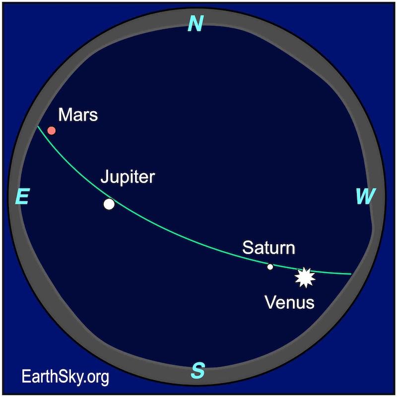 Visible planets for late January from EarthSky.org.
Sky gazing
When the skies are clear we've had four bright visible planets. Brilliant Venus in the SW sky and very easy to spot. Saturn is below Venus (but binoculars will aid in seeing the golden-tinged planet and a telescope for the rings). Jupiter is just about overhead and orange/red-tinged Mars is towards the east but still high in the early evening sky.
Social media has been shrieking about a line of six planets like this was going to be a string of Christmas lights draped across the night sky, but Neptune and Uranus are very faint. The others are obvious and worth a look.
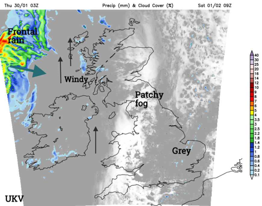
For Thursday night there will be high cloud extending over Scotland, the Irish Sea and Northern Ireland early evening but it should be clear for much of Britain. By Friday evening, a more mixed picture with western Britain and Northern Ireland more likely to have a clear view. At the weekend, there will be a lot of cloud about, perhaps clearing from the northwest by Sunday evening.
Saturday
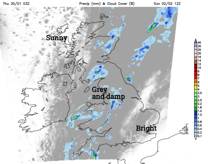
The fading weather front from Thursday night and Friday is reluctant to leave eastern Britain and will continue to bring more cloud here with even damp weather for East Anglia. Western parts will be brighter with sunshine but there will be frost and fog in places to start Saturday.
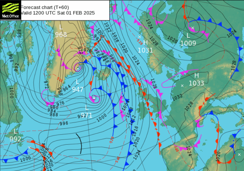
The next set of weather fronts will bring rain from the northwest but with high pressure centred over Poland and Germany these will make slow progress. Much of England will have light winds closer to the high and stay grey with perhaps glimpses of brightness or cloud that will be thick enough to give dampness in the air. For Northern Ireland and western Scotland, there will be a fresh to strong southerly wind with thickening cloud, and a few outbreaks of rain but the main frontal rain and mild air won’t arrive until Saturday evening. So overall a quiet February day.
The frontal band will edge towards western Britain with a sharp wind veer from the south to northwest overnight.
Sunday
The frontal band will fade and fragment as it moves over Britain on Sunday morning. Southeastern Britain should see bright or sunny breaks still with light winds. There will be a large area of cloud and patchy rain from Cornwall up to Shetland which should pivot away from Scotland out over the North Sea by Sunday afternoon. This will allow clear skies for Scotland and Northern Ireland by the evening and another chance to look up for the planets to end the weekend.
Although any rain won’t be heavy or persistent there are still high groundwater levels for southern England and warnings or alerts for high river levels on Thursday from the Environment Agency.
Loading recent activity...