Six ways to observe the current weather conditions and find out if the worst is over. Or is more severe weather to come?
In a named storm, or any severe weather event, it is sometimes hard to pinpoint the right information about how long the most intense conditions will last. Will it get worse still or has the peak passed?
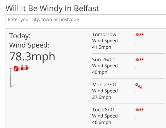
1.The Will it be…? section is a quick way to see what is coming up in the next few days, Will it be snowy, windy (gusts) or wet?
2.Met Office severe weather warnings- The most obvious starting place is the official warnings. They include the area affected and a timeframe. Click on the weather type on the coloured map for further details. However, there can still be impactful weather outside of these areas and just because a red warning ends at 5pm, that doesn’t mean that everything is fine by 5:15. Usually it would change to an Amber warning and there will be a gradual change across the warned area, say south to north or west to east.
Understanding the yellow, amber, red warnings.
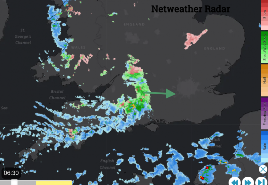
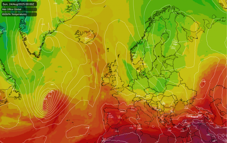
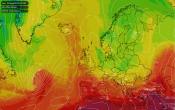
3.Netweather Radar - the radar imagery shows where the current rain or snow is falling. This gives a clear, easy to understand idea of where heavy frontal rain will be or thunderstorms. If you click on the animate button the sequence will run and you can see which way the downpours are heading. Also, turn on Lightning strikes and in Netweather Extra Radar, there are windspeeds, temperatures and model data to overlay.
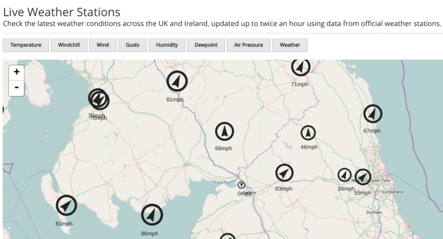
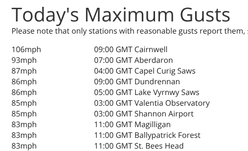
4. Observations- Look at what has been going on with the weather near you in the past hour. The current weather observations can be overlain on Netweather Extra Radar but there are available weather maps with the current observations. From the homepage there is a list of the current top 20 observations or today’s top 20; temperatures max and min, windspeeds, gusts etc found in the LIVE tab. You can also look at the Weather Now section
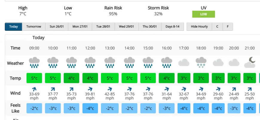
5. This can really help to see if there is more severe weather to come. The seven-day forecast lists the weather, temperatures, winds in hourly segments so you can see if the forecast looks set to worsen or the weather will improve. It is just a snapshot of one location from one model run so it is good to read the Netweather front page articles as well but the icons are a good way of seeing when the peak winds are forecast in a storm.
6.The netweather community - if you are awake listening to howling winds, or it’s just started to snow then the Netweather community forum is full of discussion topics and regional threads where people chat online about extreme weather, world weather and the everyday stuff. If you want to chat about weather or ask a question, it’s available now.
Loading recent activity...


.jpg?w=1200)