High pressure has been centred nearby on the near continent this week and will continue to control the weather as we head into the weekend, bringing mostly dry and settled weather over the weekend.
There will be subtle changes in the flow at the surface though across England as we head into the weekend. Colder and drier air spreading out of the near continent will replace the milder and moister Atlantic air that’s been over the UK this week - as the flow turns southeasterly or easterly. This will bring a drop in temperatures as we head into the weekend, with temperatures reaching 2-5C at best over central, southern and eastern England, 6-9C elsewhere, double figures in the far west. A frost Saturday night where skies clear. Sunday another chilly day, could be more in the way of cloud around too. Also there may be some patchy rain or drizzle moving in across the far west too.
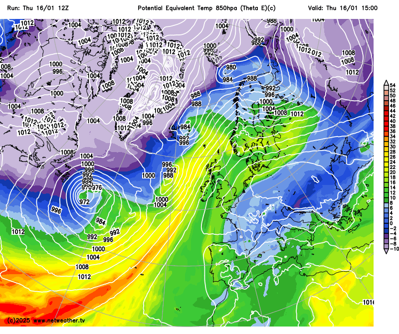 Theta-e animation shows colder and drier air moving out of the near continent into the weekend
So a generally settled and dry weekend thanks to high pressure close by, cold in the south, milder in the north. However, some changes ahead as we head through next week, which will largely be driven by what is going on over the other side of the Atlantic.
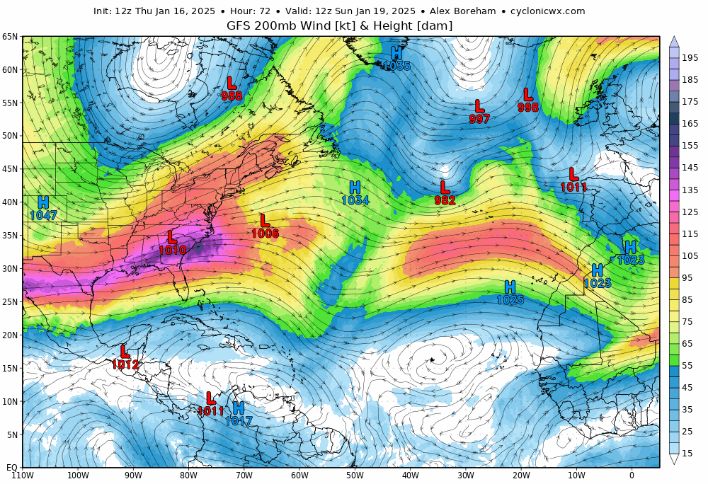
To end this week and through the weekend, a large chunk of the tropospheric polar vortex over the arctic of northern Canada looks to plunge south across Canada and deep down across the central and eastern USA. The -10 850 hPa temperature line of the cold arctic air reaching as far south as Texas and Louisiana in the deep south. This very cold air pushing against warm tropical air advecting northeast towards Florida and the eastern seaboard of the USA will fuel a very strong jet stream coming out of eastern USA and out across the North Atlantic.
 Watch deep cold air spill south from the arctic across N America over the weekend - this will fuel an increasingly strong jet stream over the N Atlantic next week.
The strengthening Atlantic jet streak looks to surge out of the USA across the Atlantic towards NW Europe / NE Atlantic next week. This will gradually erode and ease the grip of blocking high pressure over the near continent on our weather towards the end of next week.
There were hints for a few model runs that high pressure may build over Scandinavia before this transition to more mobile weather occurs, bringing a brief cold easterly flow before Atlantic fronts eventually push in from the west. But this looks unlikely to occur now. But just the hint of an easterly was enough for the clickbait news stories to appear from the usual suspects - with ‘Beast from the East’ headlines.

But the Beast isn’t stirring and coming our way. Instead, as the 12z model runs suggest, the Atlantic lows look to come rolling in from the west later next week, thanks to the strong jet streak moving in from the west. Some of the lows are modelled quite deep, which is realistic given the likely strong jet stream fuelled by the steep temperature contrasts developing over and off the eastern seaboard of North America.
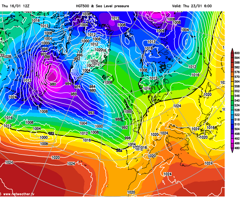 Turning stormy end of next week?
So we could be entering a stormy period, perhaps with one or two named-storms bringing a risk of gales or severe gales along with a return of heavy rain increasing the risk of flooding. There could be cold polar maritime air following in wake of these low pressure systems, which could bring an increased risk of temporary snow over hills in the north.
Loading recent activity...