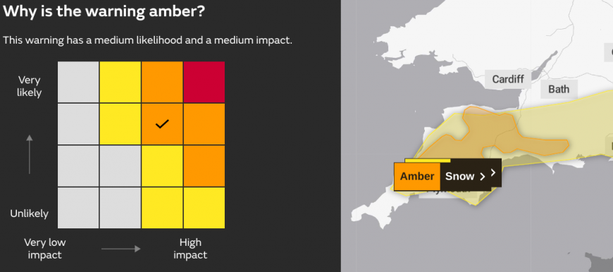
Southwest England has just seen an Amber warning for snow issued by the Met Office in Exeter. This runs until 9pm on Wednesday evening
“A spell of snow will result in travel disruption on Wednesday afternoon and evening.” MO
It joins the Low-impact yellow warning for snow which stretched across southern England, away from the coasts, although the precipitation has mainly been of rain or sleet so far today.
Plenty of people are continuing to watch the Netweather Radar and nowcast looking out of the window, watching for the possibility of snow before a cold and frosty night with a widespread risk of ice.
It’s not just been ice and snow causing issues, there has been a lot of rain in eastern England and the East Midlands in recent days.
My weather station near Nottingham recorded its wettest January day last Sunday since the 21st in 1958. There had been over 10mm the day before resulting in much of Lincolnshire and the East Midlands receiving almost a whole month's average rainfall in just two days.
This, together with snow melt, led to widespread flooding. There was a severe flood warning at Barrow upon Soar, the River Trent was very high and a critical incident was declared by East Midlands Ambulance Service with the flooding a factor in that decision.
Mercifully the water levels are now beginning to fall, with drier weather expected at least until the weekend for eastern Britain, even if there will be cold conditions and plenty of ice.
We still have a couple of Met Office weather warnings for snow and ice over the North and West of Scotland, and Northern Ireland, with Wales into Merseyside included for Thursday. “Snow and icy patches leading to some travel disruption.” MO
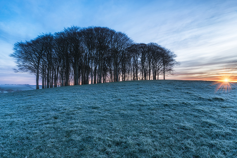
Any untreated surfaces will remain treacherous. Today brings lots of winter sunshine with winds much lighter than recently.
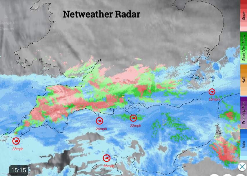
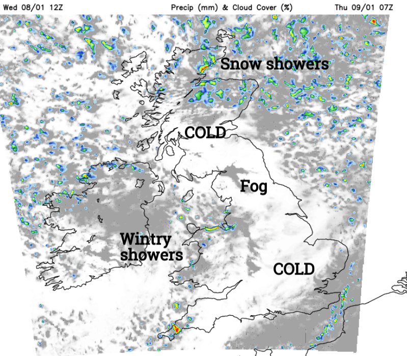
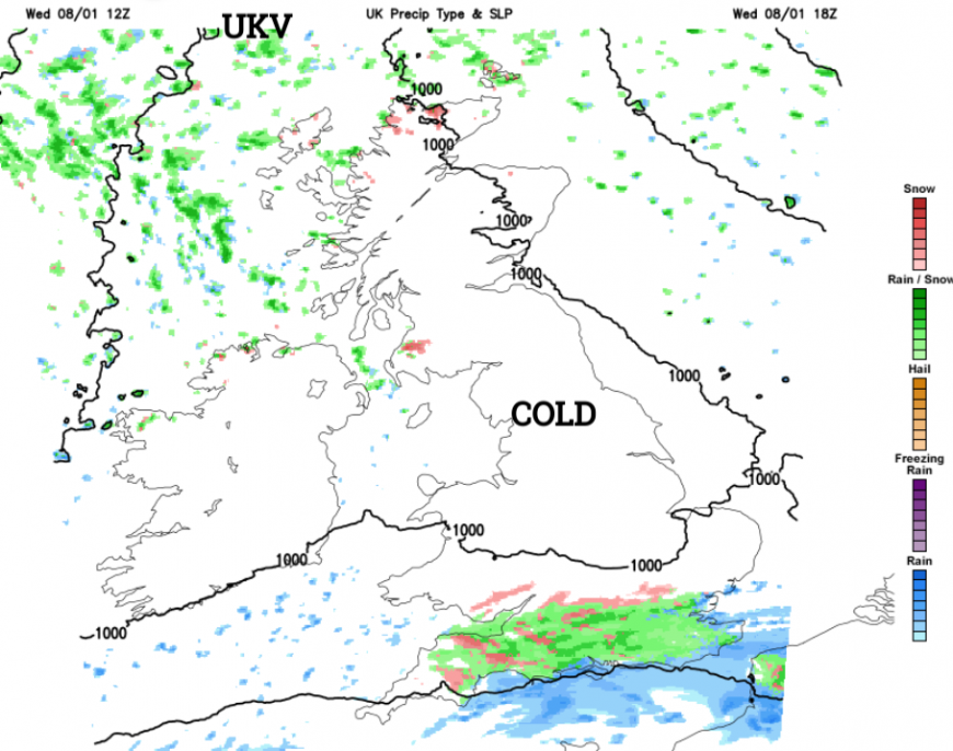
Across southern England and much of the Midlands we have a veil of high cloud, with some rain across the South West and far South, nearing the M4 corridor before dusk. It’s been a mix of rain, sleet and occasional snow. There have even been reports of falling snow on the beach at Brighton, just temporarily. Dartmoor was always looking to be the main focus with probably 5 to 10cms accumulating on the moors of the South West and perhaps the Downs later, but other areas are beginning to see the rain turn to snow late afternoon.
Meanwhile, northern Scotland continues to see sleet and snow showers in a gusty and very raw North West or northerly wind, with a few also affecting parts of Northern Ireland. Needless to say, it'll be cold virtually everywhere despite the sunshine, with temperatures across 'the board' no higher than 1 to 5C.
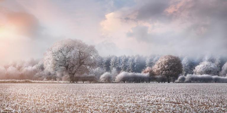
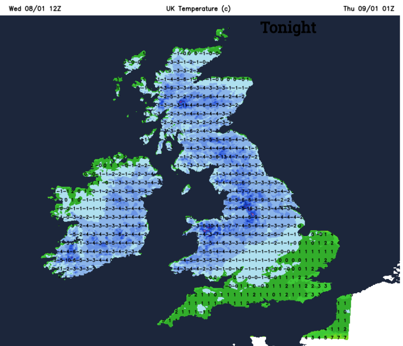
After dark, the North and perhaps parts of eastern Scotland see further snow showers. These may also become more frequent over Northern Ireland for a while, with perhaps North Wales and the Isle of Man seeing a few before morning, Across the South, any rain, sleet or snow should be clearing towards morning. But for the bulk of the country, it'll be a fine night with clear spells in mostly light northerly winds. This'll lead to a widespread moderate or severe frost particularly where you have lying snow. Here and across the North temperatures locally could fall as low as -12 to -15C in the coldest spots, with minima of -3 to -6C expected more generally.
Thursday sees more blustery snow showers over the North and North East of Scotland, but across Northern Ireland, they'll fade as pressure steadily rises and North West wind decreases. Kent and the coasts of East Anglia may also see the odd wintry shower, but for the bulk of the country, it'll be fine with lots of winter sunshine. But it'll stay cold or very cold, with temperatures mostly no higher than 2 to 6C again.

A ridge of high pressure keeps most parts fine and clear after dark, as snow showers fade from North East Scotland. Under largely clear skies and with light winds this'll lead to one of, if not the coldest night of winter. There'll be a widespread moderate or severe frost, with temperatures down to -4 to -8C but as low as -15 to -18C over the snowfields of the North and in a few Scottish glens. A few freezing fog patches may also form. Later in the night, Northern Ireland may see temperatures rising a little, but a freshening South Easterly wind will feel bitterly cold.
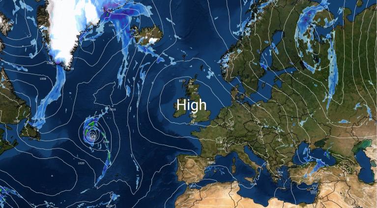
And it'll remain this way at least until the weekend before temperatures slowly rise, as milder air begins to encroach from the South West.
Loading recent activity...