A strong ridge of high pressure over western Europe over the weekend has kept much of Britain dry but increasingly cloudy since Saturday, with a milder and moister flow moving in off the Atlantic behind a warm front moving east on Sunday. The dry, mild, cloudy and rather non-descript weather continues into Monday, as high pressure hangs on close to the south.
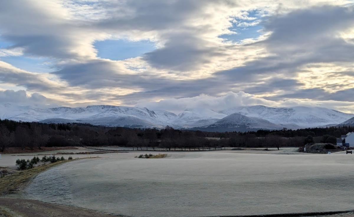
The exception to the generally dry and settled picture over the weekend has been over northern Scotland, where a trailing cold front has brought a fair bit of rain to the western Highlands, where 80-150mm of rain has fallen since early Saturday.
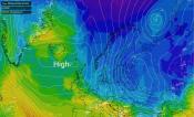
Upper trough (in green) moves across the Atlantic towards NW Europe next few days, spawning lows that will pass near or over the UK this week, bringing spells of rain and strong winds.
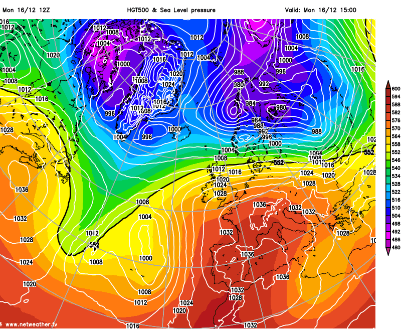
After a mostly dry Monday away from the far north, a gradual change to more unsettled conditions will take place through Tuesday and Wednesday – as an upper trough moving east out eastern Canada yesterday approaches the British Isles by mid-week. The upper trough will induce areas of surface low pressure to develop within it, which will move northeast towards the British Isles during the week, bringing some wet and windy weather.
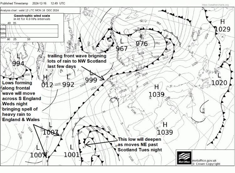
The first of these lows will move northeast past northern Scotland Tuesday night, deepening in the developmental right entrance to a strong jet streak, as it does so. This low will bring gales around northern and western coasts, with gusts of 55-65mph possible up through the Irish and around Atlantic coasts in the northwest. Outbreaks of rain will also affect northern and western areas during Tuesday, then areas further east Tuesday night.
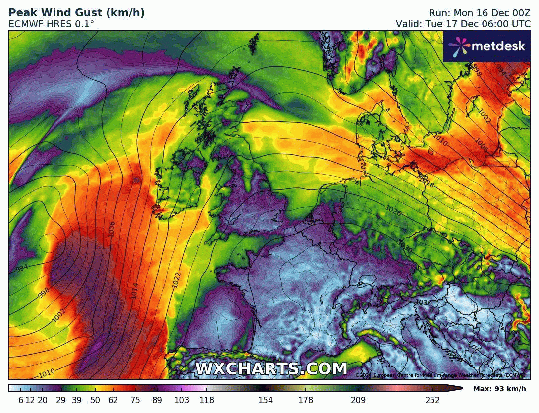
A second low develops along the same trailing frontal boundary across Scotland today, way to the southwest over the Atlantic to the northwest of the Azores later today. This low then tracks northeast on more southerly track. General consensus from model output, now, for the low to track northeast across southern Britain during Wednesday evening, bringing a spell of wet weather across England and Wales during the evening, rain locally heavy and windy through the English Channel too. Before that, very mild on Wednesday despite increasing wind, temperatures perhaps reaching 14-15C across eastern England.
Rain moving across southern areas later on Wednesday
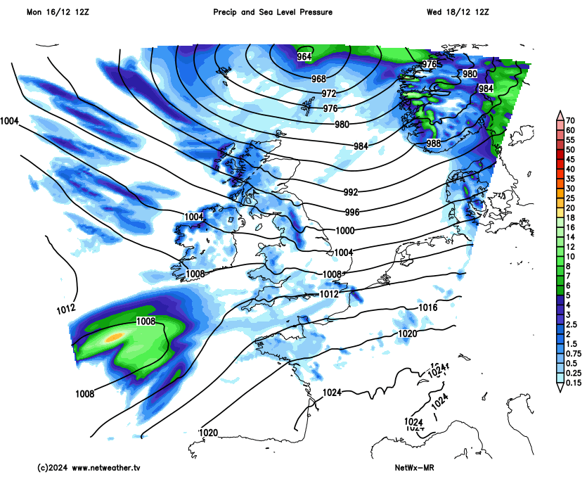
Wednesday night rain clearing to a chilly but brighter, clearer and drier northwesterly flow for a time through Thursday, though showers towards northern and western coasts, wintry in the far north. A transitory ridge of high pressure topples in for Friday, so mostly dry and bright day before a cold front, associated with an area low pressure moving east across Iceland, brings a band of rain in from the west across northern and western areas during the evening. Clearing SE England overnight, but weakened by then.
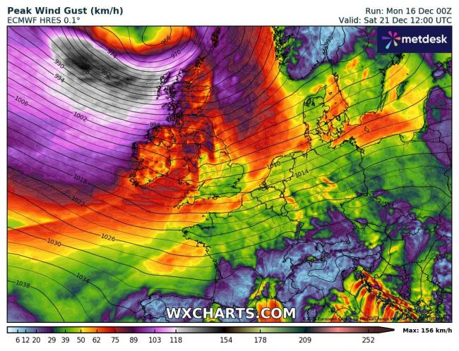
Next weekend is currently looking windy and unsettled, especially further north across the UK. A deep area of low pressure looks to move east to the north of Scotland towards Scandinavia, how far south in track will determine how far south gales and unsettled conditions reach. A band of rain moving southeast on Saturday, followed by a colder and strong westerly veering northwesterly wind, blowing in blustery showers across the north – which may turn increasingly wintry, especially over higher ground, with snow on the hills. South generally drier and brighter. Gales or severe gales possible across the northwest, but uncertainty on this for now, depending on how far south the low tracks at the weekend.
Severe gales for the far northwest at the weekend?
Into the following week, for now, the models are suggesting a generally dry picture but also mild. High pressure system over the Azores this coming weekend looks to drift east across western Europe next week, as we see reshuffle in the upper long wave patterns over North America, the North Atlantic and Europe. The jet stream looks to shift further north than usual next week, this will take areas of low pressure well-away from the UK and Ireland, tracking east / northeast between Scotland and Iceland. However, trailing fronts could bring cloud and rain to Scotland and perhaps N. Ireland at times during next week. However, much of England and Wales are looking dry, mild and settled for now, including Christmas Day, thanks to high pressure in charge. Could be exceptionally mild to the lee of high ground if the foehn effect develops in the southwest flow, perhaps challenging date records.
High pressure over the N Atlantic drifting east across western Europe next week, bringing a dry and mild Christmas
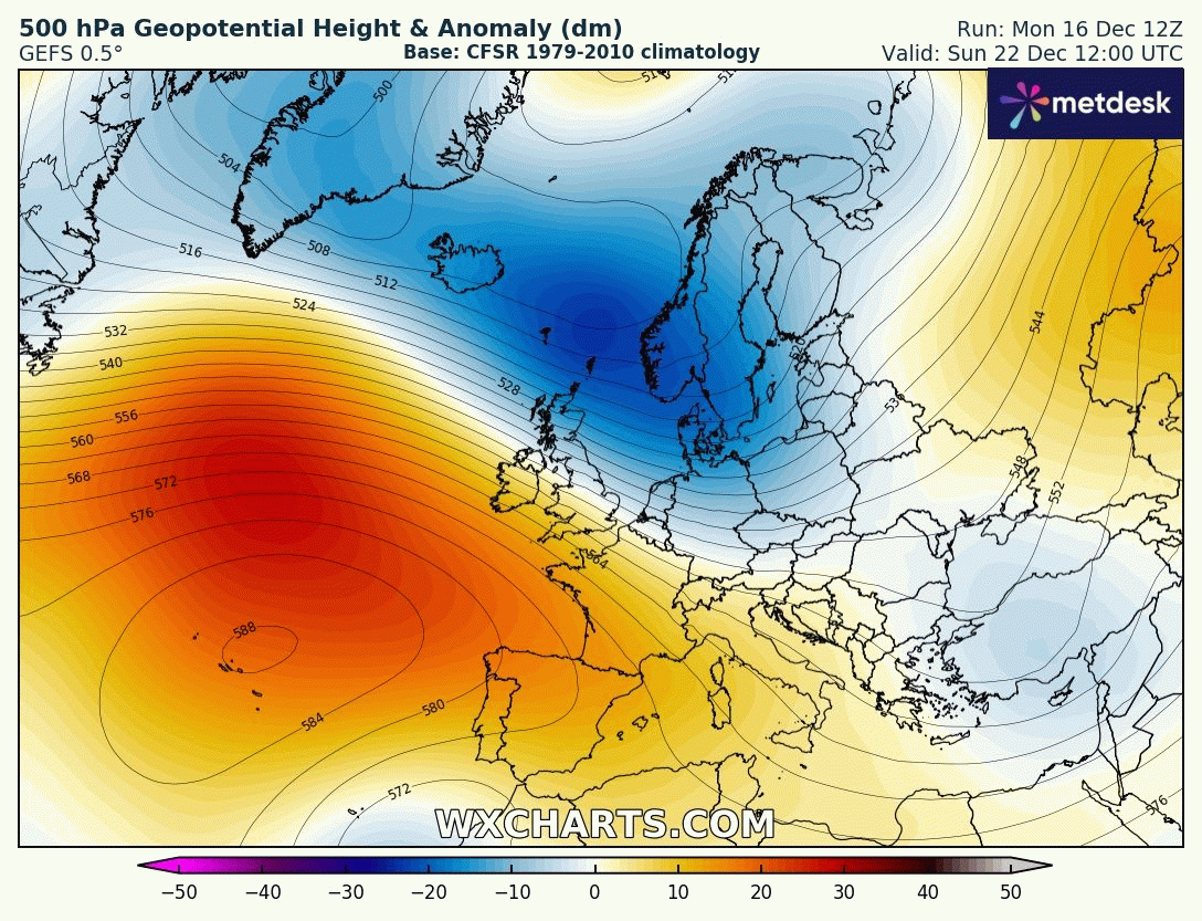
But will it be a cloudy or sunny high and will there be a frost if skies clear? Given the high will be moving in from the Atlantic and the flow will be from the west or southwest bringing in mild air around the top of the high, centred over France, across the British Isles, it is likely most will stay frost-free next week and it could be cloudy at times too with a moist flow off the Atlantic. Sometimes, cold polar air that has moved in prior to high pressure building in can allow overnight frosts to form, but this doesn’t look to the case next week.
Loading recent activity...