As our wintry band heads off into Europe, all of the UK will feel the grip of the Arctic air. Sharp frosts by night, snow showers in the northerly flow but two other lows could add wintry interest to the cold picture
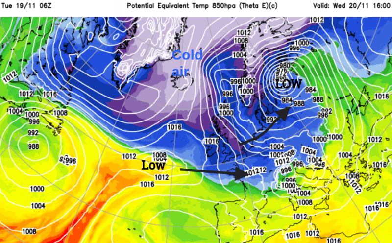
Excitement for some on Tuesday morning. Opening the curtains to a covering of snow. An incoming frontal band hit cold, Arctic air overnight resulting in parts of northern England and the Midlands seeing a covering. Even London managed to see swirling wet snowflakes, briefly. As the low pressure slides away over the Low Countries and Germany, there are rain, snow, ice and wind warnings for mainland Europe. The active cold front is forecast to bring heavy rain over France, snow to the Alps and heavy rain to Croatia. This low is forecast to deepen over the Baltic Sea and Latvia midweek as the very cold air sweeps through the UK. If you are wondering about more snow, keep an eye on the Netweather radar for showers from the north or one of two other low pressures in the neighbourhood this week.
Midweek snow showers
The next few days will see sunshine and clear skies with sharp nighttime frosts. Any snow will come from showers in the N/NW flow. Most of these will clip northern Scotland and the north coast of Northern Ireland. A cluster of wintry showers has been showing on the UKV for a few days, later on Tuesday clipping SE Scotland and NE/E England just into Norfolk by dawn on Wednesday morning and followed by another cluster for the North Yorkshire Moors down to Lincolnshire reaching East Anglia by Wednesday afternoon. There is uncertainty here because, if the wind is backed just a touch, those shower clusters will stay offshore. You might see the cumuliform dramatic cloudscapes from North Sea beaches.
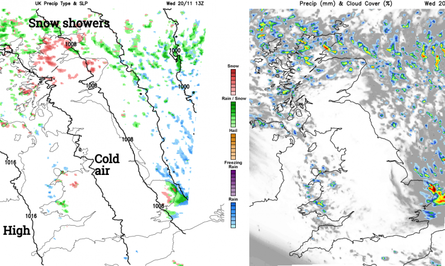
On the other side of Britain, showers from the Irish Sea will turn to snow over the Welsh mountains on Tuesday night and just depending on the winds there could be lines of snow showers into North Wales, even Cheshire from Merseyside. Streams of snow showers can be funneled inland in a narrow line, leading to some areas seeing a good covering of snow whereas a mile down the road sees very little. “The Cheshire Gap” is a famous setup for this in a northwesterly.
Pressure will rise later on Wednesday over Ireland which will subdue any showers for Wales or the few that manage to reach North Devon. The Northern Isles will feel bitterly cold in strong to gale-force winds with rough seas. Aberdeen at -1C with a fresh wind will feel more like -8C as the snow showers continue for Grampian and Highland.
Interrupting low pressures
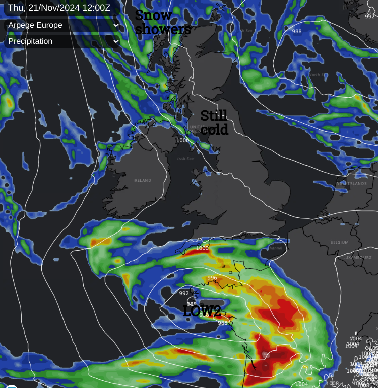
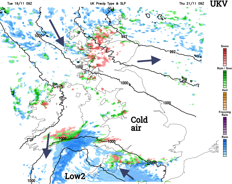
The snow on Monday night and Tuesday morning was from frontal precipitation on an Atlantic low hitting the Arctic air. This kind of setup brings uncertainty about how far north or south the low might run and which regions will see rain or possibly snow. Another low will skirt past SW England on Thursday heading for France which will attract the same low confidence at this stage although the Moors would look most likely for any snow. Also catching the eye is a significant low pressure heading our way for the weekend. This will bring very windy weather but also the risk of snow on the leading edge as it meets that same cold air.
Thursday
The sharp frosts continue but this low will throw more cloud over SW Britain early on Thursday. Met Eireann will be watching this developing low as well as it could bring wintry conditions to SE Ireland. The low looks to dive over France, but could bring rain to SW England and the Channel Islands with a chilly wind. There is a chance of snow for Dartmoor, a small chance for Exmoor, and even the Brecon Beacons. Most likely to be wet and blustery but worth watching if you are travelling on Thursday.
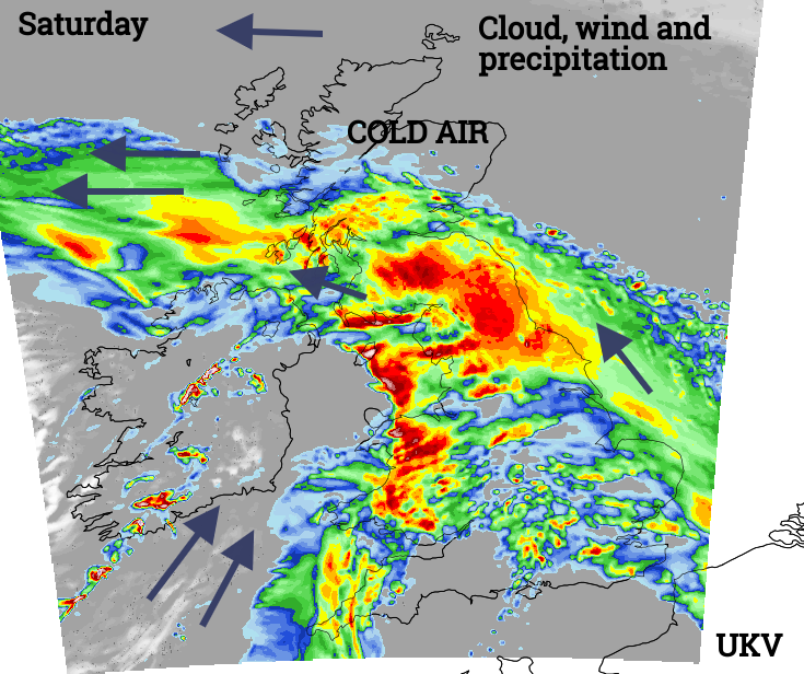
The Weekend
Friday will be another day of sunshine, cold air, light winds and any showers in the far NW fading as pressure begins to rise ahead of the main low pressure. There will be a balance during Friday night of the incoming veil of frontal cloud from the west and clear skies over northeastern Britain. There could be a hard frost with even lower temperatures until the cloud arrives and the wind begins to stir the air.
As the significant low pressure moves in any frontal precipitation will hit that cold air. Snow is likely for any high ground in northern Britain. Currently, the forecast for Saturday is for very windy and wet weather accompanied by heavy rain, possible hill snow and even stormy conditions for exposed areas. If you do see any snow from this it won’t be a Christmas card cheery scene, it will be severe weather with wind chill and poor visibility.
Loading recent activity...