
Two weeks after deadly flash-floods hit the Valencia region, as well as other areas over the following few days, a new DANA (Isolated Depression at High Levels) moves northeast to southwest from France today across the Iberian Peninsula over the next few days and remaining close until at least Friday the 15th.
DANA (upper low) drops SE over Iberia over next few days and will trigger another episode of heavy rainfall with flooding risks:
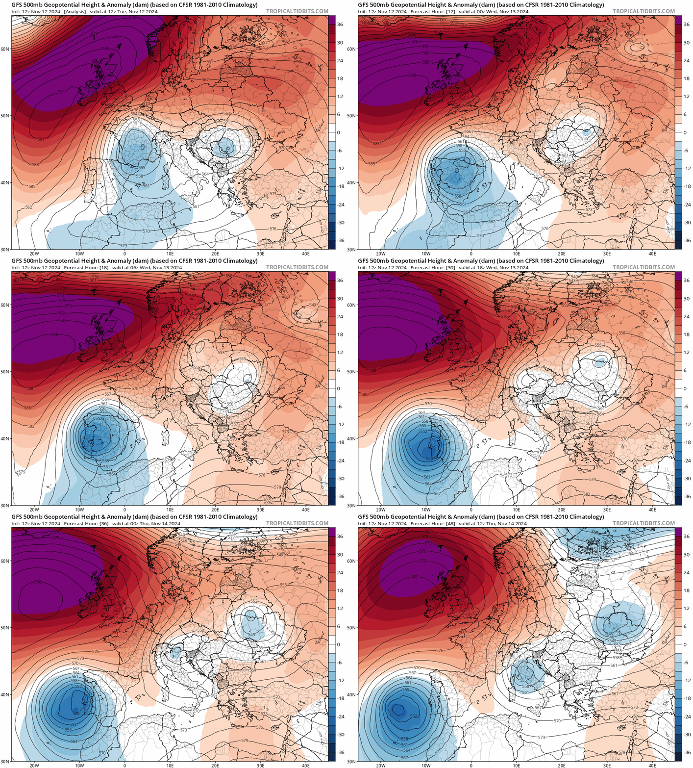
The increase in instability created by the upper cold pool of the DANA atop a humid Mediterranean flow from the east at the surface will support thunderstorms, very heavy and persistent rainfall, locally torrential, over the Balearic Islands, the Mediterranean side of Spain and Andalusia, starting Thursday. Precipitation will probably also affect, although with less intensity, other areas of the central and southwestern peninsula of Iberia and Cantabrian area in the north - where snow will fall over the mountains.
Cold air aloft and warm air off a warm western Mediterranean will fuel more episodes of intense rainfall along coastal areas in the east and south of Spain next few days
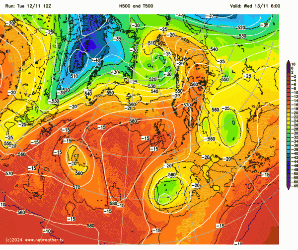
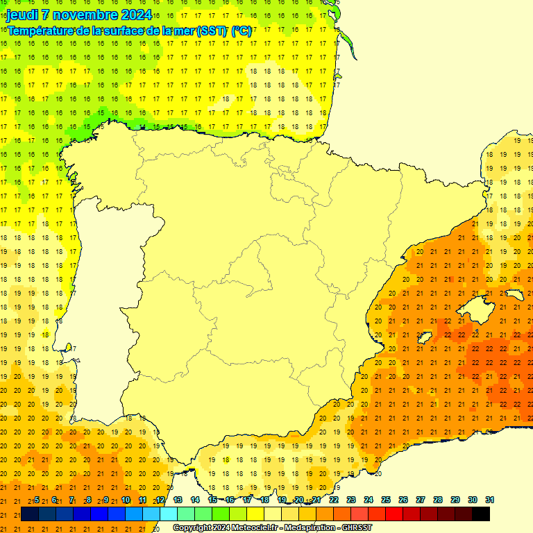
There is still uncertainty regarding the position of the DANA andeventually weakening of the system, and thus the distribution and amount of precipitation.
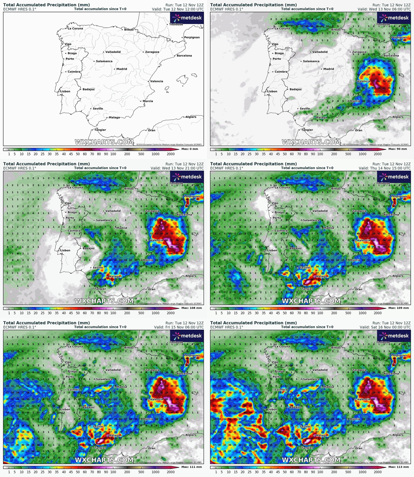
Rain over the Mediterranean areas of Spain will intensify this evening and overnight, with
rain and storms already affecting the Balearic archipelago - where rain is likely to be locally torrential and persistent, extending until Wednesday morning, with accumulations of up to 150 mm/24 h. Heavy showers and thunderstorms will also intensify over other parts of the Mediterranean coast, between Barcelona and Almeria, being more likely on the northern coast of Castellon, southern coast of Tarragona and areas close to the Murcia coast, as well as on the southern coasts of Valencia and from the north of Alicante, where locally intense rainfall is possible. Flash-flooding is likely as a result of the intense rainfall falling in a short space of time.
Spanish radar 9am Wednesday morning from AEMET
Lightning around Iberia this morning
In the Cantabrian Sea and the north of the Pyrenees, heavy rainfall is likely, including snow in mountain areas, with the snow-line dropping to around 1000 m. In addition, very strong winds with gales at higher levels of the mountains of northern Spain, along with gales through the Ebro valley and towards coast.
Further storms and heavy rain is expected on Wednesday, locally torrential and persistent, in several areas of the Mediterranean coastal areas of Spain, mainly Malaga, north of Alicante, south of Valencia, north of Castellon and south of Tarragona; and from the afternoon also on the northern coast of Valencia. In these areas accumulations of around 150 mm/24 h are possible, which will again lead to a risk of flash-flooding. In the rest of the Mediterranean area, around 80 mm/24 h.
AEMET warnings for Wednesday - Red warning for Malaga / Costa Del Sol and Tarragona, amber warnings for Valencia and Balearic islands
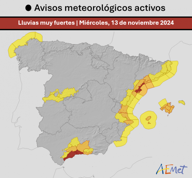
Further significant falls of snow are expected over central and northern mountainous areas of Spain, although the levels will gradually rise, restricting snowfall to high areas. Very strong gusts of wind will continue on the Mediterranean coast and across Galicia in the north, as well as in high altitudes of mountain areas in the north and central Spain.
More uncertainty for Thursday, but the most likely scenario is for the DANA to be situated across the southwest of the Iberian Peninsula, which would extend the instability towards western Andalusia. The heaviest rainfall is expected again on the coast of Valencia and Malaga, with amounts around 100-150 mm and also on the coasts of western Andalusia and around the Strait, with accumulations around 80-100 mm. Lower intensities of rain are expected in other areas of the Mediterranean area and the center and southwest of the Iberain Peninsula. Temperatures will recover, becoming locally notable on Thursday.
On Friday rainfall will continue over Mediterranean areas of Spain, but less intense and more dispersed. The greatest probability of rain across the southwestern parts of Spain, mainly to the coasts of western Andalusia and also southern Portugal - where showers may be locally heavy. By Saturday, the DANA looks to move further west out over the Atlantic, so there will be a further decrease of the probability and intensity of rainfall, bringing an end to this new DANA episode.
Loading recent activity...