A deep area of low pressure passing to the north of Ireland on Sunday afternoon, then northeast over northern Scotland Sunday evening has been named Storm Ashley by the Irish Met Service - Met Eireann - as it will bring strong southerly winds with band of rain moving northeast from tonight and Sunday morning across Ireland and northern Britain followed by a second swathe of even stronger southwesterly winds to the north and west of the island of Ireland during Sunday, before the very strong winds transfer across Scotland in the afternoon and evening. The strong winds coupled with high spring tides will bring the risk of impacts from wind and coastal flooding to the northwest of Britain on Sunday.
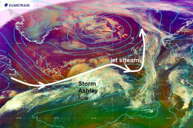
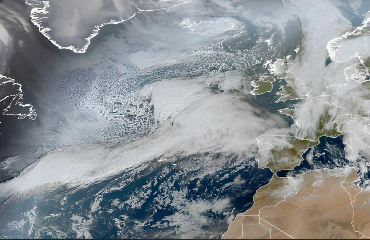
A fairly innocuous looking area of low pressure over the mid-North Atlantic this morning, to the north of the Azores, will undergo rapid deepening later today, as the low moves on to the polar side of a powerful 200 mph+ jet stream and into the developmental left exit region of the jet streak. This exit area of the jet stream is where very strong winds aloft fan out and cause divergence of the air aloft, creating a void which has to be filled by air rising up from below. This in turn causes air convergence at the surface and so lowers pressure at the surface, helping areas of low pressure deepen explosively.
Storm Ashley low will move onto the polar side and into the left exit of the jet stream where will undergo rapid deepening
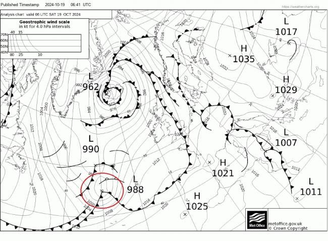
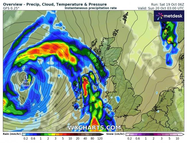
Fortunately, Storm Ashley looks to be in its deepest most intense phase to the west of Ireland tonight, with central pressure falling as low as 944 hPa. The low will then fill as tracks towards the British Isles, as it moves away from the developmental left exit of the jet stream, but will still be a powerful cyclone. At 6am this morning, the low had a central pressure around 988 hPa, that's a fall of 44 hPa in less than 24 hours. A lot of media are referring to Storm Ashley as being a 'Weather Bomb' A 'weather bomb' is an unofficial term for a low pressure system whose central pressure falls 24 millibars in 24 hours in a process known as explosive cyclogenesis or rapid cyclongenesis (RACY). Storm Ashley certainly fits the 'Weather Bomb' or RACY bill.
Deepest phase tonight west of Ireland before it fills on approach to Ireland and Britain, but still a powerful storm
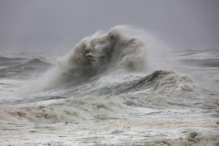
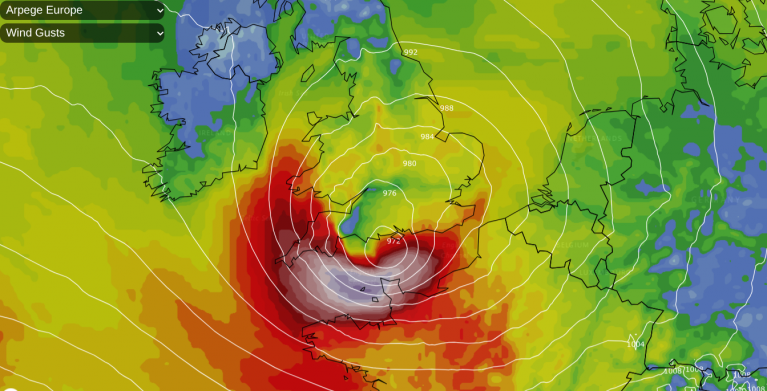
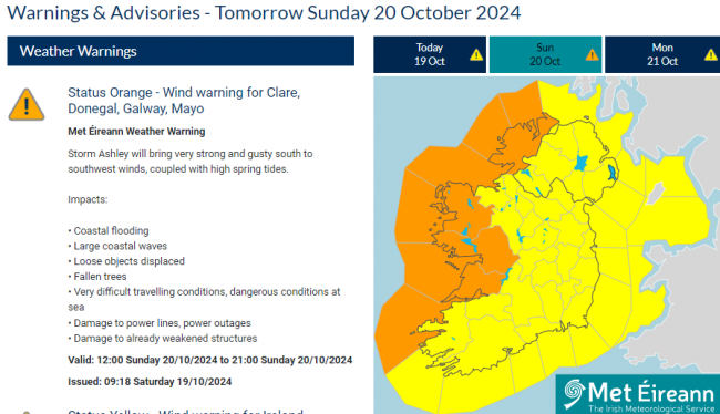
As the centre of Storm Ashley passes close enough to the north of Ireland Sunday afternoon, across the north and west of Ireland, winds could gust to 60-70mph widely inland on Sunday, perhaps gusting to 70-80mph towards northern and western coasts of Ireland, but may be up to 90mph in very exposed coastal locations. Met Eireann Status Orange wind warnings have been issued for Clare, Donegal, Galway, Mayo. The very strong winds coupled with high spring tides will bring Coastal flooding, large coastal waves, loose objects displaced, fallen trees, very difficult travelling conditions, dangerous conditions at sea, damage to power lines, power outages and damage to already weakened structures.
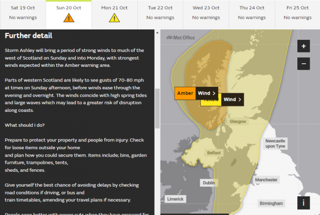
Following a band of heavy rain and strong, gusty southerly winds, with gales in the north, sweeping east across the UK Sunday morning, Storm Ashley deep low centre will then continue northeast and cross northern Scotland on Sunday evening, packing very strong southwesterly to westerly winds across Scotland, especially across the west, reaching 60-70mph widely inland here, perhaps 70-80mph over western coasts and hills. These strong winds coupled with high spring tides could bring coastal flooding and large coastal waves, with dangerous conditions at sea. Some disruption to power supplies, fallen trees and some structural damage is also possible. Disruption on ferry services is very likely, rail services and flights may also be impacted across western Scotland.
A Met Office Amber Warning for wind is in force for parts of western Scotland, including the Western Isles, for the likelihood of gusts of 70-80mph for a time Sunday afternoon. A Yellow Warning for wind is in force for all of Scotland, Cumbria, north Wales and N. Ireland for gusts of 60-70mph over exposed coasts and hills on Sunday.
Further south across England and Wales away from the weather warnings, it will be a windy day, with a spell of heavy rain moving northeast through the morning, clearing the far southeast early afternoon. Gusts of up to 40mph inland, peharps 50mph along coasts, but generally not too disruptive, though high tides could bring coastal flooding.
Storm Ashley will pull away northeast from northern Scotland Sunday night, but remaining windy across the north on Monday, with blustery showers towards the west, drier and sunnier towards the east. Winds easing with fewer showers in the west on Tuesday, with some decent sunny spells. Mid-week looking dry and sunny with high pressure building in, before more rain returns from the west later on Thursday and into Friday.
Loading recent activity...