Why is it so cold, don't worry change is on the way for the weekend. Under the clear skies tonight you might see the Aurora.
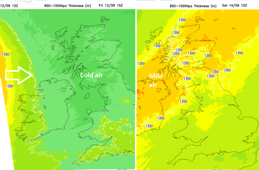
“ Why is it so cold?” The answer is an airflow from the Arctic, heading in from the northwest. Change is on the way, ready for the weekend but you’ll have to wait until after a colder Thursday night.
The airflow will shift away from the chilly NW to a milder southwesterly with temperatures up to 21C (70F) by day during the weekend. So there is hope in the forecast if you are not ready for proper Autumn weather to set in just yet.
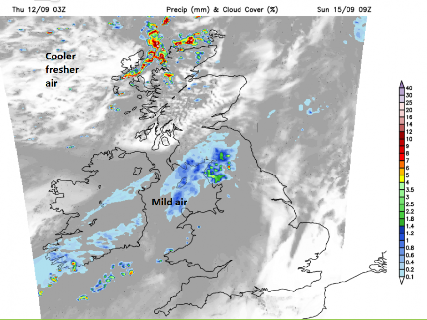
There have been heavy showers set off in the unstable air. The cold Arctic air moves over relatively warmer seas around the British Isles or over the land, as the September sunshine warms the ground. Air at the surface is warmed, and up it goes. Cumulus clouds form them cumulonimbus and the skies darken. The downpours start with rumbles of thunder and lightning. Many areas missed the showers but England saw the thundery showers on Thursday.
Pressure is rising out to the west and as an Atlantic area of high pressure edges over Britain tonight, it will subdue this shower activity. The winds will drop out with clear skies and the temperatures will fall away.

Under the clear skies, there is a chance of seeing the Aurora tonight. It’s more likely for Scotland, perhaps Northern Ireland and northern England but with the lack of cloud, it might be worth a look even if you have to wrap up warm.
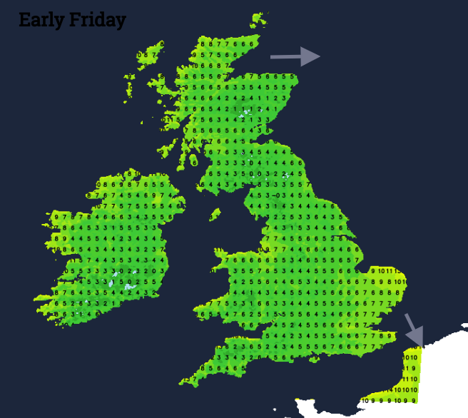
Many inland areas will be down into single figures with rural spots at risk of a grass frost, even an air frost.
Friday
Friday looks fine and dry with plenty of sunshine. There will be a few showers coming into western Scotland as the S/SW breeze picks up, High pressure will be over the UK but the air won’t have warmed up yet, so the top temperatures will be widely in the mid-teens. A warm front will approach the Western Isles on Friday evening with a strengthening southerly wind.
The Inshore Waters outlook for The Minch mentions “South or southwest 6 to gale 8, occasionally severe gale 9 later” ready for Saturday morning.
The frontal rain will reach northwestern fringes of the UK during Friday night, brushing Aberdeenshire on its way eastwards. Scotland and Northern Ireland will have a much milder night but England and Wales will see temperatures dip down into single figures again with hardly any breeze. There could be a touch of frost on the grass for SE Britain and some mist.
The weekend
A low pressure will pass south of Iceland throwing its fronts over Scotland and Northern Ireland with strong winds in the far northwest. Further south in Britain, the high pressure holds on and it will be fine, dry and calm. It will feel warmer with sunny spells with temperatures in the high teens. The air will feel different too, no longer from the Arctic.
The cold front becomes a waving front, a boundary across the UK with rain reaching northwest England on Sunday morning. East of the Pennines could feel warmer in any sunny breaks with a westerly wind. London could reach 21 or 22C depending on the cloud cover. Overall, another fair day for many, just damp and grey around the Irish Sea and the fading front.
Loading recent activity...