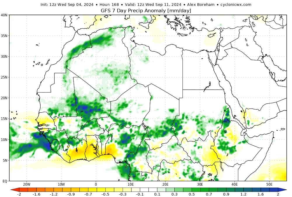
Some parts of the Sahara, one of the driest areas in the world, where rain is practically unheard of at this time of year, could see five times the average September rainfall. A few areas could experience rain for the first time on record in September.
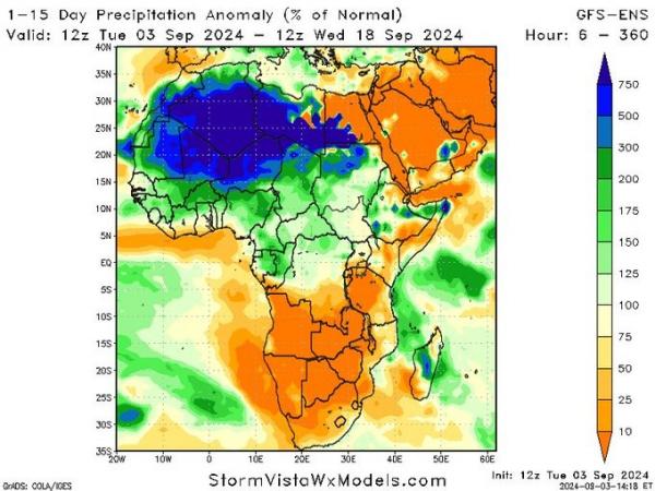
Computer models show the potential for record amounts of rains in the ordinarily parched desert, which averages a scant 3 inches of rain per year, though half the Sahara receives less than an inch of rain annually. The average yearly rainfall for London is 23.4 inches.
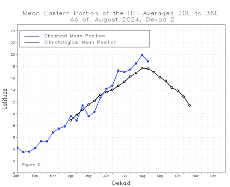
The Sahara desert experiences these rainfall events less than once per decade on average, but they are usually a sign of an unsual state in the atmosphere. This unusual rainfall event is driven by the Intertropical Convergence Zone (ITCZ) moving further north than usual. The ITCZ is an area around the equator where the trade winds from the northern and southern hemispheres meet, causing warm and humid tropical air to rise to form rain, showers or storms.
The ITCZ belt of cloud and rain largely follows the seasonal movement of the Sun, reaching its northernmost position in July-September, which normally reaches the sub-Saharan countries of West Africa. But this September the ITCZ looks to move further north over the Sahara region from its usual position in early autumn.
This graphic shows the 10-day average latitudinal position of the Africa Inter-Tropical Front (ITF) (formerly called the Inter-Tropical Convergence Zone (ITCZ)) - the position of the ITF is further north than normal
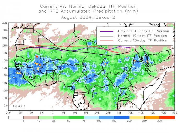
The Sahara is normally under the subtropical ridge, which is a permanent high-pressure system - where air descends from higher up in the atmosphere and makes the atmosphere at the surface dry and stable, these conditions prevent cloud formation and precipitation, explaining the general lack of rainfall in Sahara.
The reasons for the unusual shift north of the ITCZ / ITF are not fully understood yet, but the record warm North Atlantic SSTs between west Africa and USA along with record warm Mediterranean Sea SSTs could be changing surface pressure patterns, i.e. encouraging lower surface pressure, over N Africa which are encouraging the ITF to shift further north than normal and also providing an increase in moisture (warmer oceans warming the air lead to the air holding more moisture).
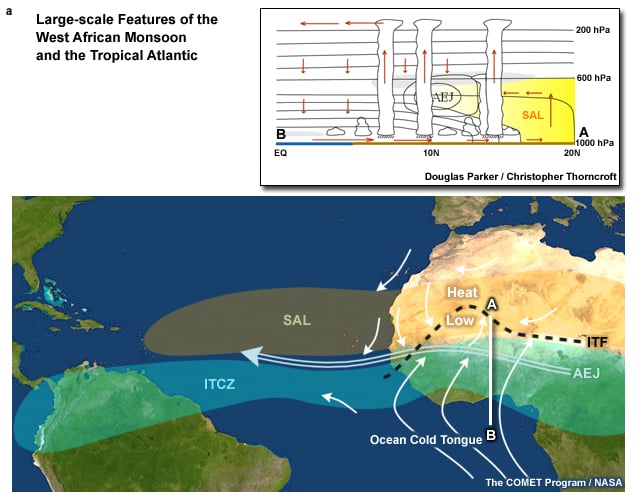
The shift of the ITCZ/IF further north than normal over sub-Saharan / Saharan west Africa could also be affecting the North Atlantic Hurricane season.
In June, three storms formed, including Hurricane Beryl - which became a Category 5 hurricane and the earliest-forming storm of such intensity in Atlantic history.
But in July, the basin went quiet due to increased levels of dry Saharan air spilling out over the sub-tropical North Atlantic. In August, hurricanes Debby (Cat. 1) and Ernesto (Cat. 2) formed, each impacting the United States. By then it was thought the hurricane season would ramp up, as the peak of hurricane season usually occurs between mid-August and late October, when the waters in the equatorial Atlantic and Gulf of Mexico have warmed enough to help support the development of tropical waves.
But after Ernesto dissipated on August 20th, no tropical systems have formed since, with tropical waves that have come off of Africa largely failing to develop.
One of the reasons that has been explained for this unusually quiet stretch is the ITCZ / ITF monsoon trough which has been displaced further north than usual, meaning tropical waves are emerging further to the north from Mauritania westward, rather than further south tp the south of Senegal to around Guinea area. When this happens, they encounter an environment of cooler waters further north over the North Atlantic and also drier air.
The other reason that has been explained is the warming of the upper troposphere over the main development region for Atlantic hurricanes. With a warmer upper-level conditions, there is a cap on thunderstorm development and increased stability. Parcels of air need cooler upper-level temperatures to rise and form thunderstorms which then go on to organise into tropical depressions, storms and perhaps hurricanes. If the air is too warm, then thunderstorms will struggle to develop.
More on the two reasons for quiet hurricane season since mid-August can be found in this discussion from Colorado State University:
https://tropical.colostate.edu/Forecast/2024_0903_seasondiscussion.pdf
Loading recent activity...