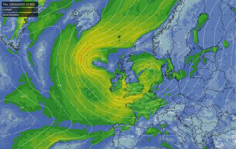
The Atlantic will throw rain and wind our way over the next few days. Western Britain especially western Scotland will see heavy rain and the Irish Sea looks to be the focus for gale-force winds. Southern and eastern Britain will escape most of the unsettled weather as southeastern England sees temperatures of 20 to 23 Celsius. Warm air will be drawn up, ahead of the various low pressures on a southerly flow and there is tropical warmth and moisture wrapped up in the system arriving today which includes the remnants of Hurricane Ernesto.
Rain
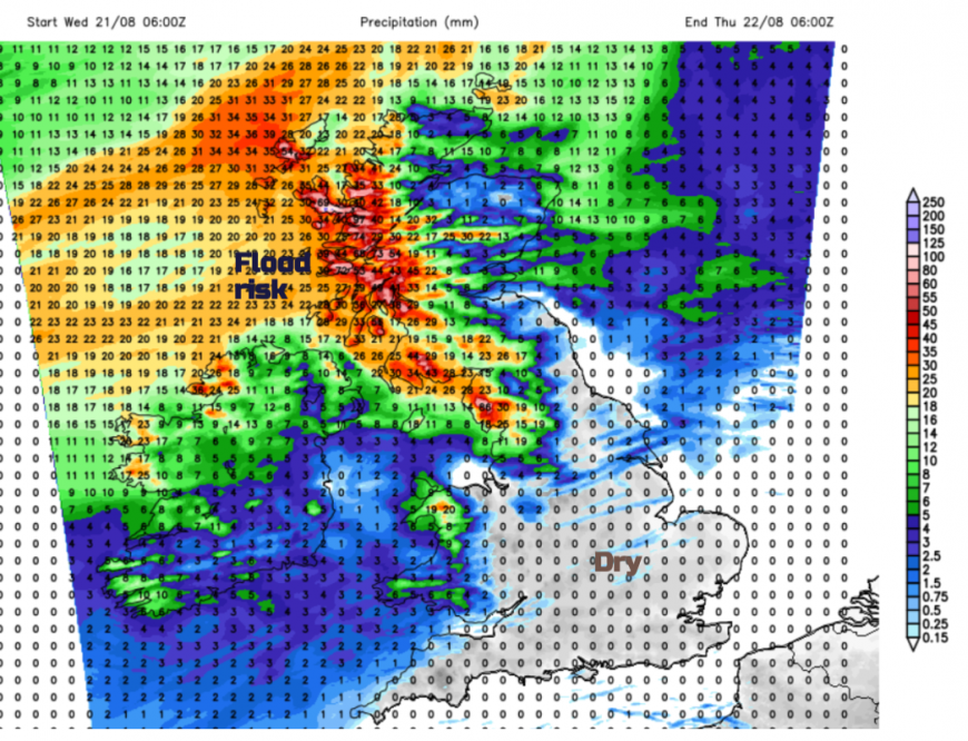
The Met Office has a rain warning until Thursday morning for "A period of heavy rain and strong winds could lead to impacts from flooding" across nearly the western half of Scotland.
Significant disruption looks possible due to the ongoing heavy rainfall which will make conditions on the roads difficult and is likely to impact rail journeys. But there is also an extra push of water from the sea. There are 'extra high' tides with the Supermoon, a surge of water from the Atlantic low and onshore strong winds with large waves as well.
A series of frontal bands will move towards northwestern parts of the UK on Wednesday and Wednesday night. Heavier rain will reach Cumbria and Gwynedd before dawn with a wet and windy start for Thursday over Scotland, Cumbria and Lancashire and western Wales, all exposed to the SW'ly flow. Gradually a cold front will begin to head eastwards and allow clearer conditions from the west.
The second spell of wet weather will approach from the southwest later on Thursday. Rain will set in over Ireland reaching across from Dublin into Wales and Merseyside later on Thursday evening. The rain continues to feed over the Irish Sea into northern England and the southern half of Scotland. It will be wet for Northern Ireland, Wales and around the BRsitol Channel as heavy pulses of rain spread over central Britain. The whole lot edges further north in Scotland before curling around the low centre over the Irish Sea which could cause problems with torrential rain and gale-force winds early on Friday.
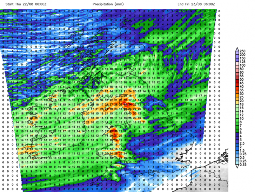
The current UKV model shows intense rain for the Friday morning rush hour from the Isle of Man hearing along the border of Scotland and England.
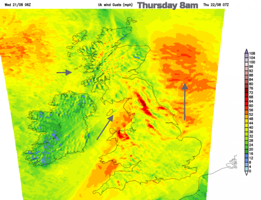
Wind
Scotland, Northern Ireland and Irish Sea coasts will have a blustery afternoon as the south to southwesterly winds freshen. For the West Highlands and Islands, the winds will strengthen, with gales forecast for coastal areas with rough to very rough seas mentioned For The Minch. Ferries journeys are already being affected.
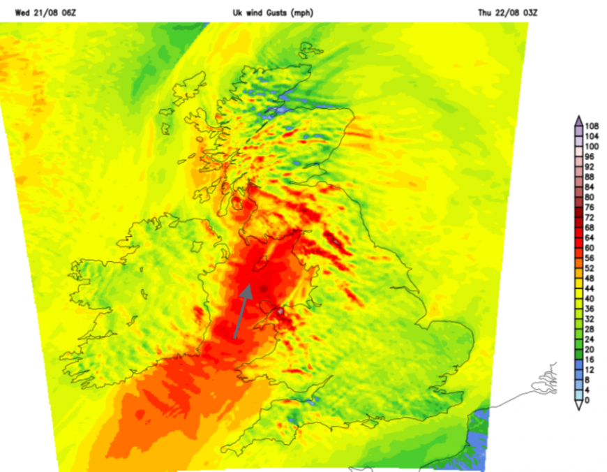
Tonight it will be the Irish Sea seeing the strongest winds with southerly gales, even severe gales mentioned in the Inshore Waters forecast close to Anglesey and the Isle of Man. There will be wider gusts over 60mph for exposed coasts and over the high ground of Wales, northern England and Scotland. The windy weather continues into Thursday morning with gusty winds to watch out for over high-level routes. As the cold front clears, the winds veer to a fresher westerly with brighter skies for Thursday afternoon.
In the small hours of Friday, S/SW winds will strengthen off the Welsh coast as the next low pressure nips in. There will be a windy start for many people on Friday in Wales and England but it is the low centre over the Irish Sea which is being watched. A curl of gales even severe gales with gusts over 75mph is showing on the UKV for Friday morning which could impact North Wales and/or northwest England. This is something to watch.
Loading recent activity...