Stunning sunrise and sunsets have been seen to start the week before heavy rain set in for western shores. The remnants of Hurricane Ernesto will give extra energy to torrential rain later this week.
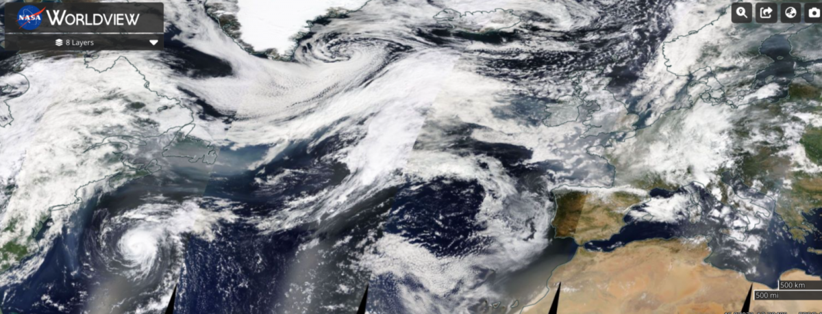
Smoke from wildfires in North America has made its way across the north Atlantic and given parts of the UK views of stunning sunsets and sunrise. It’s making the sky seem hazy, almost milky in places, where it's not raining.
There is also a full moon this evening. A rising moon can appear red or orange as it appears low in the sky, but that may be enhanced with these extra particles in the atmosphere for the start of the week.

Beautiful sunset 18/08/24 West Midlands community group in the Netweather Forum
The main wildfires are in western Canada for British Columbia and Alberta but there has been one plume of smoke out of northern Quebec and another caught around Hurricane Ernesto which hit Bermuda on Saturday. Wildfire smoke has managed to move out of eastern Canada and travel right across the Atlantic
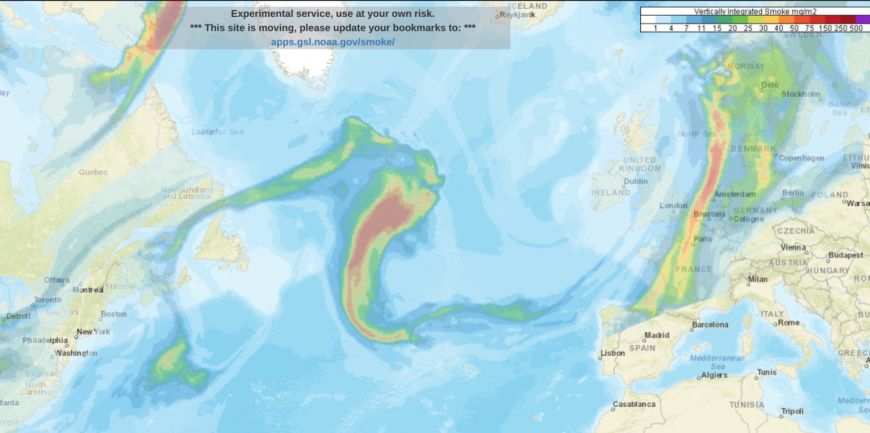
The Canadian government have warning systems in place, not only for the fires but also the smoke impacts and poor air quality. They monitor hotspots, heat sources across the huge land mass. These can be vegetation fires from forest, grass, cropland, or logging debris and maybe one large fire or a collection. The UK air quality forecast and air pollution alert system is very low key.
So if you notice a reddish/orange tinge around the sun that is the cause, North American wildfires. And the full moon rises 8:32pm London, 9pm Edinburgh in the east/SE sky later today. However, rain is on the way.
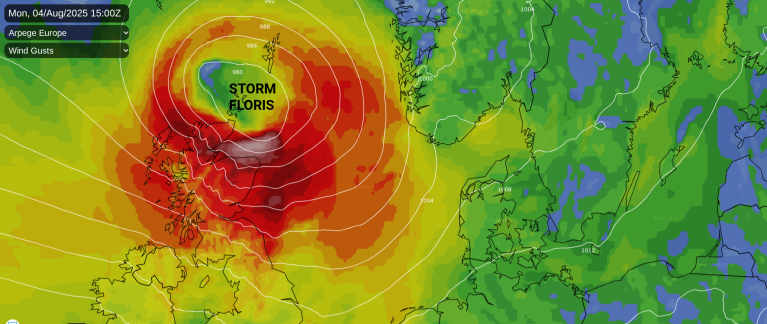
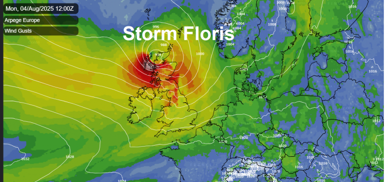
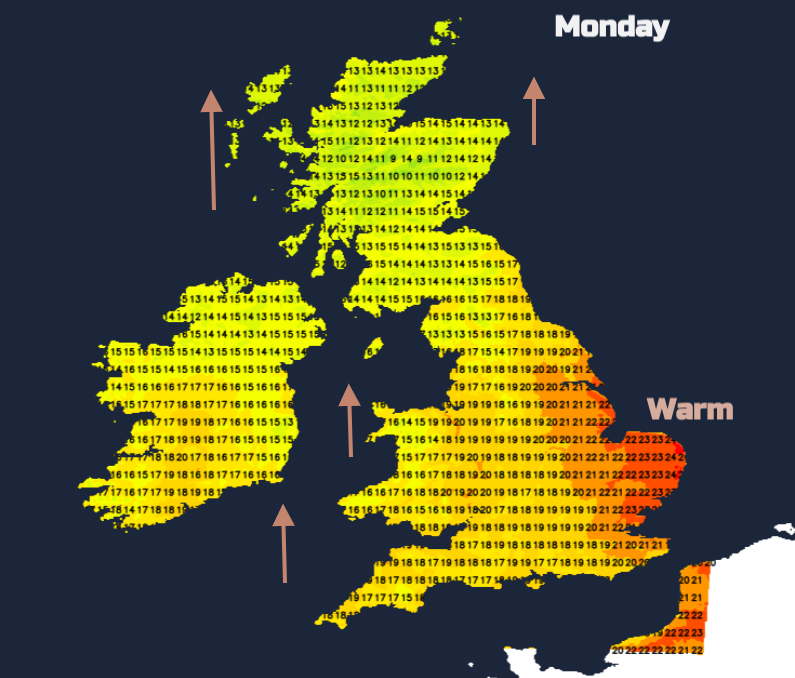
Two low pressures will be near the UK today, one south of Iceland and another racing in from SW Ireland to Scotland. Warm air will be drawn up over Britain in the southerly flow with temperatures around 25C expected in East Anglia with sunny spells.
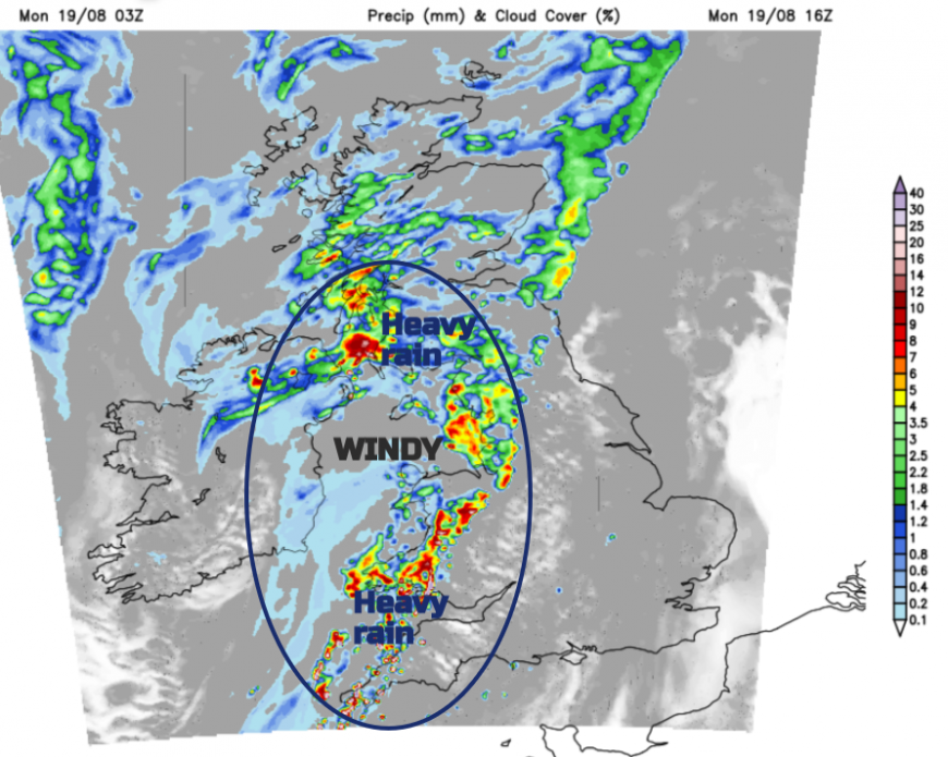
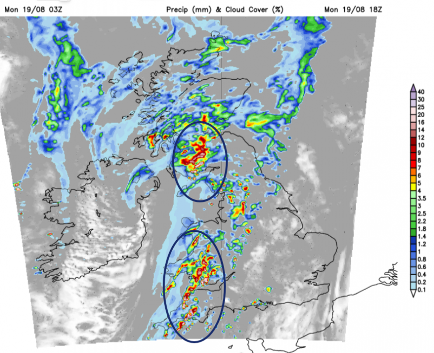
Further north and west it will be blustery with outbreaks of rain and becoming windy through the Irish Sea as heavier rain sets in. The main frontal rain will be over Northern Ireland and west coast Scotland by midday. Outbreaks of rain with thicker cloud will spread over mainland Scotland and Cumbria as heavy pulses move over the Irish Sea with strengthening southerly winds.
Shipping Forecast- “WIND South 4 to 6 increasing 7 or gale 8, then veering west or southwest 4 to 6
SEA STATE Slight or moderate becoming moderate or rough.
WEATHER Rain or showers, perhaps thundery.”
The Met Office and SEPA have identified SW Scotland as an area likely to see impacts from the heavy rain and driving winds. There is a yellow weather warning for Monday pm,
“Heavy rain bringing some flooding and travel disruption”
This warning is ‘Likely’ with ‘Low’ impacts with “25-35 mm will fall quite widely, with as much as 50-60 mm in the wettest spots”
Cumbria and southern Wales will also be very wet as the rain pushes at these regions in the mild southerly flow. Much of England will have a mild night, especially early on. The strong even gale-force winds will continue in the Irish Sea until the whole lot edges eastwards across England, northeast across Scotland and fresher air follows behind the cold front. The skies will clear as the winds veer and temperatures in Northern Ireland and Scotland will dip into single figures.
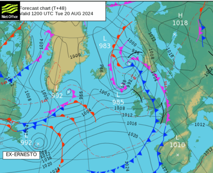
Once today's rain and weather fronts clear early on Tuesday there will be blustery showers and a cool feel in the air. There is another warning, which is for more heavy rain but it is later this week. This system has links to Ernesto. Ernesto will become an ex-Hurricane on Tuesday off Newfoundland, Canada
“The only Canadian impacts expected are moderate to heavy surf along the Atlantic Coast of Nova Scotia, and some rain and moderate winds to southeasternmost Newfoundland. Large waves can be expected there later today.” Canadian Hurricane Centre
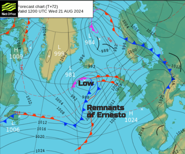
Ex-Ernesto will become caught up in another Atlantic low and the remnants will add extra tropical energy to the weather that hits the UK Wednesday into Thursday. Western Scotland has a weather warning for rain with as much as 150mm of rain forecast over the high ground as heavy and persistent rain sets in here. There are SW gales forecast by Thursday morning from the Irish Sea up the Solway Firth and that extra push of water could cause coastal flooding issues depending on the High Tide times. Warmer air will be caught up in this system so it will feel quite humid
Loading recent activity...