Hurricane Ernesto will bring strong winds and flooding to Bermuda this weekend before heading into the NW Atlantic early next week. The remnants of Ernesto then look to cross the Atlantic towards the UK bringing wet and windy weather to the northwest later in the week.
Earlier this week, Ernesto impacted Puerto Rico and the Virgin Islands as a tropical storm - bringing 75 mph winds and major flooding following up to 10 inches of rain - leaving over 800,000 customers without power.
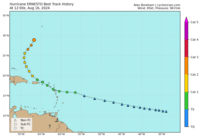
Ernesto track so far ...
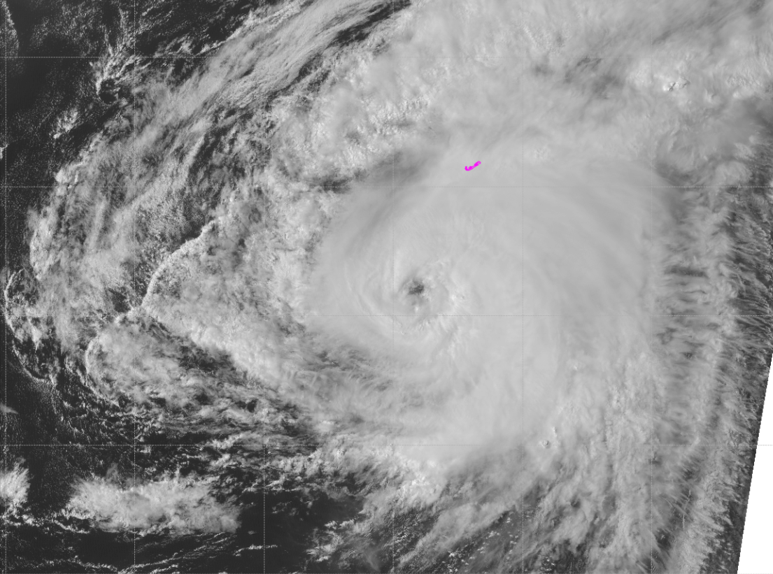
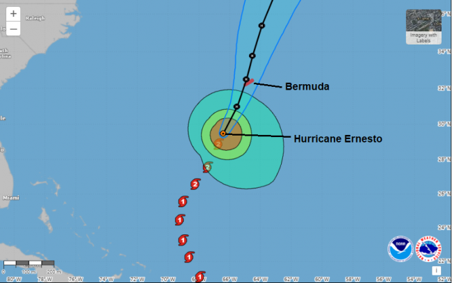
Now a category 2 hurricane, the third hurricane this season,, Ernesto is currently situated around 200 miles sout-southwest of Bermuda as I type early Friday evening, moving north-northeast at 14mph. Peak sustained winds are around 100mph but with tropical storm force winds extending 280 miles out from the centre, making Ernesto a rather large hurricane. Scattered thunderstorms in the outer bands of Ernesto are already affecting Bemuda while tropical storm force winds will also start to impact Bermuda this evening and overnight, well before the centre of Hurricane Ernesto, with hurricane force winds, passes close to or directly over the island on Saturday.
Hurricane Ernesto's track over the coming days ...
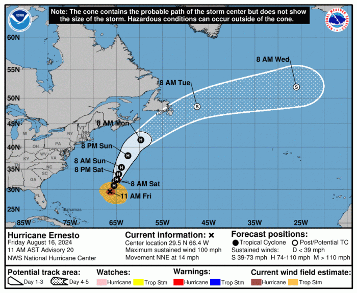
Unfortunately Hurricane Ernesto's forward speed looks to slow down to 10mph as it passes near or over Bermuda tomorrow, prolonging the impacts of strong winds which will reach hurricane force on Saturday and the storm surge associated with it. Also prolonged heavy rainfall associated with Ernesto will likely result in considerable life-threatening flash flooding, especially in low-lying areas on the island.
Ernesto then looks to track northeast to just south of New Foundland by Tuesday where it looks to be picked up the jet stream then takes a ride across the North Atlantic. Some uncertainty between weather models and runs of each model over whether the Ernesto remnant low will make it all the way across the North Atlantic to the UK or whether it loses its identity and gets swallowed up into the southern side of the broad circulation of a larger low pressure system moving out of northeast Canada that then deepens as it moves east over the North Atlantic.
Watch Ernesto in the far left at the start of the loop head past New Foundland then over the N Atlantic, picked up the jet stream and swallowed up by a larger deepening low pressure system
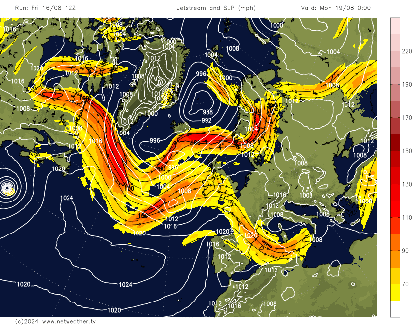
00z and 12z ECM runs today brought extropical Ernesto low all the way across to northwest UK by Thursday as a weakened open wave, but bringing a spell of heavy rain to Scotland and N. Ireland. While 12z GFS tends to bring wet weather just to the far northwest, but windy and changeable with brief spells of rain or showers across all parts later next week
Most of next weeks rain towards the northwest
Even if ex-Ernesto doesn't move all the way across the Atlantic to the UK directly next week, it will infleunce the strength of the jet stream by bringing large amounts of heat and tropical moisture up against the jet stream separating colder polar air to the north and thus strengthening the jet stream over the northwest Atlantic.
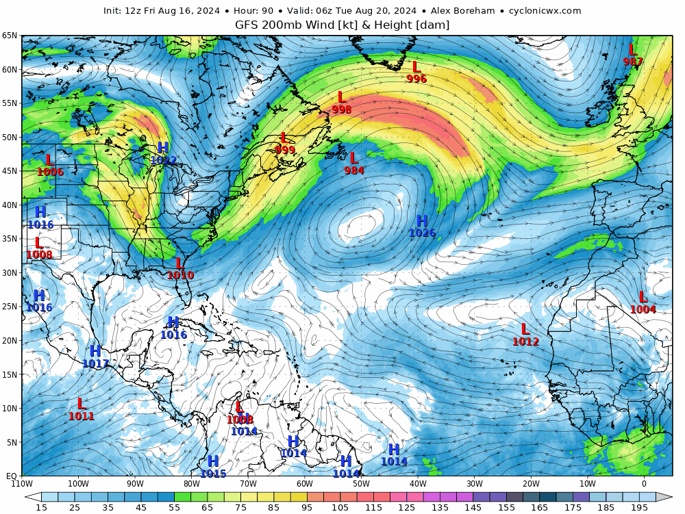
The strengthening jet stream then transfering east across the Atlantic and arriving just to the northwest of Britain later next week, with a deepening area of low pressure to the northwest bringing a windy, potentially wet and disturbed spell of weather to northern and western areas later in the week. Towards the southeast though it may well stay mostly dry, warm and sunny.
It will be an unsettled start to next week, with low pressure moving northeast over western and northern UK bringing cloud and rain to many areas for a time. However, it will tend to turn drier and brighter towards mid-week away from showers in the northwest, as a ridge of high pressure builds. But from Thursday, it looks to turn downhill, at least towards the north and west, as the strong jet streak arrives with deepening low pressure to the northwest.
Loading recent activity...